16 April 2009


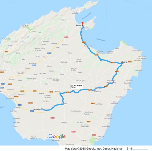
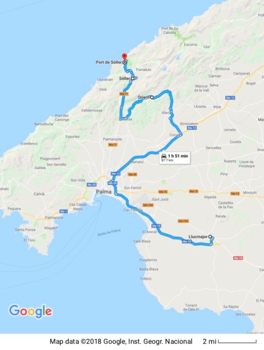
Google Maps won’t allow flights to have multiple legs so there are three maps; one for each leg. I few first to Chicago O’Hare. Left a couple of hours later for Madrid, Spain. Then flew out of Madrid for Palma, Mallorca, departing Los Angeles at 08:15 April 16 Los Angeles time and arriving at 10:25 April 17, Mallorca time.
I always take the motorcycle to the airport because Los Angeles airports give free parking to motorcycles. So I can park in the most expensive parking area – covered parking right across from the terminal, not long-term parking a mile away – and I don’t pay anything for it. The only criterion is that I can’t take up a marked parking space. That isn’t a problem as there’s always some unused spot where the motorcycle will fit.
The word must be getting out. There were lots of bikes there this time.
There was some confusion initially because I’m flying Iberia Airlines, the national airline of Spain, and I had an Iberia flight number but Iberia doesn’t have a terminal at LAX. I drove around two or three times scrutinizing all the airlines to make sure I hadn’t just missed it. Stopped to ask a motorcycle cop who couldn’t find Iberia on his list. Since the itinerary Iberia gave me said it was leaving from terminal 4 I parked and went into terminal 4 where I checked the list of departing flights. There was no departing flight with my flight number.
OK… Time to ask again. I asked a somewhat unhelpful gentleman in uniform who just said to use the check-in machine. Once I scanned my passport into the machine and gave it my flight number it was able to take my Iberia flight number and cross reference it to an American Airlines flight. It would have relieved some of my anxiety if I’d had the American Airlines flight number to start out with. (grumble, grumble) It printed out boarding passes for me for each leg of the flight and, from there, pretty much everything went without incident.
17 April 2009
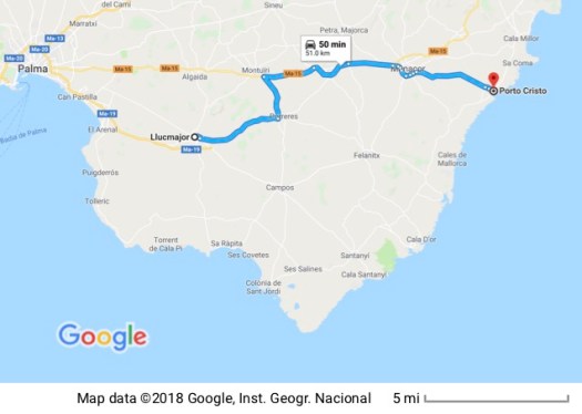
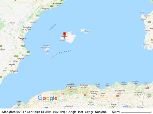 I posted a zoomed-out map of the so you can see where Mallorca is in relation to the larger area. Future maps will zero in on the island. Mallorca is one of the Balearic Islands in the Mediterranean.
The process of traveling from one place to another, packed into sardine class in a plane or enduring the “hurry up and wait” engendered by a) the nature of travel on public conveyances and b) the elaborate security precautions necessary in today’s world makes travel days somewhat difficult. Getting here was, all things considered, however, uneventful. That’s probably a good thing.
I arrived at 10:25 this morning (local time) and am, of course, jet lagged, so I didn’t do much to start out with. Found my hotel for the night without a great deal of difficulty. Internet maps that pinpoint the precise location of where you want to go and can then be printed out for reference in situ are a wonderful thing. Finding a place to park once I got here, however, was a separate issue entirely. I’m just spending one night at the Hotel Balear because I chose a cheaper flight that got me here one day before the villa I’ll be staying in for two weeks would be ready.
After finding a little spot on the street where I could shoehorn in my little rental car I walked to the hotel, checked in, showered, shaved and brushed my teeth. Now I feel like a human being again.
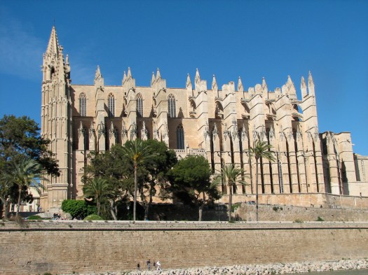
With no specific plans, I drove out to Palma to wander a little, eat, and take some pictures of the mandatory tourist stops. There’s no way any picture can do justice to the massiveness of the cathedral. It’s a very imposing structure.

For a size comparison, if you look toward the bottom of the picture you can see people by the stairs at the front of the Cathedral on the left and cars parked by the trees in the middle.
The picture of the otherwise nondescript Carrer de la Mà del Moro (which translates as the Alley of the Hand of the Moor) has a story behind it. 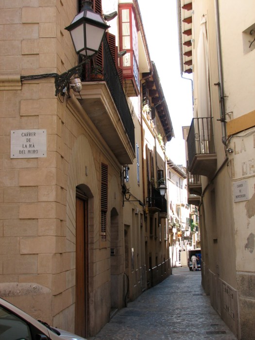 It seems that in the middle ages, Ahmed, a Moorish servant, murdered his master here in the 18th century. He, of course, was executed for his crime (no mention of his motivation for what he did) and after his death his hand was amputated and nailed above a door to the home where he committed his crime… as a not-so-subtle warning to others contemplating the same act. His hand apparently stayed there for a long time and the street came to be named The Alley of the Hand of the Moor because of that.
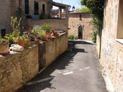
I wandered around the town, getting the flavor of the place. There’s a lot that dates back to medieval times. Lots of character.
This time of the year there’s an annual folk dance celebration here and folk dance groups come from all over to perform in the streets and squares of central Palma. I watched a Basque group and was interested to note that the introduction was in Basque. The speaker then pulled out a piece of paper and read the Spanish translation. Even though they were from Spain, his primary language was Basque and, although he could read Spanish, he wasn’t comfortable enough with it to speak it extemporaneously.
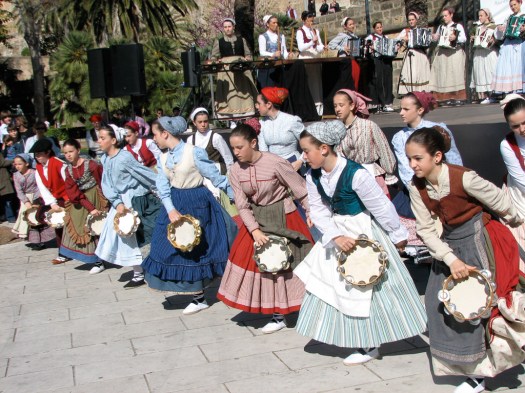
They would hit the tambourines on their hands, elbows, knees, foot in front of them, foot behind them, and forehead. All in unison.
These two kids were everybody’s favorites.
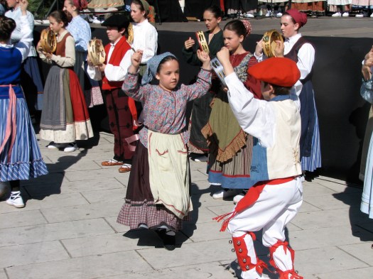
And he gave his all for the dance!
The local language here is Mallorquin, a Catalan dialect, and there’s a fierce pride in their language, history and culture. That pride was unaffected by Franco’s attempts to impose Spanish on the area. So the names of things are generally not in Spanish (though it’s spoken everywhere) but in Mallorquin.
18 April 2009
I returned to Palma to wander the narrow twisting streets in the old medieval part of the city, starting out returning to the Palau de l’Almudaina. The Palu (palace) is in the foreground, the Seu (cathedral) is in the background.
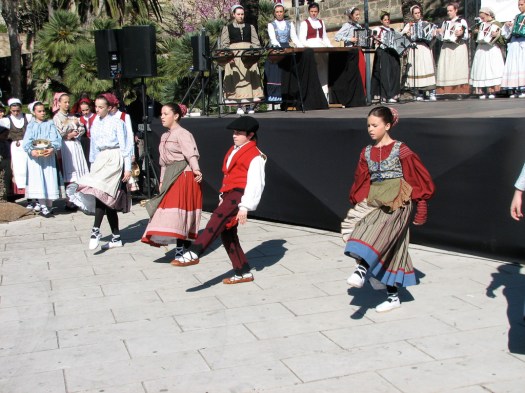
The folk dance festival was still in full swing (pun intended) and I watched a Romanian group and then an Icelandic group.
The Romanian dancers —
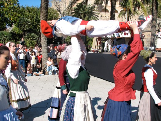
At the end of the Romanian performance the dancers came off the stage to dance in the plaza with members of the crowd. A few of them had a scarf that they would hold by opposite corners then, holding on to both corners, throw it around the neck of another person, drawing that person toward them. They would both then go to the center of the dancing group where the scarf would be spread on the ground. Both people would kneel so they were both kneeling on the scarf then touch cheeks, first left then right.


Compared to the Romanian dances the Icelandic folk dances were very restrained – not nearly as energetic or expressive.
The Icelanders did have one dance, however that was a lot of fun. They created a situation where there was an extra male in the group. When everybody paired up to dance one male was, of course, without a partner. So they gave him a broom with which to dance. He would dance with the broom, occasionally whacking one of the other men in the bottom with it when their backs were turned to him. After a while, he would cut in to a dancing couple, present the broom to the male and take his partner. The new male would then be the one to dance with the broom.


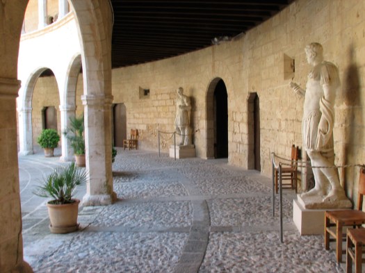
After leaving the dancers I went back to the Palau and toured the inside. The palace is still used by the Royal Family as an official, ceremonial residence and for State receptions. The king’s and queens offices in the pictures are the offices used by the current king and queen.
This was originally the palace of the Moorish Walis (governors) who governed Mallorca from 903 AD to 1229 AD when Jaume I conquered Mallorca, determined to end Muslim piracy from the island.
The Cathedral was built on top of the site of the main mosque but the Aragonese kings and governors simply took over the Moorish palace, though they periodically made modifications to it. (The Moors are thought to have built their Palace on top of a Roman fort that was located here.)
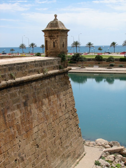
I then wandered along the old defensive walls of the city, most of which have been leveled to allow for the expansion of the city.
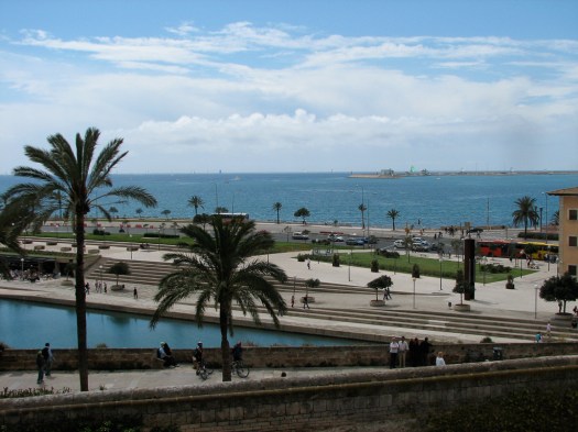
There still remain some of the walls that face the sea. The walls that exist today are from the Renaissance period that replaced the medieval walls, the difference being that Renaissance walls were lower but much thicker, to better absorb the improved artillery of the era. Begun in the 1560’s work continued on them until 1801.
Entrance to the Museu de Mallorca was free because it’s under construction and most of the exhibits are off limits. There really was little to see.
Stopping at a restaurant for my mid-day meal (the main meal of the day here) I talked to the proprietor about an article I was reading in the local paper. Tourism is the island’s primary source of income and it’s down about 20%. He agreed that his business was down about that much and we commiserated about the state of the world’s economy.
Then it was on to the Banys Àrabs, the Arab Baths. 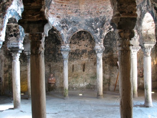 This is one of the few remaining original structures from the Moorish period and dates from the beginning of the Moorish reign in the 10th century. The baths have hollow chambers beneath the floor which were heated with a fire built in them. This heated the floor which could then be sprinkled with water creating a steam room of sorts. Each of the columns has a different capital which the Muslims are thought to have recycled from demolished Roman buildings.
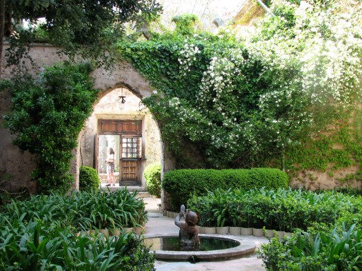
 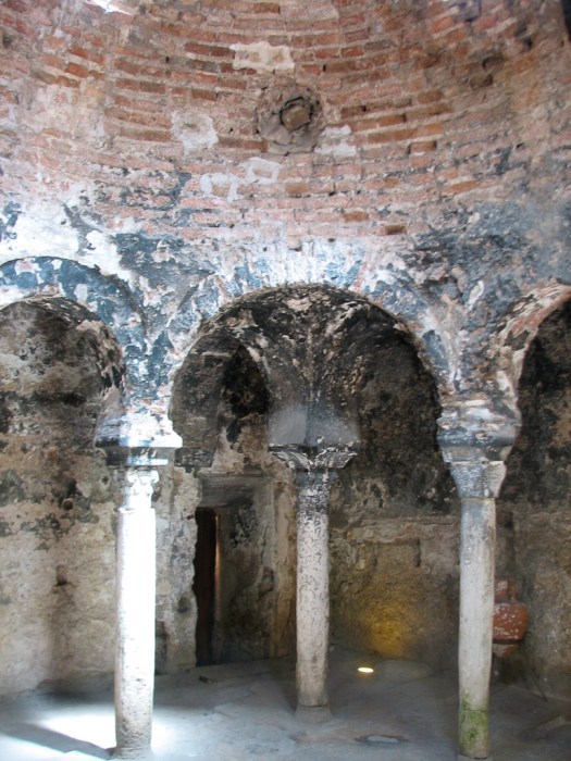 These baths were not public but part of a very well-to-do private home. Originally there would have been three baths – a cold bath, a tepid bath and finally the hot bath. This is the doorway into the baths, looking out at the garden outside.
The Arco de l’Almudaina (picture below) is thought to have originally been part of a Roman wall.
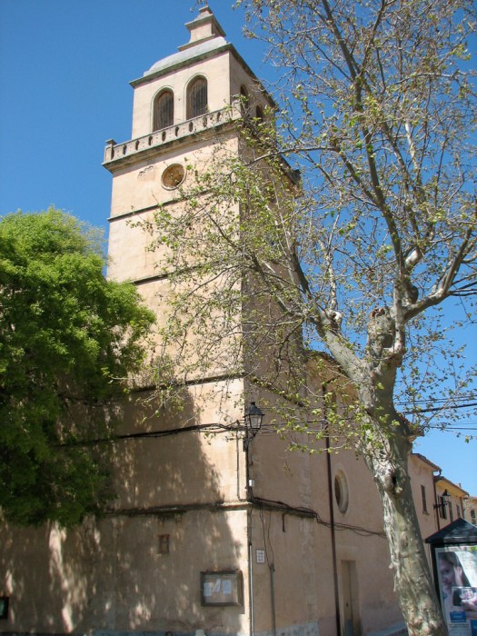
The Basílica de Sant Francesc is one of innumerable churches scattered around the old part of the city. It was begun in 1281. 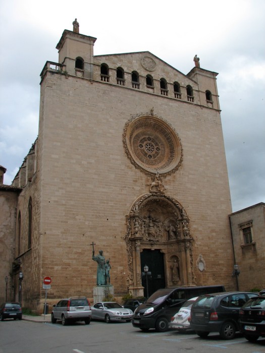 This is a closer view of the doorway.
 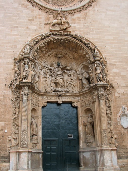 What intrigued me is that outside this church of St. Francis, is a statue of a Franciscan friar known to everyone who’s been though elementary school in California – Junipero Serra. He’s standing with what is supposed to be a Native American boy.
 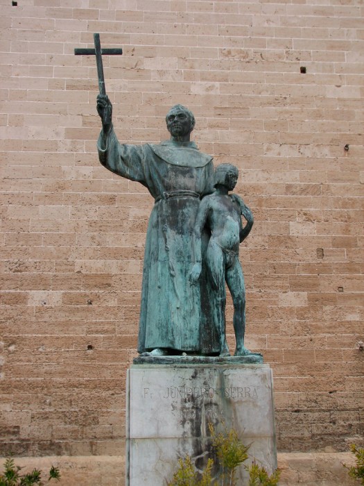 For those not from California, Junipero Serra is the Mallorcan priest who made the journey to far away California explored the area, converted the Native Americans and founded the villages of San Diego, Los Angeles and San Francisco. He’s a bit of a controversial figure since the Native Americans did not look favorably on his heavy handed approach toward converting them to Roman Catholicism.
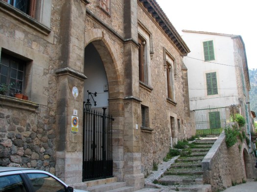
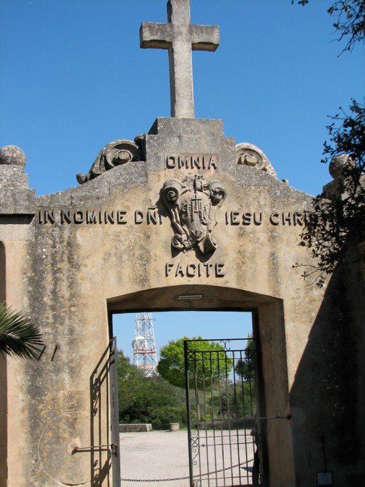
I’d heard of the Knights Templar but knew little of them. They were a military order founded to support the crusades and they established bases across the Mediterranean. The picture is of the fortified gateway to the Mallorcan base which was one of their more important ones.
 After some more wandering and admiring the picturesque narrow streets,
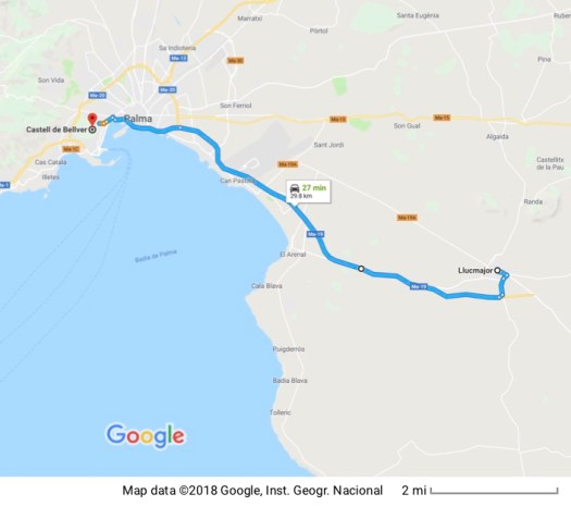
I headed back for the car. It was overcast, raining occasionally and I needed to find my way to the town of Llucmajor to check in to what will be my home for the next two weeks. It’s a sumptuous setting – a two story villa with a full kitchen, two bedrooms, living area, dining area and full kitchen. Outside the sliding glass patio doors is a patio right off the 3rd green of the resort golf course. I think I could get used to this.
20 April 2009
 Yesterday was spent being lazy (somehow seems appropriate for a vacation). I oriented myself to my villa and the amenities of the resort, got some recommendations on where to go and what to see, collected a welcome gift and generally putzed around without exerting much energy. That explains the lack of an entry for yesterday.
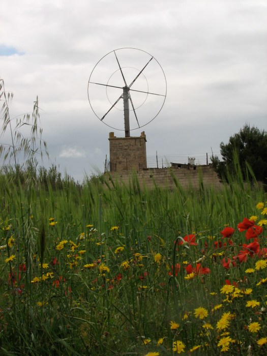
Today I wandered around the countryside a little. Mallorca is mountainous along the northwest coast with a large agricultural plain in the southeast. That area is dotted with old windmills and I took a picture of one. 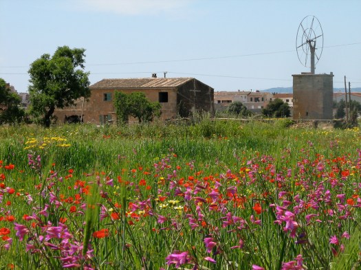 Initially I puzzled over how these windmills worked before I figured out that this is just the frame of the windmill. The vanes that catch the wind are attached to these frames. There are other styles, too, and many are in obvious disrepair. The relative importance of this agricultural area has declined as the economic importance of tourism has grown. Being here in the spring has the added benefit of blooming flowers in many places.
I also visited the Castell de Bellver, a castle just west of Palma. 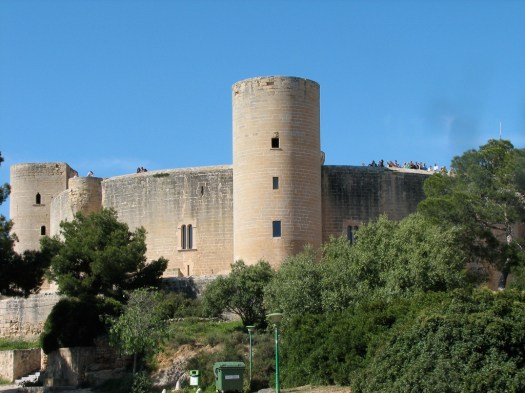 (Bellver meant “lovely view” in ancient Catalan and, since it’s on the top of a hill the view is magnificent.) This first view is looking toward the city of Palma, as seen from the castle.
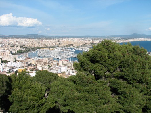
The second picture is looking more out toward the bay of Palma.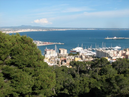 Although small, the museum in the castle was better than what was available at the Museum of Mallorca. To be fair the Museum of Mallorca’s collection is actually greater but was unavailable when I was there due to construction. The castle museum displays archeological finds on the island that include artifacts that date back about 3,000 years. That’s a LOT of history!
The interior of the castle had a throne room.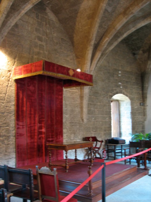 Looking out through one of the castle windows gives a good idea of the thickness of the walls.
 This is a round castle (which makes in unique among Spanish castles) built on the top of a hill just west of the city of Palma in 1300 AD for King Jaume II.
 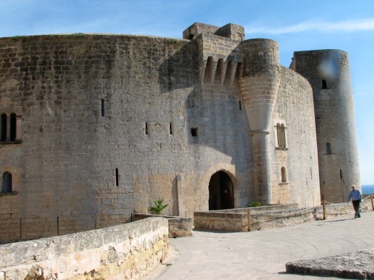 It was designed by the same architect who designed the Palau de l’Almudaina. It started out as a defensive castle and was later converted into a military prison and used as a prison in the 18th, 19th and 20th centuries (as recently as the 1950’s). The interior of the castle has a large open area, known as the castle “keep”.
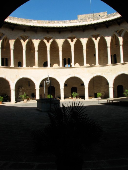
 One of the unique features of this castle is the tower in the pictures.
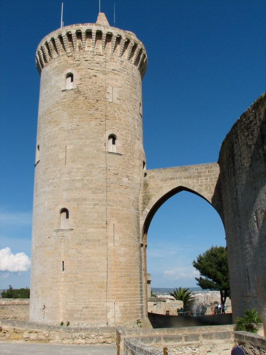 The castle’s first line of defense was the outer perimeter wall.
  If that was breached, defenders could retreat inside the castle itself which was surrounded by a moat that, by my rough guesstimate, was 30′ – 50′ deep.
If, somehow, the castle itself were breached, the tower was the last redoubt. The base of the tower was in the moat. Although it’s in the shadow and hard to see, at the bottom right of the picture you can see the outer wall of the moat. The castle itself is on the left.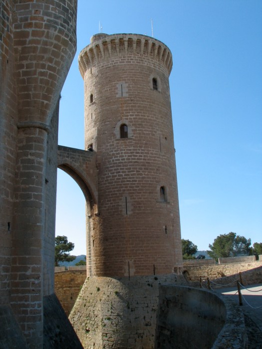 The only access to the tower was across a very narrow bridge from the roof of the castle that would only accommodate one or two attackers side-by-side, making it almost impossible to breach. This is a view of the tower from the roof with the entry to the tower just to the left of the person standing on the far right. The roof is flat and open so soldiers could move easily to fire weapons down on the invaders wherever in the castle they might be.
While I was on the roof a young boy, with the energy and enthusiasm of the young went running as fast as he could across the roof, tripped, falling face down and, because of his speed, sliding on the rough stones. In a flash he was back up on his feet and running again. I heard two women close by suck in their breath sharply when he fell and I guessed they were related to him. When he popped back up right away I commented to them (in Spanish) that it’s a good thing that kids are indestructible. One of them replied that kids “are made out of rubber”. I got a good laugh out of that.
21 April 2009
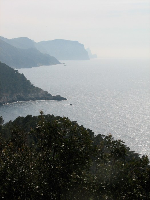
 After braving Palma traffic to attempt some shopping I headed into the Serra de Tramuntana, the mountain range that extends along the entire northwest coast of the island. I started at the southern end of the range in Port de Andratx.
 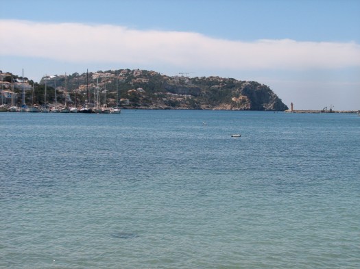 (In the local dialect, that “x” has an “sh” sound.) Tourists have made the port grow and it’s crawling with them. Originally there was almost nothing at the port, even though the town depended on it for the delivery of supplies. The town of Andratx was built some 4 Km inland to provide a better defense against Muslim pirates. The pictures show the port, the fortress-like church which is high on a hill, and the view of the town of Andratx from the church.
 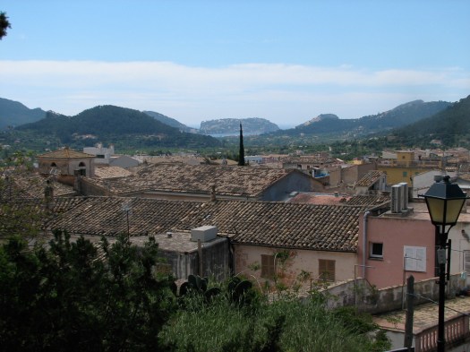 If you look in the distance you can see a sliver of ocean which gives you an idea of just how far away they built the town. The church was originally built in 1248 AD and it looks like a fortress because that was part of the intent. It was to serve as protection from any pirates that hiked the 4 kilometers up the hill from the port to attack the town.
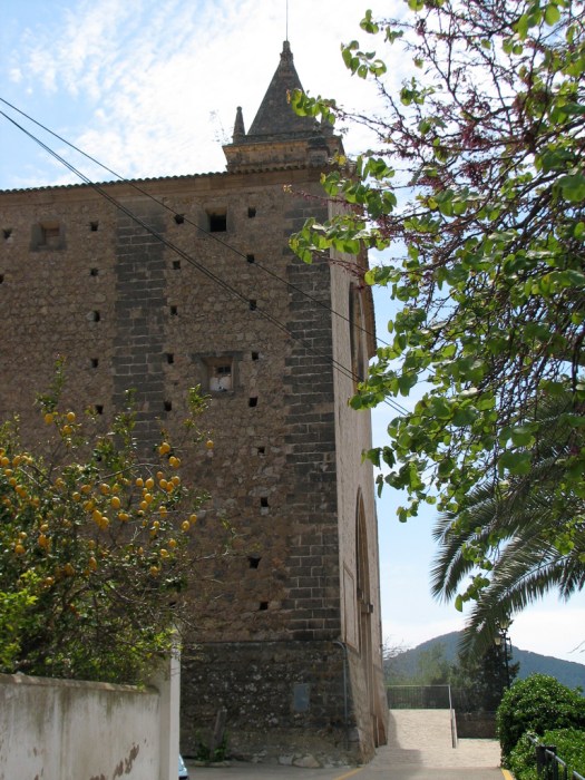
This is the Església de Santa Maria de Andratx. It was built in the 18th century to replace the original church on the same site.
It was time to eat but I didn’t see any place I wanted to eat in Andratx so I gave up and returned to the touristy area in Port de Andtrax and paid tourist prices for a meal right on the waterfront overlooking the marina. Then it was back to Andtrax again.
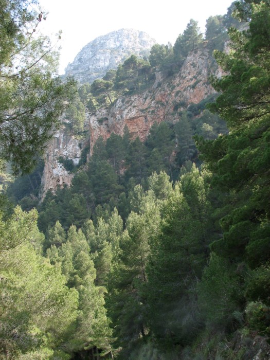
From there it was on into the Serra de Tramuntana on a narrow twisting mountain road through a primarily coniferous forest. The mountain drops very steeply into the ocean and the road follows the twists and turns of the landscape paralleling the coast so there are stunning views of the ocean that you can’t spend much time looking at because the road is so twisty. For those among us who follow MotoGP, Mallorca is Jorge Lorenzo’s home. His parents still live here and I had no difficulty imagining him cutting his teeth on these roads.
All the buildings in the local towns are made out of the stone that is taken from these mountains, of which there is an abundance. My next (brief) stop was in Estellencs. This is the view of the town as you approach through the mountains to the southwest.
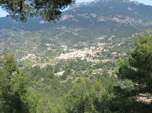
Estellencs is a small town nestled in a valley at the base of the Puig Galatzó, a peak of 1,025 meters (3,362 feet).
Well… almost at the base… it was still a ways up from the shoreline. The tallest peak in the range is the Puig Major at 1,445 meters (4,740 feet).
Then it was on up the road toward Banyalbufar. Looking back, I stopped for a picture of Estellencs from the northeast.Just before reaching Banyalbufar there’s a talayot (watchtower) that was built in 1579 AD.

These talayots are scattered around the island but this one is pretty dramatic because it’s at the top and the very edge of a cliff that drops straight down into the ocean. You can enter this tower which is small and simple. You enter the bottom section through an opening in the back of the tower a ladder goes straight up through a very narrow opening in the roof to the second level which is the top of the tower and affords a beautiful, unobstructed view out to sea.
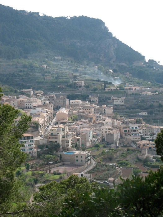
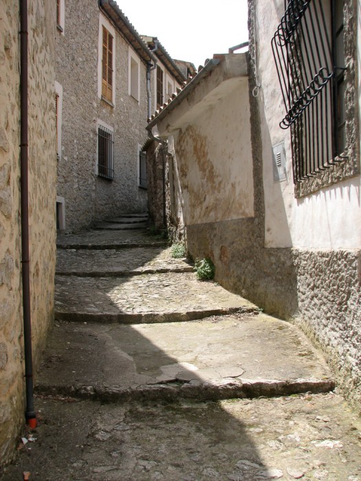
Banyalbufar, like the other towns in the area, is built right into the side of the mountain.
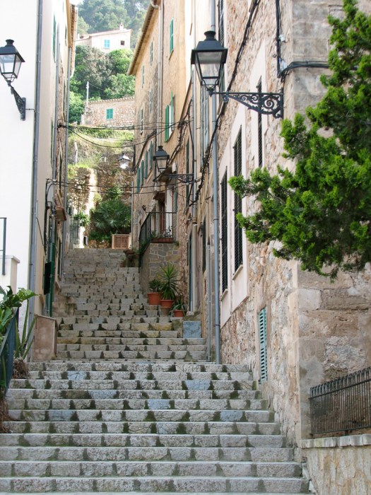
In order to facilitate walking from the lower part of town to the upper (or visa versa) there are stone steps laid between the buildings.
The town straddles the main road running along the northwest coast of the island.
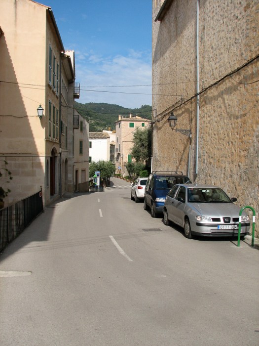
This narrow little road (the Ma 10) isn’t just the main drag through town. It’s the primary road all across this end of the island.
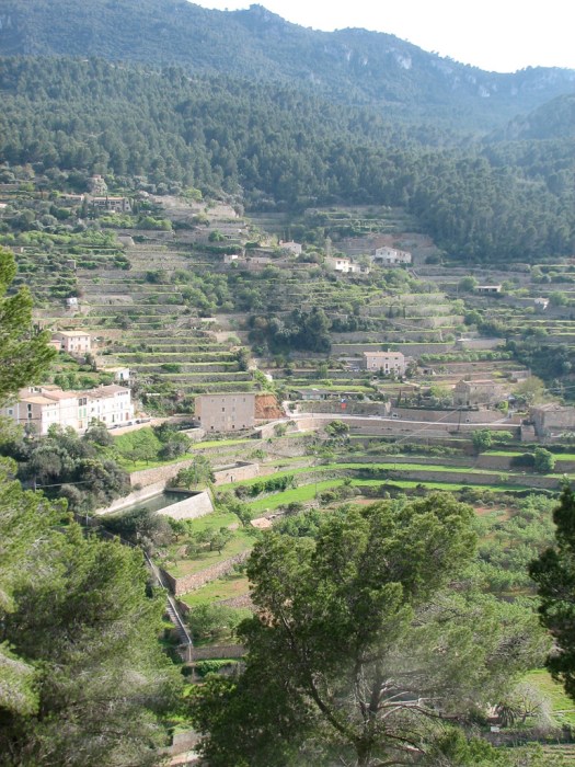
Agricultural areas outside town are heavily terraced with the terraces supported by significant stone walls.
22 April 2009
 I’m learning my way around the island and was able to skirt downtown Palma to get back up into the Serra de Traumuntana. Much nicer avoiding the downtown traffic. I started out for the town of Valldemossa,

which is crawling with tourists because it’s home to the second-most visited tourist site in Mallorca (after the cathedral) – because of the Real Cartuja de Valldemossa.
Some Valldemossa street scenes
This is just the entry to a hostel. I poked my head inside to take a picture because I loved the tilework on the stairs.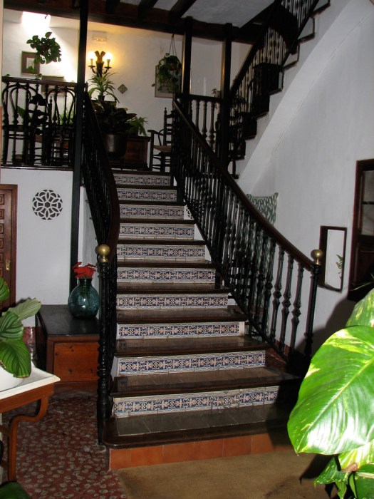
Like so many of the towns in the Serra, Valldemossa is situated on a steep hillside. Jaume II chose this location to build a palace for his son Sanxo in 1310 AD.

Its location at over 400 meters (1,312 feet) above sea level made breathing easier for his asthmatic son. It didn’t stay in royal hands for long. In 1399 it was given to the Carthusian monks for whom it served as a monastary. Martín el Humano gave it away when the Kingdom of Mallorca was annexed to the Aragón crown.
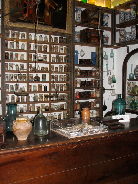
The monks’ pharmacy, which was established at the beginning of the 18th century and served the entire town, is still in place. The photo can’t capture the look of a room with all four walls lined with these old bottles and ceramic containers.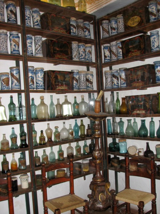
The Carthusian order was pretty severe. Monks lived in almost total isolation from each other. Most of their meals were provided to them through a small hatch that provided access into their cell so they had no contact with the lay brothers who prepared their meals.

They were allowed to eat together one meal per week on Sunday for 30 minutes. That was the only time they could break their vow of silence. They didn’t eat meat except when they were sick they were allowed some turtle soup. Three days a week they feasted on bread and water.
It wasn’t quite so bad if you rose to the top, though. The principle prior had a suite of cells instead of a single cell and one of them was even used to receive visitors. He had access to a private garden with a magnificent view down the valley. It still wasn’t exactly a life of luxury, though. In the picture of one of his rooms the corner of the blanket on his bed is pulled back to reveal that he slept on boards without padding.
What the crown gives, the crown can take away and in 1835 a law was passed that expelled the monks and divided the monastery up among nine private owners. As such it was opened to visitors, one of the more famous being Frederic Chopin and his consort George Sand who stayed there the winter of 1838/1839. Sand wrote a rather scathing account of their stay there (A Winter in Majorca). Of course the fact that an unmarried man and woman lived together in 1838 in a conservative Catholic town and George (that was a pseudonym, she really was a woman, the name she chose, notwithstanding) wore pants and smoked cigars probably did little to endear them to the local population.
The monastery has several cells devoted to Chopin memorabilia including a piano, handwritten sheet music, letters, even a copy of his death mask.
This view of Valldemossa was taken from a terrace by the palace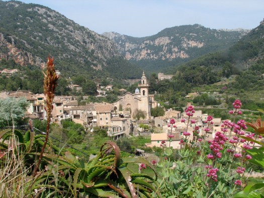
After a large and wonderful meal (of stuffed squid) it was back on the road heading northeast again toward Deià, a small (population 650) but exclusive town at the foot of Puig d’es Teix, a 1,062 meter (3,484 foot) peak. I tried to show the setting for the town so when you look at the picture, the buildings are kind of hard to see. This is the view as you approach from the southwest.
The area is much like Carmel in California, in that it attracts a large number of artists who love its natural beauty. Lots of foreigners love that beauty, too and have moved into the neighborhood, causing home prices to skyrocket. I read one source that said a 16th century stone house in the old part of town with a glimpse of the sea and four small bedrooms sells for 2,000,000 euros. That would be a little over $2.5 million US at today’s exchange rate. I probably won’t be moving here soon.
Wandering around and taking pictures was free, though, which was convenient because I could afford that. It was also, however a lot of work since there’s almost no such thing as level ground. You’re always either going uphill or downhill.
From here it was time to call it a day and head for home.
23 April 2009
 This morning I went to a small town nearby shopping. Each town has its day for a farmer’s market. I needed to stock up on fresh produce so rather than just do the supermarket trip I browsed the farmer’s market at a small town close to where I’m staying. The markets are set up in the central square of the town and I figured they should have fresher produce than the supermarket. They also have more color and are more fun.
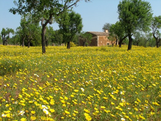
This farm I saw along the road had a for sale sign up. I think that if it had been actively worked as a farm the flowers would have been plowed under, as they had been at the other farms I saw.
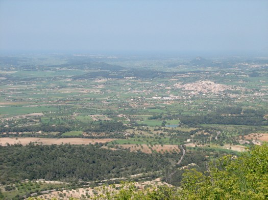
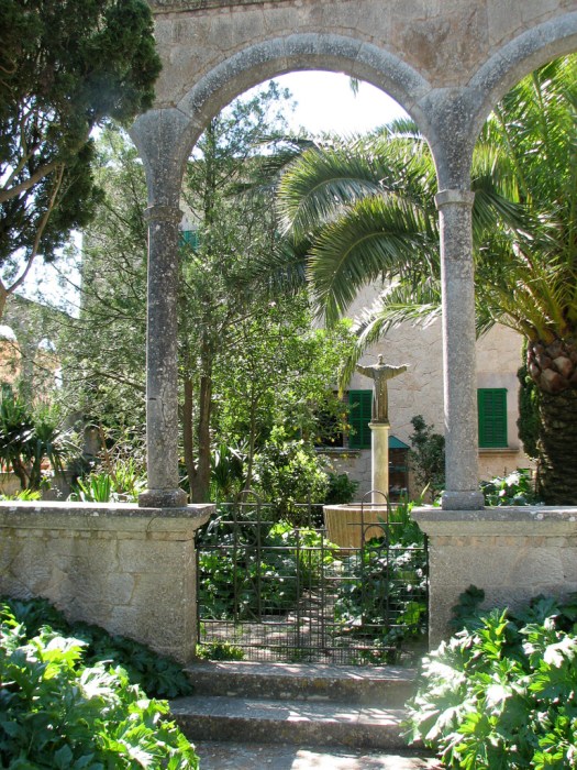
After returning home to stock the refrigerator I went to Randa. In the middle of the agricultural plains of Mallorca there’s a small hill (Puig Randa, 540 meters, 1,771 feet) on which is located the town of Randa.
At the top of the hill an old monastery shares space with a forest of radio antennae, the town is further down the hill.
I had lunch at the hotel in Randa, explored the town a little, then headed up to the top to see the monastery.
There’s an interesting story that sheds light on the thinking and attitudes of at least some of the people in this rural area. Not far north of Randa is the little hamlet of Pina. In the 1980’s a single, female British anthropologist came to Mallorca to research rural communities. She lived in Pina for several months. It seems she didn’t quite fit in. She was criticized for having her lights on too late (she should have been asleep. I guess it never occurred to them that whoever saw her lights and criticized her wasn’t asleep, either.). She was criticized for wanting to live on the edge of the village (obviously she had something to hide). Apparently she couldn’t take it any more when she got annoymous letters accusing her of coming to the area for the sole purpose of acquiring a young man to return with her to England. I suspect that rural communities everywhere tend to be pretty conservative. The attitudes underlying these specifics are probably pretty common.
I was just a tourist (of which there are thousands) so I had no problems and everybody has been very friendly and helpful. It sure helps to be able to speak the language, though. Apparently there are tour companies that specialize in arranging tours for bicyclists. Most everywhere one travels, particularly in the mountainous regions that would be very challenging on a bicycle, there are herds of bicycle tourists valiantly struggling up the mountain (or flying down it). You have to be careful driving because many times you round a bend to discover a herd taking up your whole lane.
The monastery is the Santuari de Nostra Senyora de Cura. The entry portal and parts of the chapel date from the 17th century but most of the rest of it is of more recent origin.
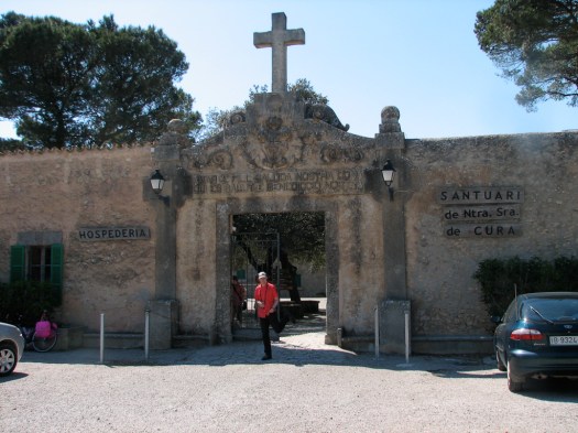
It was originally founded by Ramon Llull in the 13th century.
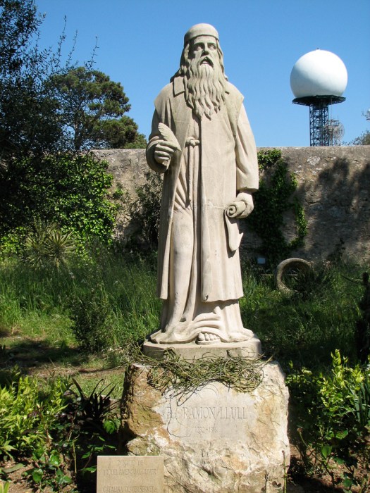
His tomb is in the Basílica de San Francesc that had the statue of Junipero Serra out front. He was big on education, particularly languages, and was a tutor to Jaume II. He became a Franciscan and learned Arabic for the purpose of converting Muslims to Christianity. Interestingly, he also advocated for the unification of the three monotheistic religions: Christianity, Islam and Judism. This explains the picture of a painting of the monk, the imam and the rabbi in a boat that’s painted on a wall at the monastery.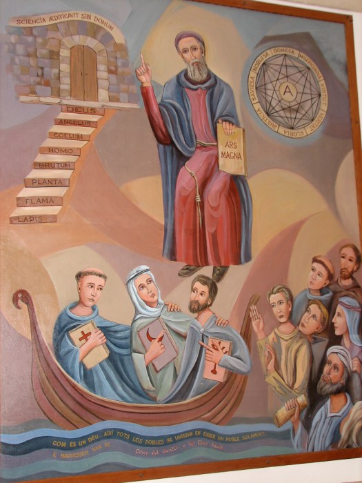
He’s a Mallorcan native and is honored here. He was one of the first to write books in Catalan. There’s a Ramon Llull University in Barcelona with a prestigious school of business.

24 April 2009
 My destination today isn’t very photogenic, looking pretty much like a rock pile.

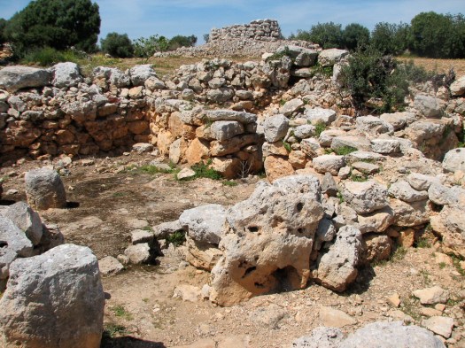
It’s the oldest prehistoric site on the island – Capocorb Vell, the ruins of a village that archeologists believe existed in about 1000 BC. That’s about the time that David was King in Israel. Although they believe that the village was bigger than what’s been uncovered there are five talayots (three round and 2 square) and 28 stone residences. The talayots are towers made of stone and can be either round or square but nobody knows for sure what their functions were.
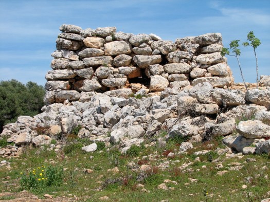
Some appeared to be watchtowers, others were used for burials, they could have been religious, or they could have had military functions. They also think they might have been status symbols for important families. Or the answer could be D) all of the above.
The entire village was surrounded by a stone wall. The individual houses have a separate area in the front of the house that archeologists believe may have been used to keep a few animals. The houses are all together like apartment buildings, so the south wall of one is the north wall of the next. Doorways are really short. You have to bend way over to get through. 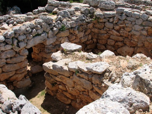
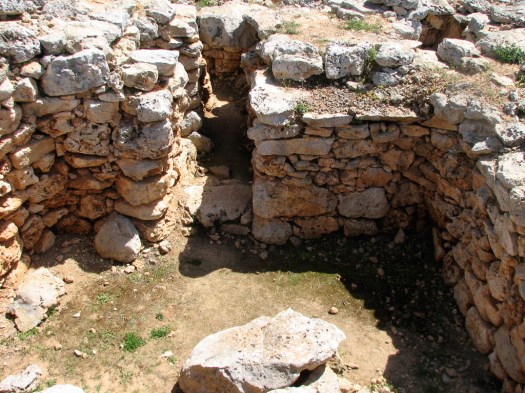
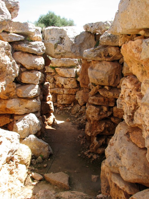
 And you’re allowed to climb all around these buildings which I found kind of surprising. Archeologists have worked on these sites but little is known of the original residents.
And this was the only place I went today where I took pictures. I had other stuff to do (laundry, shopping… pretty boring stuff) The roads getting down here were mostly little one-lane country roads. The only problem was that those one-lane roads carried two-way traffic… plus the herd of bicycles. Bicycle touring seems to be mostly a German thing. Every bicycle group that’s been at a restaurant where I’ve eaten has been speaking German.
Saturday I started out the day going to flea markets that are set up weekly. For the most part it was just wandering from one stall to another without buying. I already have all the purses I need… lots of purses… lots of clothing… lots of used stuff I wasn’t interested in. Checked out a couple of different markets – the bigger one was set up along the Avingudas (the wide avenues that generally follow the former walls of the city). There was a smaller one at the Plaça Major.
In the afternoon I wandered around towns in the central plain. One of my guide books suggested there were lots of the traditional windmills around the town of Muro so I went to check it out. I got myself lost a few times wandering around the twisting medieval streets of little towns and had to retrace my steps a few times. I explored all around Muro. I did find lots of windmill remains… just the base… but no windmill. The day was completely overcast with occasional sprinkles so the conditions weren’t conducive to photography. Maybe tomorrow.
26 April 2009
 The town of Artà is located in a smaller range of mountains than the Serra Tramuntana where I’ve been before. This is the Serres de Llevant range on the eastern side of the island. At the top of the hill is the Santuari de Sant Salvador. This was the site of a Moorish fort which was destroyed by Catalan soldiers and replaced with a shrine for an image of the Virgin Mary they’d brought with them. In 1820 that shrine was knocked down in an effort to stop an epidemic that was decimating the local population. Destroying the shrine didn’t seem to help stop the epidemic and the current Santuari was built in its place. Though, if you ask me, it still looks more like a Moorish fort, than a Santuari.
This is the view of the Santuari exterior as you climb the hill approaching it.
As I said… sure looks like a fort to me. And this is the view looking into the Santuari through the entryway.
These are the walls as seen from the interior.
And this is on the top of the walls.
Looking down on the town of Artà from the Santuari above it you can see how this medieval town was built in a circle with the church and central plaza in the middle of the town.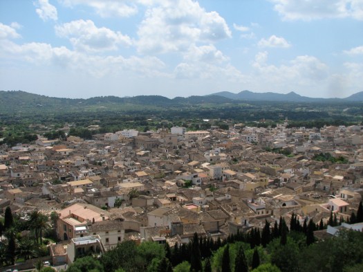
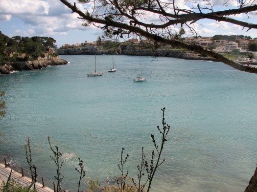
From there I went to Port Alcúdia and then to the town of Alcúdia itself. Port Alcúdia is a major tourist area with lots of beaches, hotels, restaurants souvenir shops and places designed to separate the tourists from their money. It is a pretty bay with a very large marina filled with yachts from all over.
Phoenicians settled at this site in about 700 BC, using it as a link for trade between Africa and Spain. The Romans came in, destroyed the Phoenician town and built their own town of Pollentia, the capital of the Island. In 426 AD, Pollentia was destroyed by Vandals and wasn’t rebuilt until the Moors built Al Kudia in about 800 AD. With the Christian conquest the town was again demolished and rebuilt as Alcúdia.
The town of Alcúdia has restored much of the medieval wall that surrounded the city so it adds to the medieval sense of the place as you wander the wall and look into the town to see the 16th to 18th century stone homes and narrow winding streets.
27 April 2009
This morning started out cold and rainy so I got a slow start. Wandering around in the rain wasn’t what I wanted to do. It cleared up in the afternoon and I headed out to Porto Cristo. I went via some back roads and got a couple of windmill pictures.

I saw this sign driving down the road and had to stop to take a picture.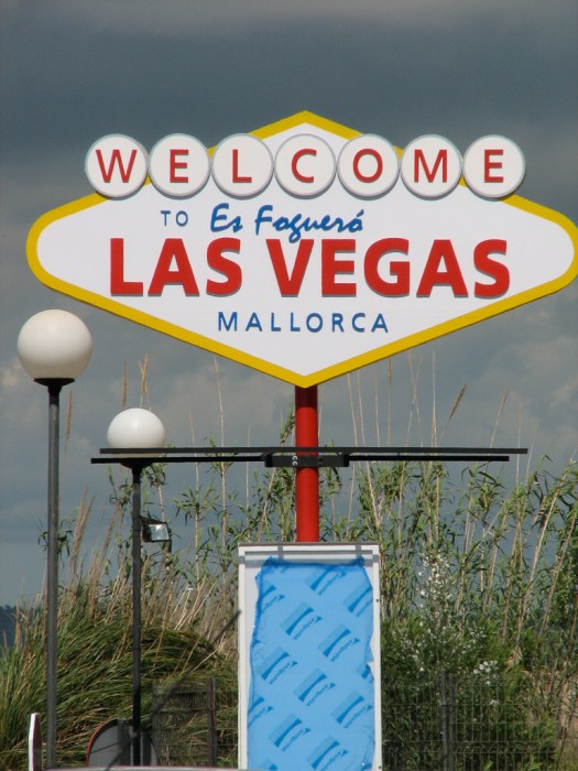
My primary reason for going to Porto Cristo was the caves there, the Coves del Drac (the Dragon’s Caves). These are truly beautiful caves with impressive stalactite and stalagmite formations. They are very commercialized, however and don’t allow any photography whatsoever… with or without flash. To no great surprise, as you exit the cave there’s a stand selling post card collections, CDs and other goods with all the pictures they wouldn’t let you take with your own camera. So… I have no pictures of the cave interior.
The cave is about 1.2 kilometers long (about half-a-mile) with four very large chambers. In addition to the truly impressive stalactite/stalagmite formations which absolutely cover the cave for its full length there are underground lakes that are crystal clear. The largest of these lakes is in the last and largest chamber. The lake is 177 meters (580 ft.) long by 40 meters (131 ft.) wide by 30 meters (98 ft.) deep. That makes it one of the largest subterranean lakes in the world. For the entire length of the cave the stalactite/stalagmite formations are dramatically lit to highlight their beauty.
They bring visitors into the cave in large groups and in this last chamber everybody sits while the guide gives a multi-lingual speech about the cave. Most of the lights are then turned out and three rowboats appear on the subterreanean lake with lights all along their gunwales. The chamber is lit primarily by these lights and their reflection in the lake. One of the boats has a group of four muscians in it – two violins, one cello and a small organ – that play classical music as oarsmen very slowly row their boats around the lake. When the 10-15 minute concert is over the lights are turned back on and the group is invited to either walk out of the cave or you can get in one of the rowboats to be rowed to the other end of the lake where you get out and walk the rest of the way.
The area was pretty, though. With hotels taking up the prime beaches.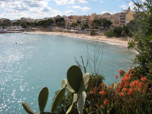
I’ll bet those homes are expensive.
28 April 2009
 My first destination this morning was Alcúdia. This time not to take pictures but to browse the open air market. Wow. I was surprised by the size of this market. For anybody coming to Mallorca, skip the other markets… this is the one to go to. I assumed Palma, being the large city that it is, would have the largest market. Not so. The market in Alcúdia is easily 3 to 4 times the size of either of the two markets I went to in Palma.
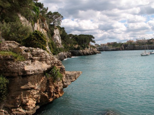
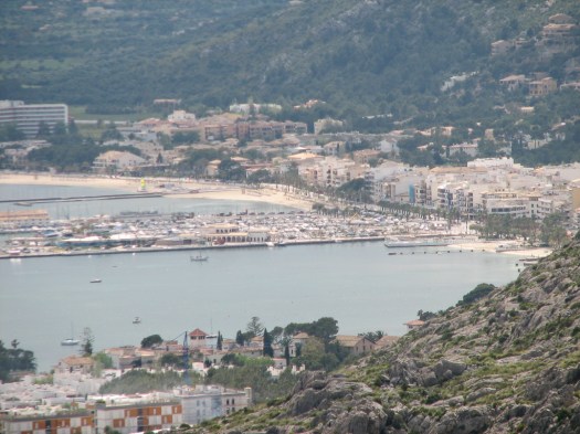
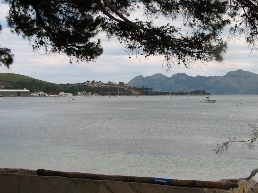
From Alcúdia it was a short hop to Port de Pollença. Those cliffs behind the port are almost sheer.
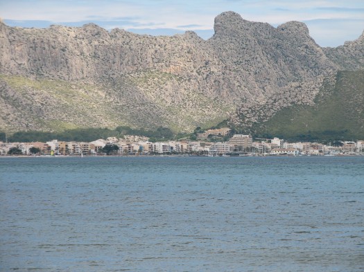
Like the other towns in Mallorca Pollença was the fortified city built inland to discourage pirates and the port was an undefended outpost. Although, apparently, this strategy didn’t result in complete success elsewhere in Mallorca, in Pollença, it did, although the Turk, Dragut, almost succeeded in defeating the towns defenses. Every August 2 the citizens of Pollença have a very energetic celebration with mock battles in the streets reenacting the victory of the townsfolk over the Turkish pirates in 1550 AD. Today, Port de Pollença is the tourist meca as opposed to the town of Pollença itself. You can see how full the marina is and all the hotels along the beach.
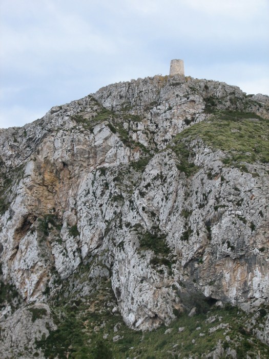
This tower, the Talaia d’Albercutx, was on the top of a hill across from my viewpoint. It was originally used to watch for the approach of pirates.
And the bay away from the congested tourist area of the port.
After lunch in Port de Pollença I continued on to the extreme northeastern corner of the island which is marked by a lighthouse. 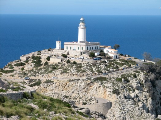
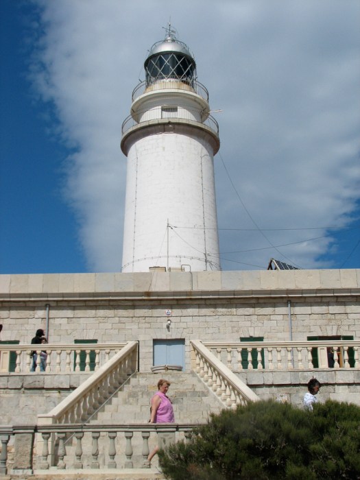 The Cap de Formentor was purchased in its entirety by the rather wealthy Argentinian, Adam Diehl. He built a hotel for his friends who came to visit, but he and his heirs have permitted no other development so the entire peninsula is still very wild. As rugged as the terrain is I’d think it would be hard for developers to blanket the place with hotels, villas, apartments and restaurants for tourists but I have to admit that developers have been much more inventive in this regard than I ever would have thought.
Traveling the road along the cape took longer than I would have expected due both to the ruggedness of the terrain and resulting twists and turn of the road, but also due to the time I took trying to find some little spot where I could safely squeeze my car into a space off the road to stop and take pictures.
The cliffs are quite sheer right down to the Mediterranean and the road eeks out a narrow and twisting route along those cliffs. I never got a picture of one, but goats with long brown hair seem to wander wild along the length of the cape.
I did go through the town of Pollença itself but had a hard time finding a place to park so I could wander and take pictures and it was getting late so I headed for home.
29 April 2009
I headed back toward the Tramuntana but never made it. I ended up spending my day nursing my rental car back to the airport. I don’t know why but it began to seriously overheat so I could only drive a short distance then had to stop and wait for it to cool down before driving another short distance. I tried to open the hood to check the water level in the radiator (seems like a rather simple task) but no amount of searching could locate a hood release and the glove compartment failed to contain an owner’s manual (though it did have the protective jacket the owner’s manual had come in). I suspected that the rental agency would not appreciate my using a tire iron to open the hood so I alternately kept driving short distances, then enjoying the view of passing traffic as I waited by the side of the road. By the time I made it back to the airport the power steering had disappeared. The rental agency cheerfully gave me another car, but I lost an entire day. Tomorrow is my last day on the island.
30 April 2009
Today I’m going back north. First stop will be the hamlet of Orient, a bare handful of homes clustered at one end of a small valley in the middle of the Serra de Tramuntana. After following a narrow twisting mountain road the terrain opens into this valley and the hamlet of Orient, as seen from the west.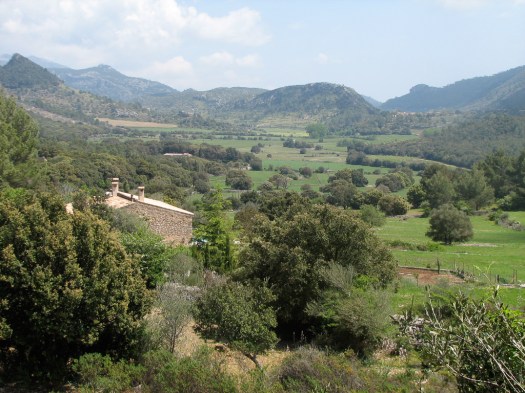 And from the east.
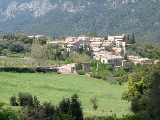 Even little Orient (population, not counting tourists, is about 30) is cashing in on the tourist trade with three hotels and a few restaurants. This is one of the restaurants.
 Needless to say the tourists bring in more money than the orchards that surround the town, but they haven’t given up on the orchards. This one had a number of newly planted little trees.
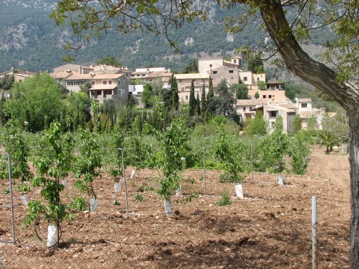 As poor and small as Orient is, it still has a little parish church. I climbed the road up the hill to photograph it but found the small area in front of the church filled with trucks that had apparently come up from Palma for some film project. There would have been no way to get a picture of the church without having it half-obscured by the trucks. This is the road to the church.
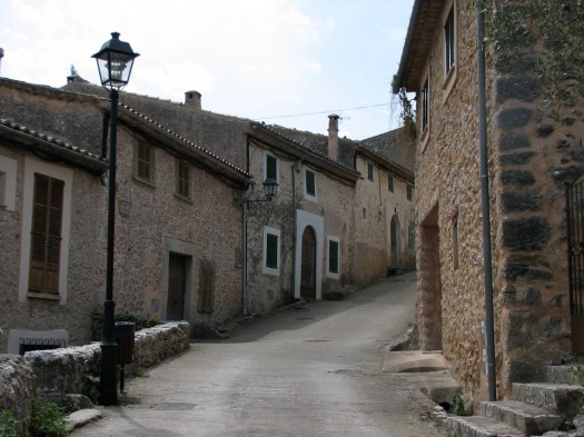
The road to Orient is a very narrow little track with lots of 180 degree switchbacks that had me turning the wheel of my little car until it hit the stop in order to make it around the bend. It’s a very popular road with bicyclists who routinely ignore multiple signs telling them to ride single file meaning I have to be really careful I don’t turn one of them into a hood ornament. Here are a few that made it into town.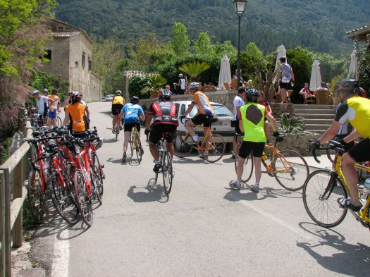
Orient is full of quaint and picturesque walkways and streets.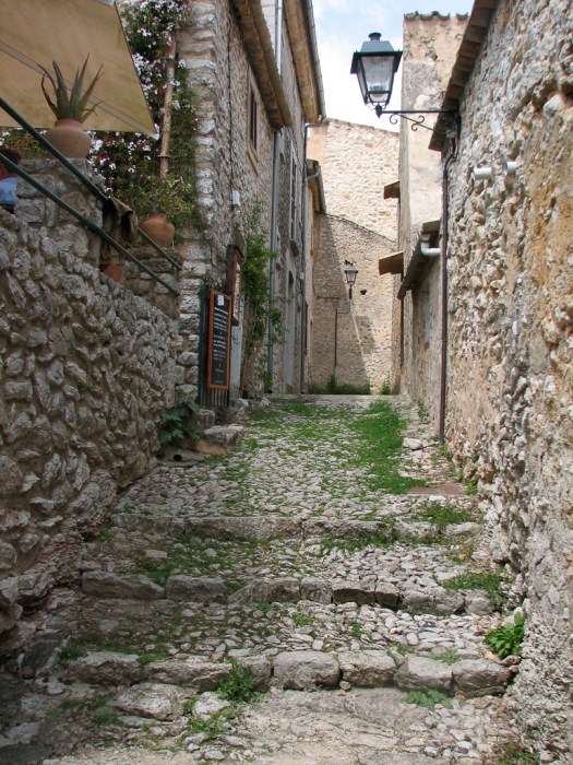
From Orient it’s back to the main road to continue north toward Sóller. First stop is the Port. 
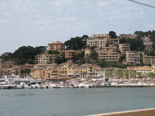 As has been true elsewhere on the island, so here, the port is popular with tourists, though today, more seemed interested in shopping than sunning on the beach. But the port is more modern and touristy than the town.


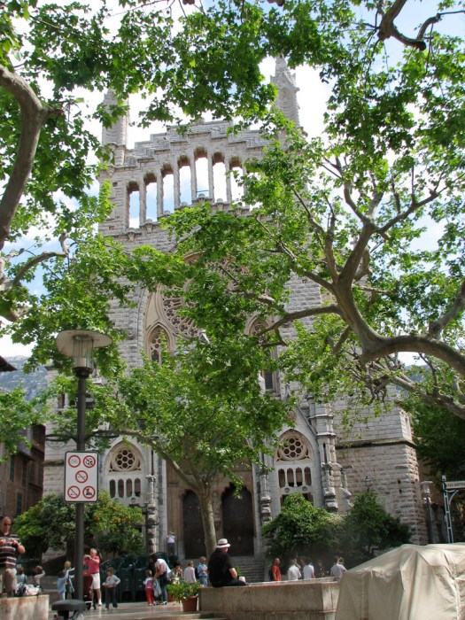
Then it was back inland to the town of Sóller itself. Sóller is a beautiful little town whose streets are lined with Plane Trees. 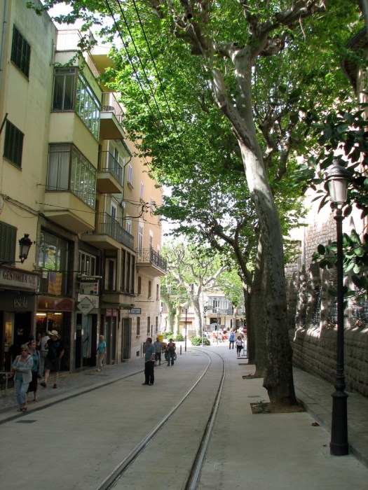 The tracks in the middle of that street are for a train that runs between Palma and Sóller. It was originally built as a more efficient means to transport the region’s citrus crops over the Serra Tramuntana to Palma but now it’s mostly popular with tourists.
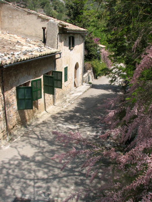
As with many medieval towns there are lots of narrow streets that, while picturesque, are challenging for drivers and pedestrians to share. Many of the 18th and 19th century buildings have iron grillwork on second floor balconies.
 The main square in the center of town, the Plaça Constitució is dominated by the 16th century church of Sant Bartomeu with its enormous facade. That facade is a later Modernista addition to the original Gothic structure.
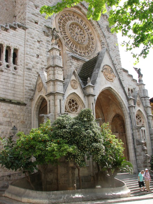
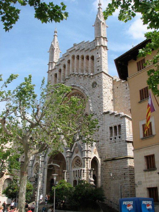
 Just across the street from the church the same architect (Joan Rubió) created a Mondernista building for the Banco de Sóller.
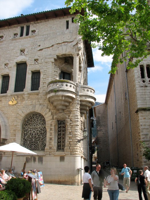
From Sóller it was back home to pack for an early morning flight out tomorrow.
