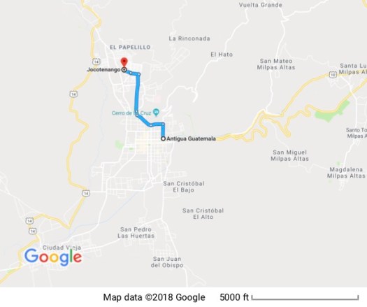
27 November 2009


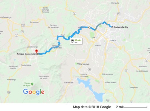
Instead of flying directly to Guatemala City, my cheapest flight was on American, and they flew me to their hub in Dallas Fort Worth before heading south to Guatemala. Google Maps won’t allow multiple legs by plane on one map so each leg has its own map. Nothing particularly noteworthy about the trip. Flying just isn’t much fun anymore. They graciously allowed me to check my bags for free and I brown-bagged enough food for two meals so I didn’t have to buy one of their $10 sandwiches.
When I got to Guatemala my cheap car rental turned expensive when they pointed out the fine print on the website where I booked the rental – it said in the big print that the insurance was optional. That’s fine. I never buy it. The fine print said that in order to waive the insurance I had to bring a letter from my insurance company saying they’d cover me in Guatemala. Not only did I not ask for a letter like that, but I’m sure they would have laughed at me if I had asked.
Grumble, grumble, grumble.
The kids behind the counter tried to make it up to me. I was there at their closing time and they locked up for the night then led me through Guatemala City to my hotel. I’m sure I got there a lot quicker because of their help.
This is a little hotel (10 rooms) and they were great. They showed me to my room and told me to go ahead and crash. I could sign in and settle accounts in the morning.
28 November 2009
 My guidebook says that Guatemala City, “is not a place to visit for its beauty or architectural charm. If you arrive in the central area, your first impressions are grim, as a depressing vision of urban blight unfolds: potholed streets choked by fumes from rasping buses, thoroughfares blocked by street stalls and many of the city’s fine buildings in a state of advanced decay.”
They did not lie but they failed to add that, once there, your efforts to leave will be painfully slow for because the streets are totally overwhelmed with traffic. LA rush hour has nothing on Guatemala City. And it’s also true that there are many fine buildings there. It’s just that so many are vacant and in serious disrepair that “grim” is really a good description.
I chose to stay there because my flight arrived so late I didn’t want to drive to Antigua at that hour, and there are a few things in Guatemala City I wanted to see. I ended up cutting my time in the city short, though, skipping the museums I wanted to see because getting around and parking were sufficiently aversive to me that I just wanted OUT!
The capital of the country was moved to Guatemala City from Antigua in 1776 when Antigua was destroyed by an earthquake; a common occurrence here. I walked to the central square where the National Palace resides on the north side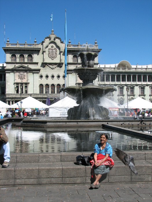
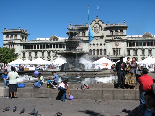
 and the Cathedral on the east.
 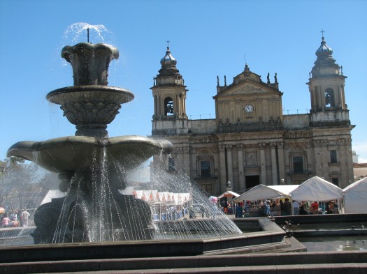 Staging a protest is a sign of democracy and these are protest signs in the plaza, all facing the National Palace.
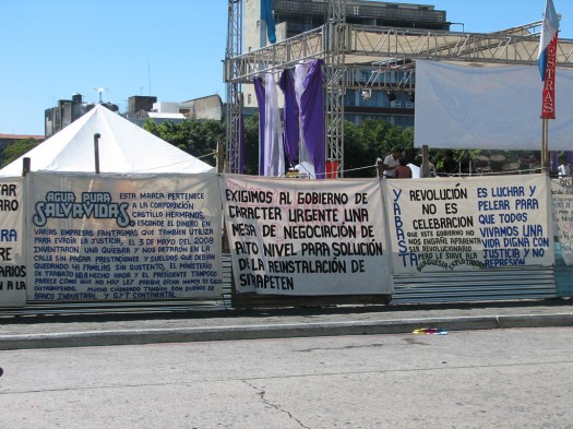 At the time I was there they were having a huge anti-domestic violence fair with performances on a large stage and numerous booths offering a variety of services including one staffed by dentists who were doing what appeared to me to be oral surgery under an awning in the city square.
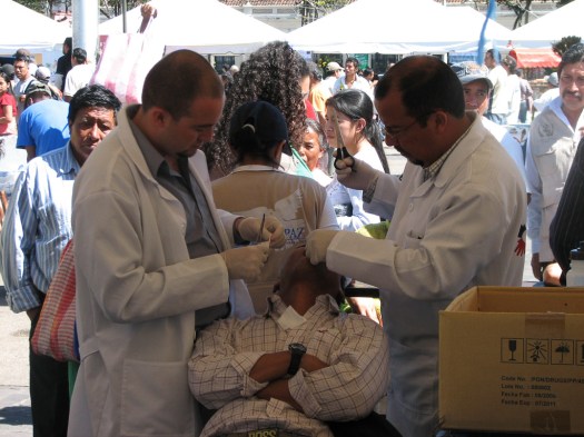 It’s hard to tell from the picture but that’s a man in the chair with two dentists stuffing his mouth full of gauze. I don’t know what they’d just done, maybe pulled a tooth, but his mouth was definitely bloody.
In all of the pictures above, the white awnings and tents are part of the anti-domestic violence fair.
I toured the National Palace which is really quite impressive. Much more so than the pictures convey. It was started in 1939 and finished in 1943. It’s designed around two large open Moorish style courtyards that allow offices all around the building to have a window.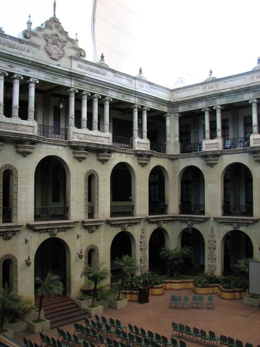

It’s hard to tell from the pictures, but the stone from which the palace is made is a natural pale green. The open courtyards are covered by awnings to keep the direct sun off the stone so it doesn’t fade. This picture shows the green color a little better.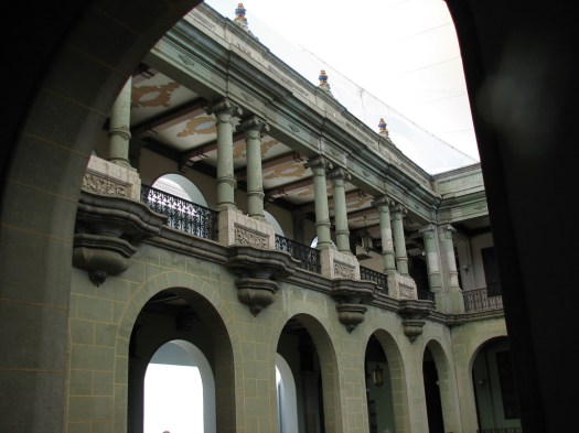
I had my choice of either a French language tour or a Spanish language tour. Needless to say, I picked Spanish. The wide and high-ceilinged halls have a system of lights on the walls – with red, yellow and green lights. Those lights were used to control movement within the palace to protect the head of state. If the light was red nobody could leave their office. The head of state was out and about. If it was yellow, only department heads could leave their offices and if it was green, anybody could wander the halls. This is one of the halls surrounding a courtyard.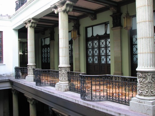
This is a shallow reflecting pool located to one side of one of the interior courtyards.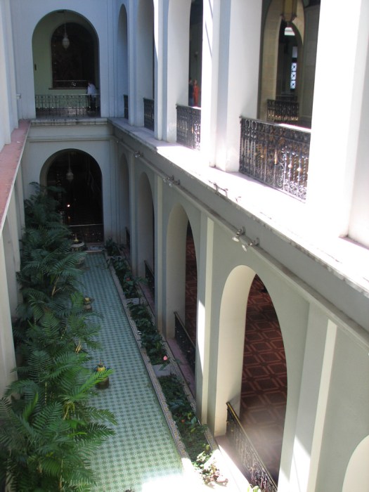 With hand-painted and gilded open beam ceilings, stained glass windows, multi-ton chandeliers, huge hand-painted murals, interior pools, gardens and amazing woodwork, it’s called a palace for good reason. It does look fit for royalty.
This arch crosses 12 Calle and allows pedestrians to traverse from the third floor of one building to the third floor of another without having to go downstairs or cross the street.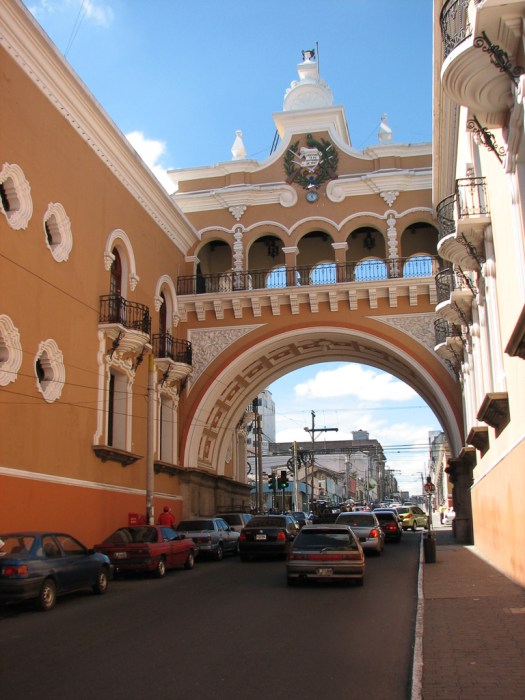 I made my way out of the city toward Antigua, arriving in time to check in, get settled and make a trip to the grocery store to stock my kitchen. Guatemala is an interesting mix of measurement standards. The speed limits on the highways are listed in kilometers per hour (I spent a lot of time sitting stock still in traffic looking wistfully at a 70 kph limit sign) so you’d think it would be the metric system everywhere. But when I went to the grocery store, food was being sold by the pound… not the kilo. Go figure.
The rest of the day was spent unpacking, getting settled, orienting myself to the hotel grounds, getting internet access set up, etc.
29 November 2009
I walked into town today to first of all buy a new battery for my film camera (the little digital uses common AA’s but the film camera uses a “special” battery) and found a camera store across from the Parque Central that had what I needed. So now I can take both the digital pictures I’m sharing with you as well as slides from a better camera.
Like all towns, in the center of Antigua there’s a central square, which, in Antigua is now a park surrounded by a cathedral, stores and government buildings. Antigua’s “Parque Central” is large and beautiful, full of flowering shrubs, trees and fountains. Here’s a Mayan woman and child photographing her son in front of a fountain. 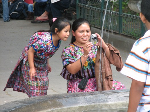 It’s impossible to capture the park in a picture because of its size and all the large trees. In colonial times it was a more open square and a large market was set up. The market was sometimes cleared away for bullfights, military parades, public floggings, public hangings and other forms of public entertainment.
The Parque Central has at its center what is probably the most photographed fountain in Guatemala. Designed by the primary architect of the city it features mermaids covering their breasts with their hands and water streaming from their nipples. 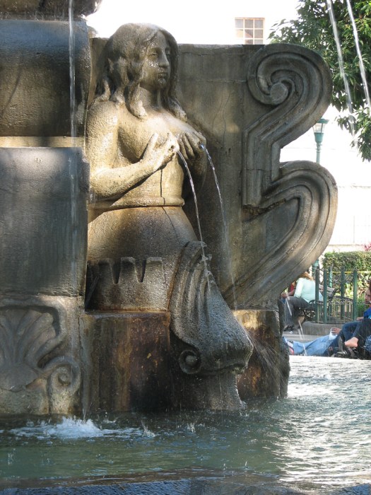 Today being Sunday there were a lot of people enjoying the park. Unlike Guatemala City, I’m finding the people here very friendly. I commonly get a smile and an “hola” from people I pass on the street or looking at a site of interest, which not uncommonly turns into a more extensive conversation when they discover I speak Spanish.
On the south side of the Parque Central is the Palace of the Captains General.  A long two-story building with 27 arches on each floor. It was originally built in 1558 but, like most buildings here, was destroyed by earthquake and rebuilt, first in 1761 and again in 1773. It’s currently under restoration. It used to house the colonial rulers, barracks of the dragoons, stables, the royal mint, courts, tax offices, ballrooms, etc. etc. More recently (before the current restoration) it was home to the Sacatepéquez Police Department and the local tourist office.
On the east side of the Parque Central is the Cathedral, originally built in 1545. 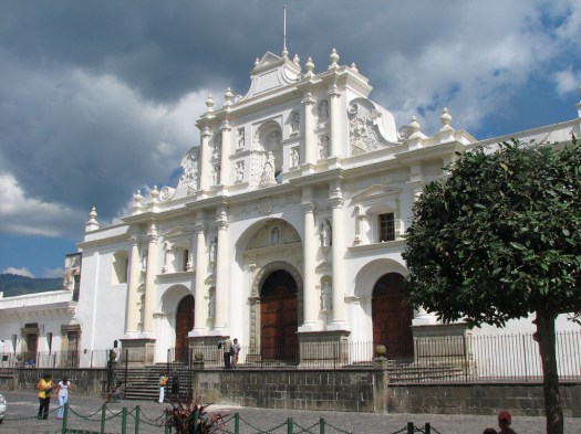 This version didn’t last long, being destroyed by (you guessed) earthquake in 1583. A new cathedral was built in 1670 by conscripted Maya labor. This cathedral was massive with five naves, 18 chapels and a central area 90 meters by 20 meters (295 feet by 65 feet). It, too, was first damaged by earthquakes in 1689 and 1717. The walls came tumbling down in the earthquake of 1773. Two of the original 18 chapels have been restored and today are the Church of San José.
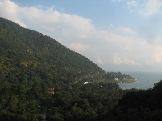
Walking north from the Parque I passed under the arch of Santa Catalina, which is all that remains of a convent founded here in 1609. 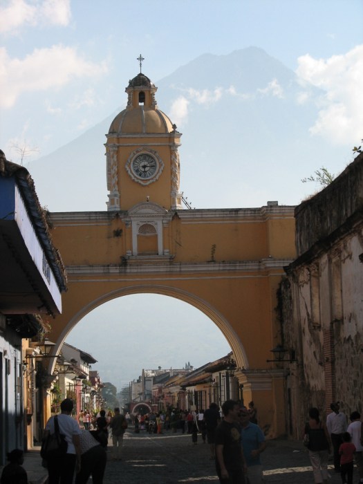 The arch was originally built so the nuns could walk between the two halves of the convent without being sullied by contact with the outside world. The view of the arch looking south shows the Volcán de Agua which towers over the town. It was hazy so it’s hard to make out the volcano in my picture. Though I understand that’s normally the case, I’ll try to get a picture that more clearly shows the volcano to post.
Further north is the church of La Merced which has been impressively restored. 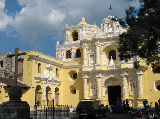 There was a small market in front of the church with it’s collection of stalls. I bought lunch at one of them – freshly barbequed beef tacos on handmade corn tortillas. Fried banana covered with cream and sugar was desert. Nummy!
From there I went west to the ruins of San Jerónimo, a school built in 1739. These ruins really are impressive and, I understand, this site is frequently used for classical music concerts which are held among the ruins.
While wandering and photographing I met an off-duty Guatamalan soldier who was out from his home in Guatemala City with his family. He was back in Guatamala after serving as part of a UN peace-keeping mission in Africa. He wanted a picture of me with his family and invited me to his home when I return to Guatemala City. I took a picture of him with his family, thanked him for his generous offer but declined to return to Guatemala City.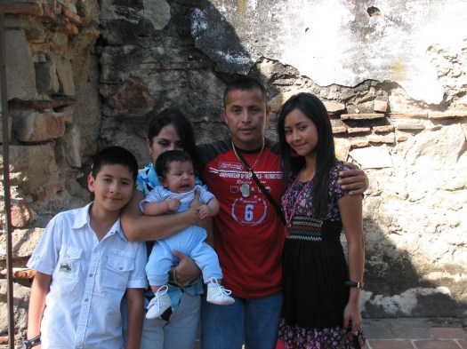
From here it was all the way back across town to the southeast. It was my intent to see the Casa Popenoe, a restored colonial mansion originally built in 1634 but there was a sign out front saying it was closed until further notice. I’ll check back before I leave Guatemala but I don’t expect to be able to get in. The story of this mansion is amazing, though. It was in ruins when it was bought by a United Fruit Company scientist in 1932. He sifted through the rubble and, piece by piece, restored the mansion to its former glory then filled it with colonial-era antiques and art. The house includes a pigeon loft. Those pigeons provided the residents with their mail service.
Further south is the Church of San Francisco, one of the oldest churches in Antigua, dating from 1579. 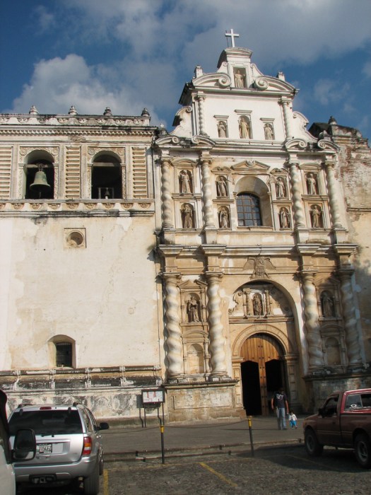 This is the entry gate to the church, looking toward the church.
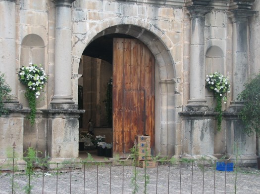
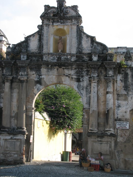 And this is the gate as seen from inside the church grounds, looking out.
 The church eventually became a huge complex that included a hospital, a school and a monastery. When the monastery was destroyed (yep… in an earthquake) it was never rebuilt and you can tour the ruins.
This was the home of Hermano Pedro de Betencourt, a Franciscan from Tenerife in the Canary Islands, who was made Central America’s first saint by John Paul II in 2002. He’s credited with numerous miraculous healings and an entire room in the little museum on-grounds is filled with hundreds of plaques from people thanking him and attesting to their healing by his intervention. Some of those plaques are dated 2009, although he died in 1667.
The streets of Antigua are all cobblestone; but not the smooth cobblestone I’ve seen elsewhere. These stones are all very rough volcanic rock.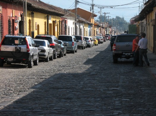
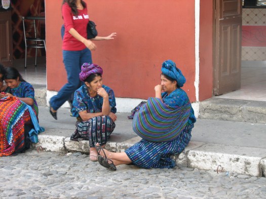
And everywhere are these old, extremely colorful buses, usually packed to the gills with people. My guidebook calls them “chicken buses” because passengers are frequently carrying chickens to or from the market.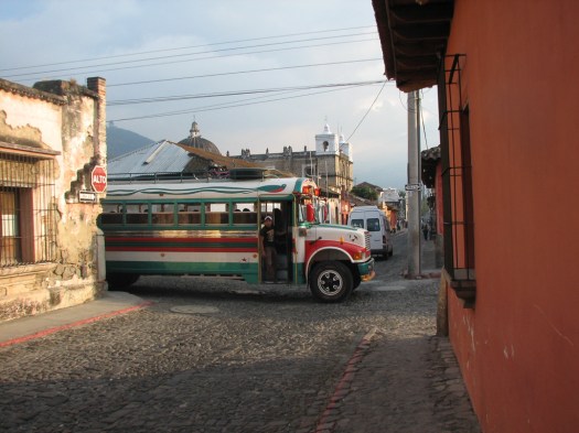 And everywhere there are indigenous people in traditional dress.
 The camera equipment I was carrying felt as if it was gaining weight, I was getting tired of lugging it around, and it was getting dark so I hiked back to my room to fix myself dinner, check email, and write this blog entry. Haven’t yet decided where I’m going tomorrow but I’d probably better decide soon.
30 November 2009
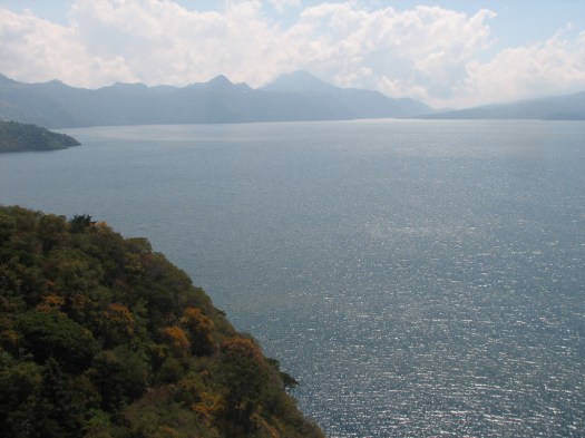
 I tried driving up to Lake Atitlán but never got to see much of the lake. It was socked in with fog. The lake is beneath the clouds. On the left, rising above the clouds is Volcán Atitlán.
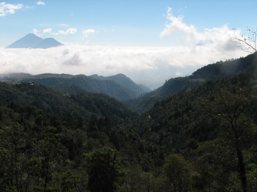 The route that I chose on the Pan-American Highway took me right by the lake but far above it. From that vantage point you could see only the volcanoes sticking up above the clouds. And the fog never cleared. So I drove up… drove around in the fog… and drove back… and that was pretty much my day… The small volcano on the left of the picture is Volcán San Pedro.
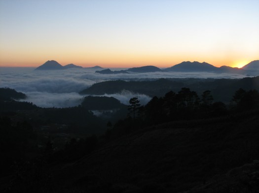
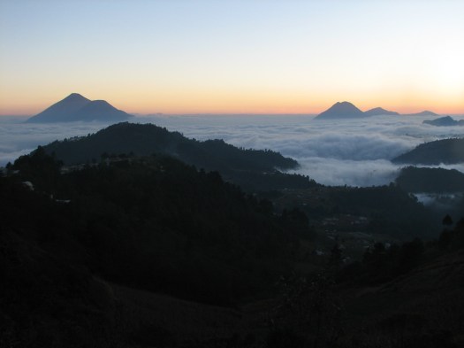
In this picture Volcán Atitlán is on the left and San Pedro is on the right.
Driving here, however, can be a bit of an adventure in itself. I’ve read plenty of stories about driving in developing countries and none of it is a surprise, but it’s one thing to read about it… it’s another to actually drive in it. The chicken buses play a big role because they’re so ubiquitous. Their drivers know every square inch of their route, I’m sure, and they waste no time whatsoever in covering that route. They drive like the logging trucks in the Pacific Northwest in the US, except they have a bus full of passengers. Those buses have blown right by me in the opposing lane of traffic on twisting mountain roads. Now that would be unlikely to happen if I were on two wheels, but on four wheels, I just let them go. Sometimes these buses put out a smoke screen behind them that would make any battlefield commander proud.
You see that double yellow line? It doesn’t mean a thing to those buses. Not a thing. Some places on the Pan-American Highway have two lanes going up the mountain and one lane going down so faster vehicles can get around slow traffic going uphill. I’ve seen a downhill-bound chicken bus cross the double yellow and simply take over the second uphill lane. And he’s being followed by a line of cars the way a running back follows his blockers. (If you were going uphill and wanted that lane would YOU argue with him? I didn’t think so.)
Where parking is at a premium in towns that means one of the two lanes going through town is frequently used for parked cars and the traffic has to organize on the fly which direction gets to use the remaining lane.
The road is shared by more different kinds of traffic than in developed countries. Pedestrians walk in the road because, except in the middle of town, there are no sidewalks. And LOTS more people walk along the roads. I’m sure for financial reasons. LOTS more small motorcycles and scooters weave around through traffic. LOTS more bicycles are on the street. Tuk-Tuks are as ubiquitous as the chicken buses. And, of course, there’s the usual assortment of cars, pickups and commercial trucks. On narrow roads I’ve seen plenty of cars, trucks and buses swerve partially into opposing lanes of traffic to avoid a bicycle, Tuk-Tuk or a group of pedestrians.
Vehicles are used differently, too. I’ve seen a family of five on a scooter. (The father was driving with a small child seated in front of him. The mother was behind him with one child on each knee.) I’ve seen 20-25 people in the bed of one of the small Toyota pickup trucks (not a full sized truck… one of the small ones). OK… they were’t all “completely” in the bed… some were standing on the back bumper and some were sitting on the sides that enclosed the bed.
Once, while driving at night, and passing a commercial truck on a narrow two-lane road, bicycles appeared coming right at me. Of course they had no lights and I couldn’t see them until I was right next to the truck I was passing. The truck and I took up the whole road and the bicycles had to make a quick dive for the weeds. No harm, no foul.
Another time, as I was coming into a small town there was a large truck stopped in my lane. I couldn’t see around him so I wasn’t sure what the hold-up was but as I peeked around, then passed in the opposing lane of traffic I saw he was right outside a repair shop. All their space in the shop was filled so they had set up shop in one of the traffic lanes and there was somebody under the truck lying on his back in the street welding part of the frame.
My first hint about road conditions was when I picked up my rental car. I’ve never had a rental car where it took them a full five minutes to show me every dent, ding, scratch and owie on the car and mark it on their form so I wouldn’t get accused of putting it there. It’s also the only rental car I’ve ever had that had the hubcaps zip-tied to the wheels so the hubcaps didn’t go flying off on the chronically rough, pot-holed roads.
The amazing thing is that it all works. It works just fine. I haven’t seen an accident yet. Everybody knows that it’s highly likely that lots of people won’t follow the rules so they watch more carefully. In developed countries people think everybody else will follow the rules, so when they don’t it’s a surprise and there’s an accident. That expectation that other people will follow the rules simply doesn’t exist here… for good reason.
1 December 2009
 I tried returning to Atitlán Lake today and found sunshine. Yea!
It’s hard to give a sense of Atitlán Lake in pictures because you can’t get the panorama. My guidebook quotes Aldous Huxley, “Lake Como, it seems to me, touches the limit of the permissibly picturesque; but Atitlán is Como with the additional embellishments of several impressive volcanoes. It is really too much of a good thing.”
There are two volcanoes in this picture. The one on the right is Volcán Tolimán and is closer than the one on the left (Volcán Atitlán) which is partially obscured by clouds. Volcán Tolimán is actually shorter (at 3150m) than Volcán Atitlán (at 3537m) though it looks higher because it’s closer.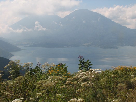
This is a really big lake.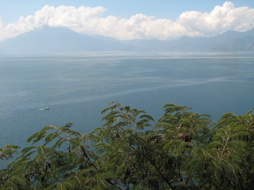
I don’t know that you can get “too” scenic but this lake rates as the country’s number one tourist destination. And that’s in a country with some of the world’s biggest and best Mayan ruins.
The lake is 320 meters (1,050 feet) deep and 18 km by 12 km (11 miles by 7 miles). In the morning the air is calm and the water still. But in the afternoon a wind blows up from the ocean, the xocomil (the wind that carries away sin) comes up and churns the surface. According to Mayan legend, when the wind blows from the north it means the spirit of the lake is giving up the body of somebody who drowned after having claimed his soul.
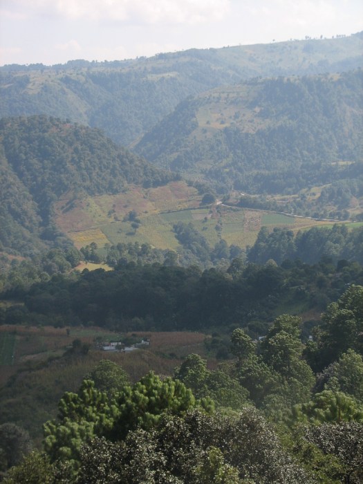
One of the things that interested me was how the local farmers planted crops right up the steep slopes of the mountains. I’m used to seeing only flat land used for farming. Caring for those crops can’t be easy.
The lake is surrounded by Mayan villages each of which has its traditional patterns and colors for their clothes, which they still wear. I believe this is the village of Santa Catarina Palopó as seen from the mountain above it.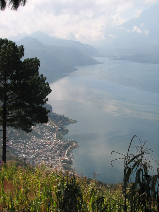 In these villages, the traditional clothing isn’t a costume for tourists or reserved for special occasions. They’re everyday wear. The patterns and colors all have special meaning. I talked to a woman who wanted to sell me some weaving and she explained some of the meanings for me. The red was in memory of the Mayan blood that was shed in the European conquest of Guatemala. The blue was for the blue of the lake. There were animals from everyday life (rabbits and horses) and Mayan mythology (a two-headed serpent).
Nothing, however, is set in stone. One of the villages I went through, Santa Catarina Palopó, used to make their huipiles (women’s blouses) predominantly in red. A North American coming through in the ’70’s, however, commissioned a huipile in purple, blue and green. Those colors became so well liked that now they are the predominant colors worn in the village. Although the woman I was talking to was selling her goods in the neighboring village of San Antonio Palopó you can see the colors of Santa Catarina Palopó in my picture of her.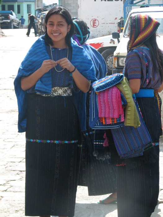
If you don’t ride a bike this won’t interest you but, for those who do, how many times have you seen a dual sport Kymco being used as a police bike?
This is San Antonio Palopó as seen from above
and as seen from close up.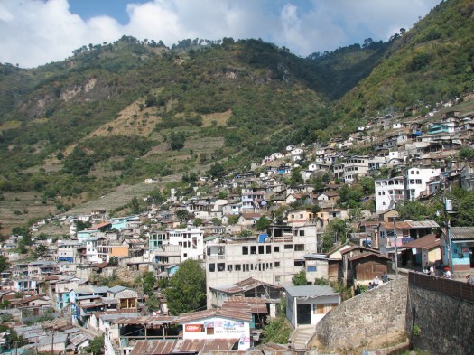
While I was driving around these mountains I passed a couple of elderly women carrying firewood up a mountain. You can see from the picture above how steep the mountainsides are. I pulled over to take a picture but didn’t have the chutzpah to stand in front of these old ladies and snap pictures of them as they trudged uphill carrying loads of wood I’m not sure I could have lifted off the ground, to say nothing of carrying uphill on my back. That just seemed insensitive, so I only have pictures from the back.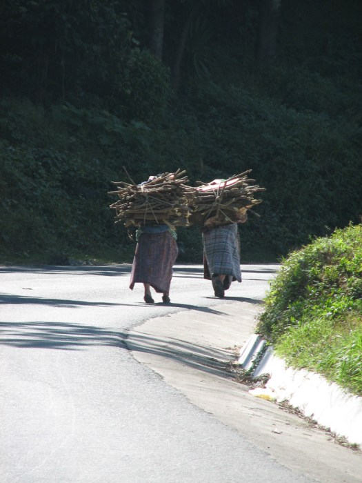
After lunch in Panajachel I left town toward Sololá and stopped at the Reserva Natural de Atitlán, a nature reserve with hiking trails and zip lines. It’s set along a ravine that goes up the steep sides of one of the mountains that go up from the lake. I enjoyed hiking the trail up the mountain though lush forest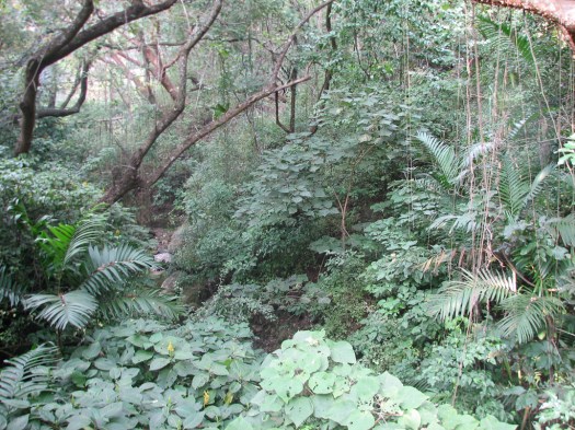
across pleasant streams
and past pretty flowering plants.


I think these were ginger plants.
Of course I had to try the zip lines and that was a kick!! The lines zigzag back and forth across the ravine, taking you down to the bottom where we started. One of the lines was a full kilometer long and they said you reach a speed of 14 meters per second (31 mph)! Woo Hoo!


I kept my camera on some of the zip lines and took pictures as I flew. This is the view near the top. 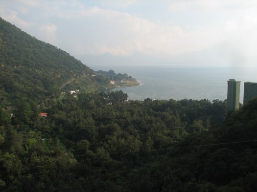
And this is farther down the zip line.
This is looking straight down at the tops of the trees. And I gave the camera to one of my guides on a couple of others and he took pictures of me as I came in.


They send you up with two guides. One goes ahead of you to slow you down and stop you as you come in if you have problems doing it on your own, and the other stays behind to make sure you get locked in and set off properly. I never had any problems braking on my own so after observing me on a few lines he felt confident that he could not worry about his having to stop me and he could just take pictures of me.
It was a fun day.
2 December 2009
I didn’t take much time for travel today. Too many other exciting things (like washing clothes in the hotel sink) to do.
After the necessary but boring stuff got done I went to the nearby town of Jocotenango to check out a couple of museums. That means I have very few pictures for you but it was interesting for me. Before going into the museum I took a couple of pictures of the cathedral. A group of girls were having a pick-up basketball game in front of the colorful cathedral.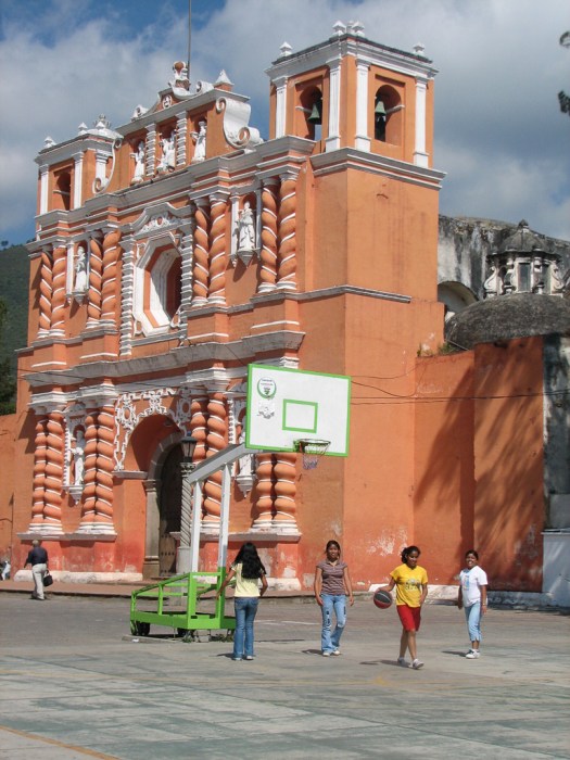
 The first museum was dedicated to Mayan music and they had lots of instruments on display showing the pre-Colombian instruments and the changes brought by European conquest. I went through the museum on my own and just before I left museum staff came and told me they were starting a narrated tour so I went through it all again with a guide who picked up the instruments and played them for us so we could hear how they sounded.
This was an oboe-like instrument that they said was very difficult to learn how to play. It used a palm leaf as a reed. Brought over by the Spaniards, the Maya were attracted to its mournful tone.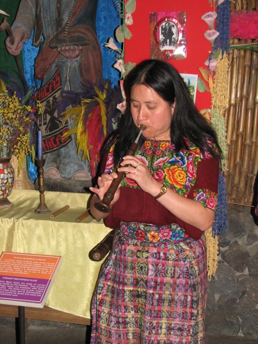
The marimba is a major instrument in current Guatemalan music but its origin is from Africa. This was an old one that used gourds under the wooden bars to serve as resonators.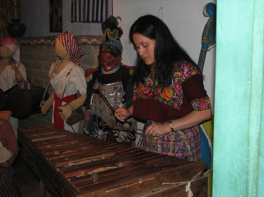
Since the museum’s focus is on music, I was surprised to see a display on Maximón but I took some pictures and will share what I learned. Maximón is an evil saint. I know that sounds like an oxymoron, and I suppose it is, but that’s what he is.
In Guatemala the Maya mixed a lot of their indigenous religious practices with Catholicism after the Conquista. That mixture of traditional Mayan religious practice and ritual with Catholic practice and ritual continues today. One of the many church ruins in Antigua has a room where the ceiling has been blackened with smoke from the many burning candles used in Mayan religious practice.
Although Maximón is not actually part of pre-Columbian Mayan religious practice. The Mayans developed him after the Conquista. He’s considered a saint in the same way Catholic saints are. He exists to protect, heal and care for his people and there are hundreds of plaques attesting to his answers to prayer, just like San Pedro de Betencourt and other Catholic saints.
He’s an evil saint because he does all the things the good saints would never do. There are a few places in Guatemala where there’s an effigy, an idol, of Maximón that is worshiped. It’s kept in a darkened room and always has a cigar in its mouth. Petitioners who come to him bring offerings of cigarettes, money and rum. An attendant will pour some of the rum into the idol’s mouth. The rest of the rum presumably goes into the attendant’s mouth at some point in time. This is Maximón in his darkened room.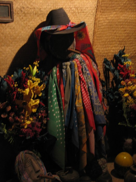
And this is how he looks with his face illuminated by my camera’s flash.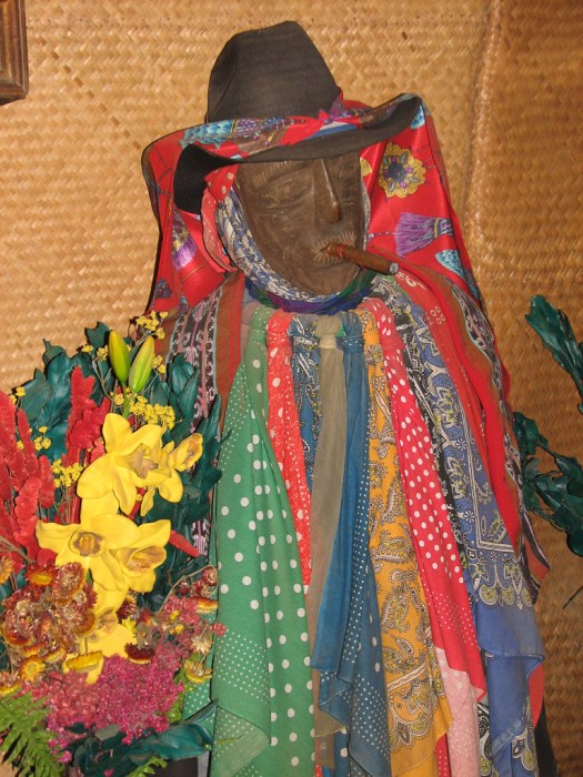
The multiple scarves he’s wearing are gifts to him.
Although he’s a Mayan creation, he’s always dressed in Western clothes and he’s always seen as an enemy of the Catholic church. He is always associated with ladino (western) vices such as drinking and smoking. His image has no legs and some say he represents a Franciscan friar who had a habit of chasing young indigenous girls so his legs have been removed to prevent any further activity of that nature.
One of his attendants has the job of removing the ashes from his lighted cigarettes. Those ashes are then sold as a cure for insomnia. When villagers come with a petition they frequently light candles and burn them before him. The color of the candle indicates the nature of the request – white for the health of a child, yellow for a good harvest, red for love and black to ask for bad luck for an enemy. Here’s a picture of the altar with all the offerings in the darkened room.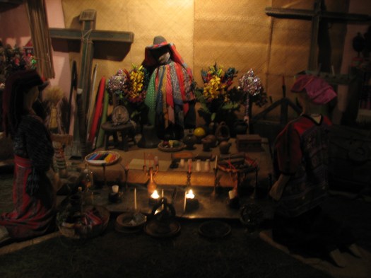
And here’s what it looks like when illuminated by my camera’s flash.
His effigy is brought out and paraded around the streets during certain fiestas, just as an effigy of Christ is; sometimes in the same fiesta. Those who worship him take their worship seriously and there are reports of ladinos who made fun of him and were overheard being beaten up. If you go to see a real effigy you’re expected to pay for his upkeep and, if you want to take pictures of him, you pay some more. Since what I saw was in a museum I didn’t have to pay (except for the museum entrance fee!)
In a way, it kind of makes sense to me that, having experienced the incredible cruelty of the conquistadores simultaneously with the introduction of their religious practices the Maya would see the conquistadores and their priests as both evil and powerful. And that’s what Maximón is – evil and powerful. That would also explain why he’s always dressed in western clothes. I never heard anybody present it like that but looking at it that way helps me make sense of the practice.
Next door to the Mayan music museum is an operating coffee finca that offers tours. It’s a small operation that grows and processes organic coffee and has been in operation continuously since the 1880’s. Because it’s small, none of its crop is exported.
Shade-grown coffee is the best so trees are planted and pruned so as to limit the amount of sun that reaches the coffee plants.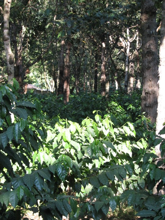
As trees get too big and give too much shade they’re harvesed for their wood and new trees are planted.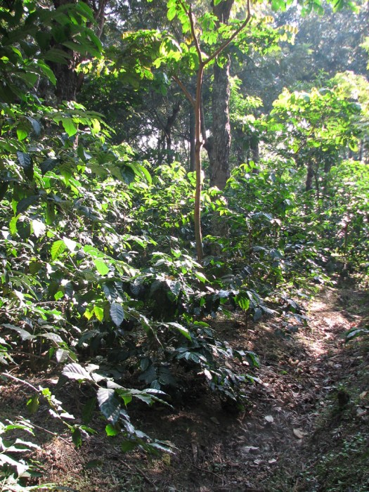
Organic mulch is added to keep down the weeds. Although I didn’t take a picture of them, predatory insects are controlled by creating traps out of old plastic soda bottles. A hole is cut in the side of the bottle. The bottom is filled with kerosene and a small container of an attractant is put in the top.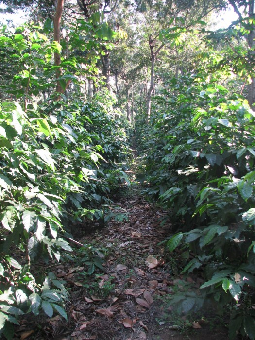
These coffee beans are green (obviously). When they’re ready for picking they turn red. 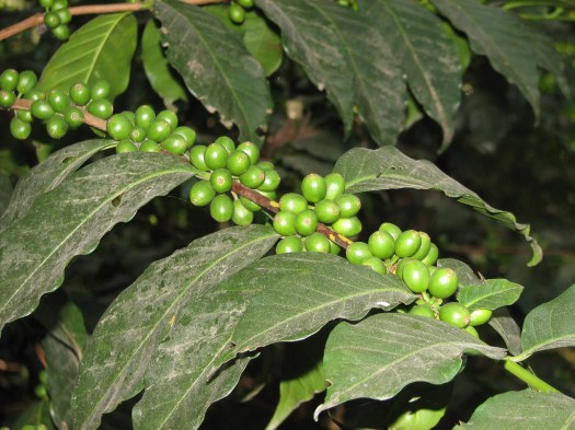
In a very labor-intensive process arabica beans, which make the best coffee, are sprouted. Their roots are then cut off and, one plant at a time, the arabica plant is grafted into the stronger robusta root stock.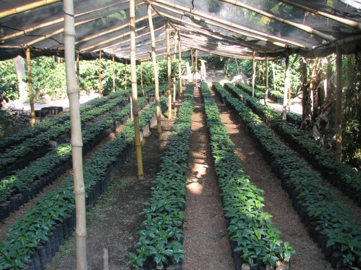
After picking by hand, the coffee beans are laid out in the sun to dry.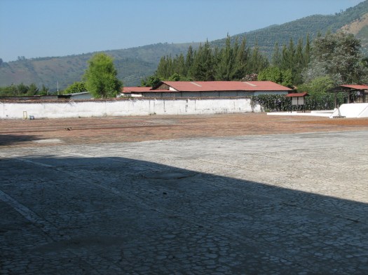
This would normally be the time that the coffee harvest would be beginning but climate change has impacted coffee plants, too. The coffee beans are ripening later now than they used to, so the harvest has to be delayed. Of course at the end of the tour we could buy some of the coffee beans.
3 December 2009
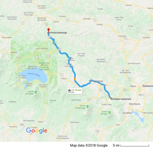 There is probably no more famous market in Guatemala than the market in Chichicastenango. My guidebook warned of difficulty finding a place to park nearby because of the combination of the crowds of locals who come to this market from all over the western highlands as well as the tour buses that truck in hoards of tourists. It’s a twice-weekly market, held on Sundays and Thursdays and I picked a Thursday hoping there would be a smaller crowd on a weekday.
Chichicastenango was not originally a Mayan town. It was created by the Spanish in 1524 as a place to dump the K´iche´ Maya refugees they created by destroying the nearby town of Utatlán.
I suspect the current economic climate had more to do with the small crowd than the fact that I was there on a Thursday, but, either way, although there were a lot of people there it wasn’t nearly as crowded as I thought it might be based on the descriptions I’d read. I got a place to park not far at all from the center with the help of a man wearing a red uniform vest and a photograph ID around his neck.
It turned out that he’s a registered guide and, by helping me park he got first crack at me to sell me his guide services. One of the commonalities of developing countries that you don’t see in developed countries is the aggressiveness in hawking your wares or services to tourists. Great effort and ingenuity is expended in finding ways to separate tourists from their dollars.
Instead of doing my usual thing of saying “No, gracias” and walking away, I accepted his offer. He could offer me information I wasn’t going to get elsewhere and I’d never hired a guide before so I decided to give it a try. Instead of heading for the market first we went outside of town. As we walked he pointed out a plant growing out of a sheer dirt wall and talked about its spines. This plant is the origin of the name Chichicastenango which means, “Place of Nettles” in Nahutl.
We climbed a steep hill just outside town. Many of the hills in the highlands are topped with Mayan shrines and we were heading to just such a shrine; this one know as Pascual Abaj. I was grateful for my education on Maximón at the museum. It helped me understand better what I was seeing. Part way up the hill was another shrine with people performing Mayan religious rites. Much to my surprise, my guide (Carlos) told me it wouldn’t be a problem to take pictures, so I did.
We finished climbing to the top of the hill where the shrine to Pascual Abaj was located. There was a central altar. The large stone in the center of the main altar is Pascual Abaj. Carlos told me the original Pascual Abaj was stolen some years ago so this is a replacement which is sunk several feet into concrete.
The central altar was surrounded by smaller altars and there were a couple of people there beginning a ritual with the help of a shaman. Two other people at another altar there performing a ritual, Carlos told me, were a shaman and his assistant. The shaman and his assistant had been hired by people to perform the ritual, though the clients weren’t present.
These are the people with the shaman. The ritual begins with the shaman drawing a circle on the altar with sugar.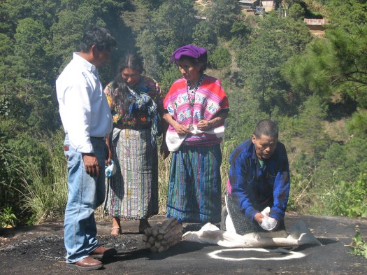
Designs are then added inside the circle, also with sugar.
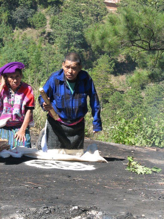
Mayans will hire a shaman to perform a ritual to cleanse them of spiritual impurities, help a business succeed, for healing for themselves, a child or other relative, put a hex on an enemy or most any other need that comes up in human lives. Here the shaman is running a handful of candles over the proprietor of the business to cleanse him. The candles will later be added to the sacrificial fire.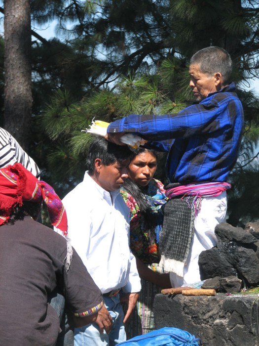 The shaman, in a highly ritualized ceremony, burns an offering on the altar while praying to the Mayan gods out loud. These are long, loud and impassioned prayers. The offering burned on the altar varies somewhat, depending on what’s being prayed for. In the case of the first set of pictures, the success of a bakery owned by the petitioner was the purpose of the ritual and the offering includes bread. A cheap, potent locally produced alcohol is also commonly sprinkled on the fire. Chickens may be sacrificed or meat added to the fire. Here the women cut meat to be added to the sacrifice.
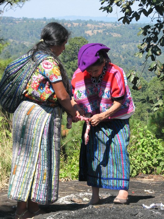 Candles and incense are usually burned and flowers are scattered around.
Everything has significance. Different flowers are used in different ceremonies. Different colored candle have different meanings and purposes. The items burned on the altar all have significance and vary depending on the situation. In this case the clients help build the structure on which the sacrifice will be made.
In the other ritual, this one with no clients present, the shaman’s assistant brushes clean the area for the sacrifice with leaves. The shaman and his assistant kneel before the sacrifice and pray. Notice the red head covering on the shaman. This indicates he was praying for good.
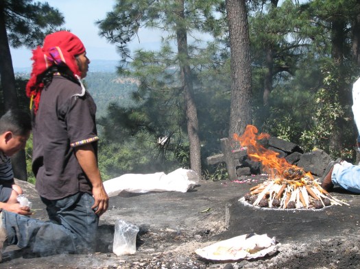 The burning sacrifice. Note all the candles around the base.
 Going down the hill and back into town, we went to the Catholic church.
 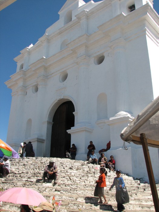 No photography is allowed inside but the inside of the church has some of the same low altars I saw on the hilltop. Francisco Ximénez, the town priest from 1701 – 1703 found and read the Popol Vuh, the Mayan holy book. The Maya saw he respected their traditions and set up their altars inside the church.
Before entering the church, the faithful make offerings before the front door, burning copal and estoraque incense in perforated cans. This woman is praying at the top of the steps to the cathedral. The tin can in front of her has burning incense in it.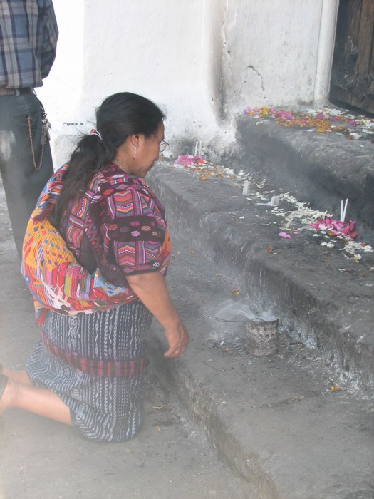 Inside the church, instead of the open fires I saw on the hilltop, the altars had candles burning in various configurations. The configuration of the candles varies based on the nature of the petition – whether it’s for a good harvest, healing, children, travel or whatever.
Carlos told me that a couple who planned to marry would come to the church, light two candles, one for each of them, put the two candles right next to each other and place them on one of the low altars. If both candles burned to the ground and remained standing next to each other, it signaled that the marriage would last. If one of the candles fell over before it finished burning, it meant the marriage would not last.
The couple whose candles didn’t stay standing would then go to a hilltop shrine for a ritual by a shaman to cleanse them of whatever the impediment was that would prevent their marriage from enduring.
For these Maya, the church is alive with the spirits of their ancestors. The spirits of the “first-people”, the ancient ancestors, live under the altar railing at the front of the church. Former officials are in the middle aisle. Commoners are in the nave and native shamans are beside the door.
Catholic saints are incorporated into the Mayan pantheon and are appealed to in prayer and offered candles and the same alcoholic beverage poured out at the Mayan shrine on the hilltop.
After leaving the church we wandered through the market which is, indeed the most incredibly immense town market I’ve ever seen. All the stuff tourists would be interested in is around the outside with large stalls and comparatively wide aisles.
Just in case the hawkers in the stalls haven’t convinced you to buy, women walk around among the crowd to stand right in front of you and offer you their wares.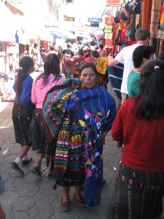 In the interior, where everything is smaller, closer together and darker is the stuff for everyday needs – foodstuffs and everyday household items. Here you can see the profusion of awnings over some of the market stalls.
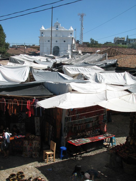
On the side of the market opposite the main cathedral is a smaller church known as El Calvario. The scene outside is the same, with people offering incense in perforated cans and praying outside the front door. Inside, at the front of the church is a glass-encased supine effigy of Christ which is taken out of the church and paraded around the streets during Easter week.
My last stop was at the town cemetery which looks like a small city with cement monuments almost as big as a small shack.


Of course it’s wealth based and if your family can’t afford a huge cement monument you get a mound of dirt. Here the mounds of dirt are in the foreground with the cement monuments in the background. Poverty or wealth even follow you to the grave.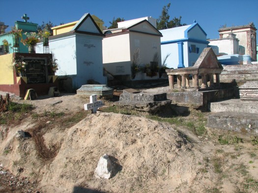 At the back of the cemetery are more Mayan altars. When we got there two rituals were in progress. One was well underway with people standing around a fire praying loudly and fervently. The other was just starting.
I took only one picture because one of the shamans motioned to me not to take pictures. This shaman was wearing a black head covering and using black candles. Carlos told me this indicated he was praying to Maximón for evil and that he motioned to me not to take pictures because taking a picture would interrupt or cancel the hex. He’s the shaman at the front of the picture. The group at the back were praying for good, Carlos told me. The people praying for good were loud and fervent. I could hear nothing from the shaman praying for evil.
I asked if there are particular shamans who pray for evil and others who pray for good but Carlos told me a shaman will use whatever ritual is appropriate for a client’s wishes. The older woman who was the client of the shaman praying for evil did not participate while I was there but sat off to one side and watched the entire ritual as the shaman performed.
Chichicastenango is about a two-and-a-half hour drive from Antigua so I left before it got too late and I could get home. When I did get home I managed to drop my camera and damage it.
4 December 2009
Today was spent taking care of errands in Antigua. One of the camera stores I stopped at gave me directions to a store that might be able to fix the camera. I had been absolutely sure that they’d tell me they had to send it off somewhere (Guatamala City? the US?) to get repaired by a factory-authorized repair shop. That’s the story I’d hear in the US.
Instead a business that sold wine and had an Internet cafe was reputed to be able to fix cameras. It sounded questionable to me but I had nothing to lose so, following the directions the camera store gave me I found the shop. They said they’d charge me 250 Quetzales (about $30) to determine what the problem was and see if they could fix it. I took them up on their offer and, when I returned they had it all fixed, so I can keep adding pictures to this blog! (Sure would be boring if you had to just read my writing with no pictures.)
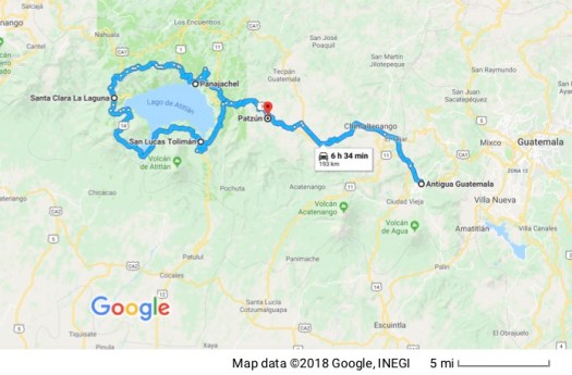
I also stopped by a travel agency. I had planned to make day trips around the country using Antigua as my home base but in order to get to the department of Petén where the most impressive Mayan ruins are, would require 10 hours of drive-time one-way (in Guatemalan traffic on Guatemalan roads). Ten hours out, plus ten hours back plus at least two nights hotel (probably more) plus gasoline just wasn’t worth it. I do not like group tours. But this time that seemed like the better option if I’m going to see Tikal, which I do not want to miss. So I relented and have a group tour scheduled for next week.
There’s much, much more to see in Petén department than just Tikal but that will all have to wait.
5 December 2009
The plan today was to drive down to the Pacific coast. The town of Monterrico is in the middle of a nature reserve that exists to protect a turtle nesting ground. You notice I said that’s what the plan “was”… past tense? The best laid plans of mice and men…
When I made my reservations at the hotel I did it through a timeshare exchange. In addition to minimizing what I pay for the room it also allows me to get an apartment-like suite with a kitchen which minimizes what I have to pay to eat. I fix most of my own meals and groceries are much cheaper than restaurant meals. (Although I frequently eat like the locals, buying from street vendors or eating in comedores, which is pretty cheap. Lunch today was 20 Quetzales, about $2.40 US from a street vendor.)
Because it’s a timeshare exchange, reservations are set up in one week increments. When I checked in the hotel clerk confirmed I was leaving December 5 and I explained I had two weeks, back-to-back and wasn’t leaving until December 12. He said he’d fix it so they knew the Steve Gray checking out December 5 was the same Steve Gray checking in December 5. This is not an uncommon occurrence so I didn’t think anymore about it.
Today, as I was leaving for Monterrico I stopped at the front desk just to make sure everything was set. It wasn’t. The hotel had me scheduled to check out of my room today and to check into another identical room today. I explained (multiple times) that the people set to move into my current room could go into the identical type room I was currently scheduled to move into and it would be no inconvenience to them but it would inconvenience me significantly to have to pack everything up, move up one flight of stairs, and unpack everything again; especially since I had all my groceries to move.
Logic had nothing to do with it. I was scheduled to leave room 310 and other people were scheduled to move it. So I had to leave 310 and move into 410. The clerk checked with his boss and came back saying that’s the way it had to be. (Grumble, grumble, grumble)
Monterrico is a a little over a two-hour drive from Antigua, four-and-a-half hours round-trip, so by the time I packed up everything, moved it up one flight of stairs, unpacked everything and put it away, called housekeeping to inventory the dishes, pots, pans, silverware, etc. in my former room (so they knew I hadn’t stolen any of their plates) and then unlock the kitchen cabinets in my new room and inventory everything there to document what I was starting with… there wasn’t enough time for Monterrico and I was blessed with the opportunity to practice what I preach – that we have to let go of the things we can’t control.
I walked into Antigua to notify the travel agency with which I’d booked my Tikal tour that when they came to pick me up to take me to the airport they probably shouldn’t knock on the door at room 310 as I’d previously told them. I bought my lunch from a vendor set up in front of La Merced (picture posted on 29 November, the yellow and white church) and sat down on a stone wall to eat. A Mayan woman carrying a load of textiles to try to sell to tourists sat down next to me as I ate and tried selling me some of her textiles. As most of them do, she started by speaking to me in English. When I responded in Spanish, she switched, suggesting that I buy something first for my wife, and when told that there is no wife, she suggested my girlfriend. When told there is no girlfriend (all in Spanish) she expressed surprise at my Spanish and asked where I was from because I looked American but spoke Spanish without an American accent.
We ended up having a nice conversation which was completely free of continued efforts to sell me her wares (well… almost…). Her Spanish was good (which isn’t true of all Mayans). Her native language, she said is Kaqchikel.
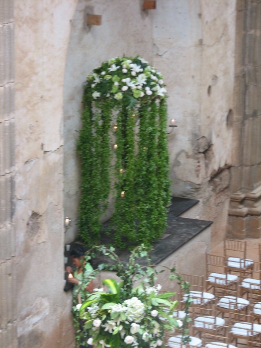
From La Merced, I went on to Las Capuchinas (no… it has nothing to do with the Italian coffee drink). The Capuchin nuns were probably the last order of nuns to come to Guatemala and colonial authorities only allowed them to come on the condition they exact no money from their novices. They came in 1726, founding the city’s fourth (and largest) convent. This is the exterior of Las Capuchinas chapel which was being prepared for a wedding. A massive display of flowers and hundreds of candles were being prepared.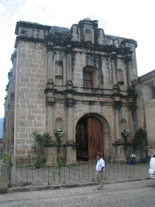
The chapel interior, decorated for the wedding.
 If you’ve ever listened to medieval chanting you know the traditional echo. This was the room in the convent used for their chanting. It’s underground and in the shape of a circle with a rounded ceiling and a very large center pillar to allow the sound maximum reverberation. A few windows at the top of the room and the doorway allow the sound above ground.


It isn’t visually exciting to look at but I thought it was interesting the way they created the architecture to enhance the sound quality they wanted.
This was a very strict order and nuns slept on wooden boards with straw pillows. Once they entered the convent they were allowed no visual contact with the outside world. Food was passed to them by means of a turntable and they could only speak to visitors through a grill. This is the area where the nuns’ individual cells were located. Each tiny cell was set around this circular open central area.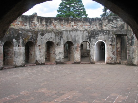
More pictures from the interior of Las Capuchinas
From there I went to the supermarket to buy a few groceries. I use the word supermarket because that’s what they call it here, but I’m not at all sure what the correct term would be. They have all the usual things supermarkets have (food, cleaning supplies and consumable household and personal products). But there’s a lot more. You want to pick up some clothing? They’ve got a pretty good selection of men’s and women’s clothing. You want a bicycle? They’ve got ’em. You want a motorcycle? Yep they’re there too. How about appliances for your home such as built-in cook tops… garden supplies… tools… you-name-it, they’ve got it. As you might guess, it’s pretty big. There are three entrances on three different streets.
I took a few more pictures of the chicken buses to share. It really is hard to convey the incredible number of these buses that are absolutely everywhere.
I think all the chicken buses had former lives as school buses in the US. Some still carry those markings, though they aren’t school buses. Because of the unconscious associations I have with marked school buses it surprised me once to see a yellow bus marked as a school bus like this one stop in the middle of the street, the back emergency door opened and two soldiers or police officers with automatic weapons jumped to the street.
6 December 2009
Since my earlier effort to drive down to Monterrico was frustrated by the hotel kicking me out of my room, I decided to try again today. So off I went.
There are a few other aspects of driving in Guatemala that I have to explain so this makes sense. One is how signs are posted so you know which direction you’re going. Many times you come to a fork in the road and, like the old joke, you just have to take it. There is no sign to give you a clue as to which way to turn to get to where you need to go.
Maybe this comes from a financing issue – there just isn’t enough money to pay for all the signs that are needed. Maybe it comes from the fact that many of the roads I’m taking are little two-lane roads that go through the country rather than major highways. That’s the only way to get anywhere, though. There aren’t that many major highways. Most roads are just little two-lane roads. Maybe there aren’t signs posted because they assume that anybody on that road is probably a local who already know where they’re going.
Whatever the reason may be, until I’ve driven a route enough to know where I’m going without signs, there’s always some guessing and some of my guesses are wrong so eventually I decide, “This doesn’t feel like the right direction” and turn around, or I see a sign that tells me for sure I’m going in the wrong direction.
There’s also some interesting Russian Roulette in the sign posting. Signs always tell you direction based on what city is ahead. So one of my tactics is to look at the map and pick out reasonably large towns along my intended route so I’ll recognize their names when they show up on signs along the way and I’ll know I’m heading the right direction.
Sometimes that actually works. Sometimes they pick a town to list on the roadside sign that doesn’t even show up on my map so it’s anybody’s guess as to which direction that town might be. Sometimes they pick a town that is actually a town I know is along my intended route but at another point along the road they choose to put up a sign for another town that isn’t on my map. When that happens I have to try to figure out if I a) missed a turn for the town I wanted and I’m now heading in the wrong direction, or b) I’m still on the right road but somebody just randomly decided to list a different town to indicate the direction I’m heading.
It tends to make finding your way around a much more time-consuming process than it would be if you actually knew where you were going.
En route to Monterrico I had to pass though the town of Escuintla and pretty much all of the above applied. I tried every major road around town and couldn’t find one that went the direction I wanted to go. Of course that doesn’t mean that road doesn’t exist. It just means I couldn’t find it. So I tried going through the center of Escuintla.
Unless a town is really tiny, keeping your sense of direction through a town is always somewhat entertaining. You bump into lots of one-way roads, roads closed for construction, and other ad hoc problems. In addition, just because a road is the main road coming into town, doesn’t mean it will be the main road heading out of town. And sometimes the main road you’re on splits into a couple of main roads and there are no signs telling you which way to need to go.
If it all sounds confusing, that’s only because it is. At least it’s confusing for me. Entrepreneurs here make good money picking up tourists at their hotels and driving them to where they want to go.
After wandering around Escuintla for a while and running into major traffic problems wherever I went I asked a traffic cop and got directions. But something was going on and traffic was at a standstill where I needed to go. I wandered around for a while, improvising on his directions and eventually got close enough to the road I needed to turn on to see what the problem was.
They’d closed off the main street for a parade. So you couldn’t leave town in that direction.
So I decided to do what any good Guatemalan would do. I parked my car in the middle of the street I was on, locked it up, and walked up to the street with the parade to watch.
It was a horse parade. Nobody was in any kind of costume but it seemed as if everybody around town with a horse rode their horse through town that day. If you’re a horse-person, this may be interesting. It was only moderately interesting to me but it’s all I had to take pictures of, so I did.
I was really surprised that a number of men were armed. Their weapons weren’t part of a costume or historical weapons. They just wore sidearms. That is not an everyday sight so it was just for the parade.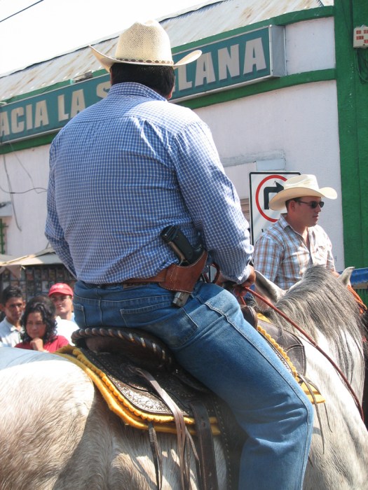
When the parade was over I went back to my car, opened it up and waited for the owners of the parked cars in front of me to show up and move so I could move. Today being the Sunday market day I ended up driving right through the middle of all the market stalls on the main road but I was determined and eventually got out of town and found my way to the intersection where I thought I needed to turn to get to Monterrico.
The landscape changed dramatically as I drove. It’s all downhill from Antigua and the housing changed from cement tile-roofed buildings to palm-thatched huts and the agriculture from highland coffee fincas to very large sugar cane fields. Most of the sugar cane was in bloom which was very pretty as it puts out a large feathery bloom like pampas grass.
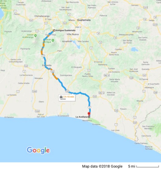
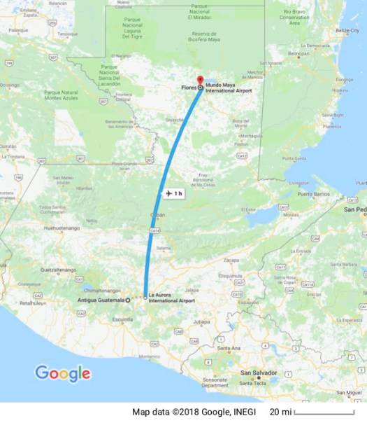
I eventually made my way down to where I thought I could connect with a small road to Monterrico but came to a deadend at a canal at the edge of the Biotopo Monterrico-Hawaii, a large nature reserve. I decided not to go exploring for what appeared on my map to be a small road from my current location in La Avellana or to ask any of the locals because my time was up. I have to get up at 3:00 am tomorrow morning. A shuttle picks me up at 4:00 am for a flight that leaves Guatemala City at 6:30 am for the airport in Flores in the Department of Petén.
So I turned around and headed back for home. I was just not intended to see Monterrico. I’m sorry I have no interesting pictures for you, but it wasn’t for lack of trying. What was supposed to be a two-hour trip to Monterrico (one way) ended up being over a six-hour trip (two way) if you count my stop to eat.
7 December 2009
 Whoever wrote the “early to bed, early to rise” rhyme probably didn’t have 3:00 am in mind. At least I hope not. I asked for a wake-up call and was somewhat surprised that the phone actually woke me up at that hour. I made myself a quick breakfast because my next meal was about 12 hours away, added last minute stuff to my little overnight bag and headed out to the front gate to wait for the shuttle.
This time, all traveling was uneventful. The shuttle ride into the Guatemala airport was quick and uneventful. (Even Guatemala City doesn’t have much traffic at that hour!) The 45 minute ride on national airline TAG aboard a 33 seat turboprop was smooth and uneventful. And the shuttle from the airport at Flores was there and waiting. My name on the sign the driver was holding was badly fractured but it was close enough that figured it was probably me.
As soon as we got to the hotel, which was one of a few actually located inside the national park, I dropped my bag and left on my tour. Although the agency that booked the tour package originally set me up for an English language tour I had them change it to a Spanish language tour because I get enough practice speaking English. More Spanish is what I need.
That turned out to be a fortuitous decision. There was a fairly large group taking the English language tour. That’s always a problem for me because I take a lot of time taking pictures and tour groups don’t want to wait around while I juggle two cameras and multiple lenses. The Spanish language tour consisted of two people: a Chilean lady and myself. Perfect. It was almost like having an individual guide and they didn’t mind giving me the time I wanted to juggle photographic equipment.
The evidence now is that Tikal was first inhabited around 900 BC. It wasn’t until about 500 BC that the first humble stone astronomical temple had been built. The Mayans were amazing astronomers and developed a very accurate calendar that had 18 periods of 20 days each (roughly equivalent to our month) and one “month” of five days, for a total of 365 days in the solar year. The Mayan counting system was a base 20 (we have a base 10) because they had 20 digits – 10 fingers and 10 toes; hence the 20-day month. They also had a ceremonial calendar that was used to calculate the timing of religious ceremonies, and that calendar had 16, 20-day months, for a total of 260 days in that year. As if that wasn’t complicated enough they also had a calendar that has received some attention lately that covered a cycle of 5,128 years that will end in the year 2012.
Tikal grew slowly. The Gran Plaza was taking shape around the time of Christ. Over the centuries larger temples were constructed on top of smaller temples and the site grew. Tikal remained the dominant power in the area until approximately 900 AD.
One of the first things we saw upon entering the park was a gigantic Ceiba tree. 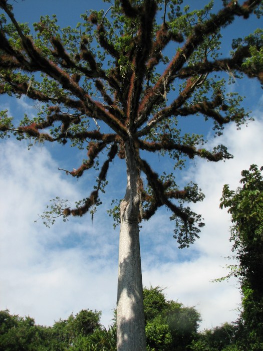 The reddish almost fuzzy looking stuff on the branches aren’t part of the tree but a parasitic plant. This tree is actually engraved on the Guatemalan 5 centavo piece and is the national tree of Guatemala. It figured heavily in Mayan culture where it’s roots were thought to connect the underworld with the trunk that connected to the terrestrial world and the branches connected to the heavenly world. Here’s the base of this tree. Four of the five major buttressing roots on this particular tree point more or less in the four compass directions.
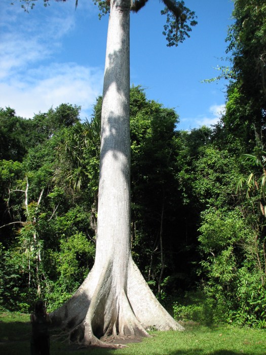
There are still people who think this tree is pretty special. As we entered, lots of tourists were gathered around the tree with their foreheads pressed against the trunk. As they remained in this position for a lengthy period of time I asked our guide about it and he said it had to do with energy fields and they were connecting their energy through their foreheads with the tree’s energy. I’m not sure if their energy helped the tree or the tree’s energy helped them or maybe both, but I had to wait until they were done doing their energy swap to take a picture.
Modern Maya, out of respect for this tree will sometimes leave it standing when harvesting timber. It can grow to a height of over 230 feet and the buttressing roots you see in my picture of the base are over 6 feet tall.
There were some interesting animals we saw. My guide said this was a turkey, though I don’t think I’ve ever seen one colored like this.
And this is (in English) a Motmot.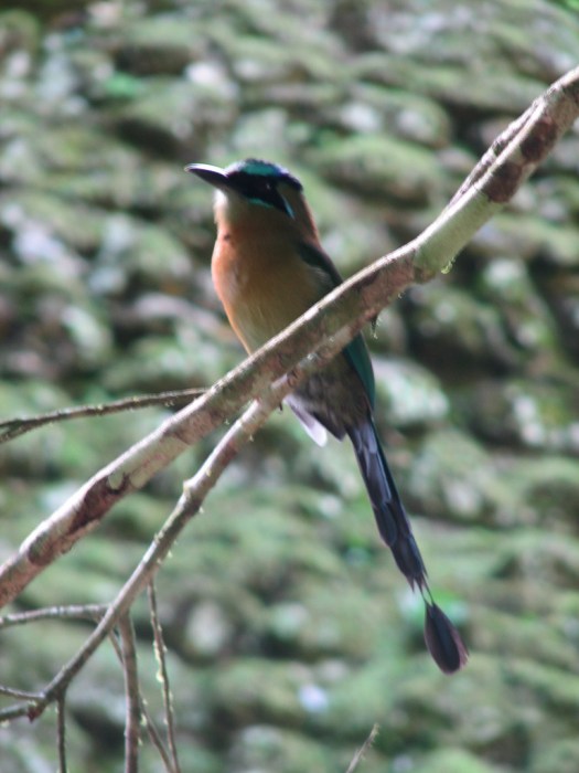
We ran into a large group of Coati in the jungle. They communicate with their tails.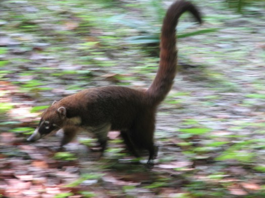
This coati is digging a tunnel, looking for grubs.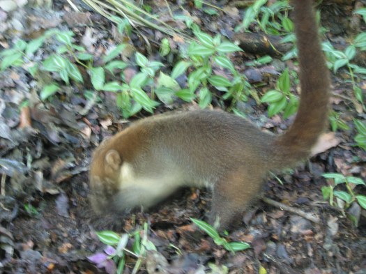
Our first stop was the Central Acropolis. This is a maze of 45 connecting rooms and stairways built around 6 courtyards. Needless to say it’s impossible to capture in a photograph (except maybe an aerial photograph). Archaeologists think these were palaces, courts and administrative buildings. It is thought that one of these residences was the residence of Chak Tok Ich’aak I (Great Jaguar Paw) and it served as a royal residence for about 400 years.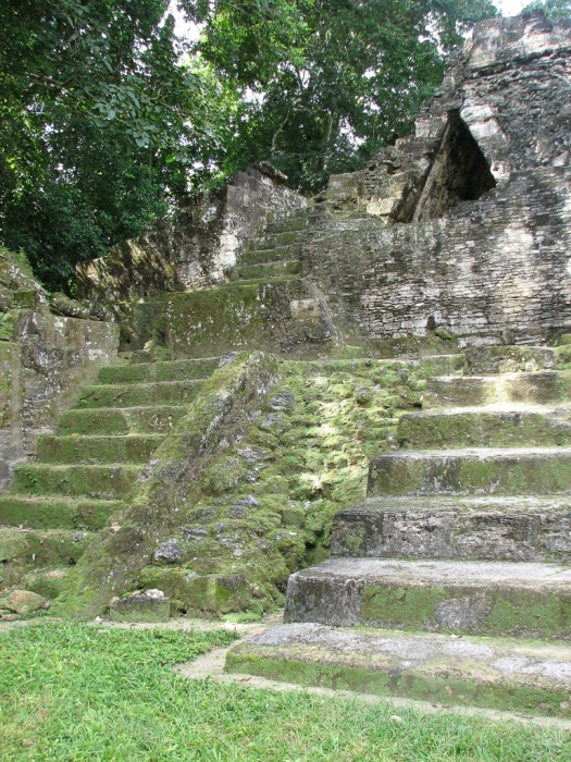

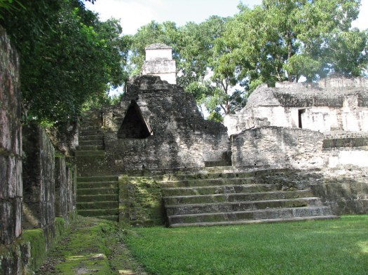 In the left third of the picture you can see a dark triangular shape. It’s called a false arch because the triangle is squared at the top. The opening to the right of that false arch has a stone throne where a ruler could sit and observe the activities below him in the acropolis or receive visitors.
This is the doorway to the bedroom behind the throne. A narrow zig-zag passageway leads from the throne to the bedroom. The wooden lintel is the only original wood lintel in Tikal and is made from the chicle tree whose sap forms the basis for chewing gum. (Or at least it did before the advent of mostly artificial ingredients.)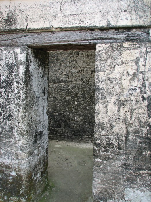
In the next picture, The large stone platform at the front was the bed and the smaller one at the back could be used to hold small personal articles. This was a very tiny room with not much more room behind the camera.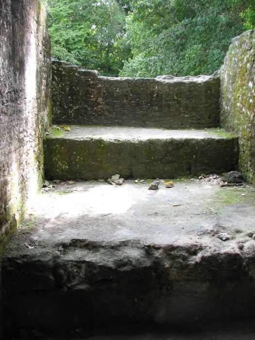
A carving on one of the walls. The general layout of Tikal was all the important people (rulers and priests) were in the center of the city. Those of lesser importance were outside but still close to the center and those who were least important were on the outskirts. That way, if they were attacked, the important people would have time to mount a defense or escape and only unimportant people would be sacrificed.
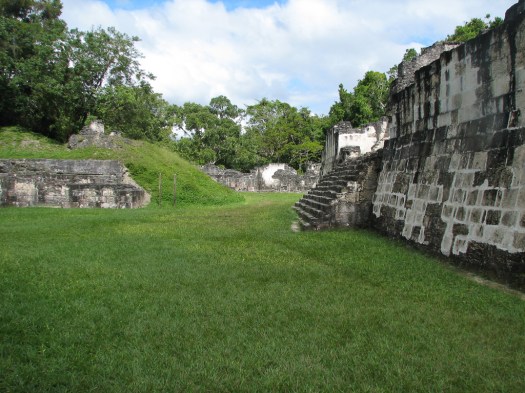
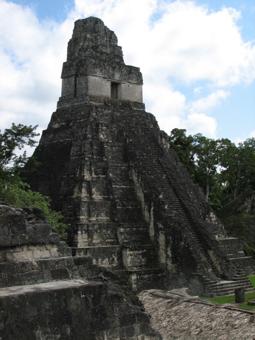
From the Central Acropolis we went to the Great Plaza which served as the center of the city for about a thousand years. At the east end of the plaza, the side of the rising sun was Temple I or the “Temple of the Great Jaguar,” so called because of the jaguar that was carved on the door lintel at the top of the temple. This is the top of Temple I rising out of the jungle. 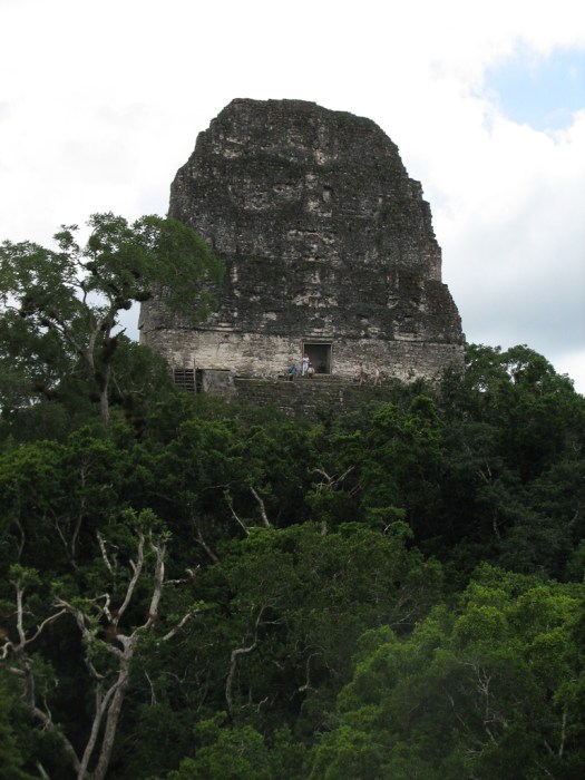 And this is the south side of Temple I as seen from the Central Acropolis.
 This is the back of Temple I as seen through the jungle while approaching the Central Acropolis.
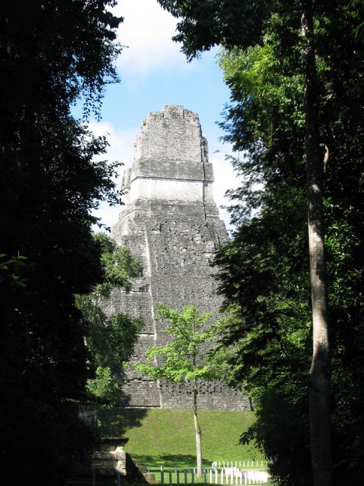 This is the ball court.
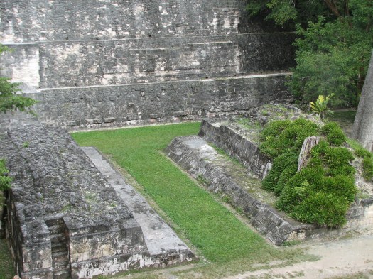 If you’ve seen the ball court in Chichen Itzá this ball court will look very tiny. Apparently that’s a function of age. As the centuries went on the ball courts built by the Maya grew. This ball court is an early version.
This view of Temple I is from the North Acropolis.
 This is the North Acropolis as seen from the Central Acropolis. In the far right of the picture are the stairs of Temple I.
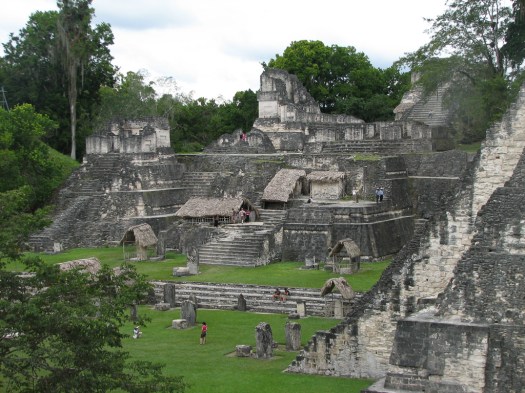 The entire north side of the Plaza is called the North Acropolis. About 12 temples can be seen today but this area was torn down and built over many times. Archaeologists say there are over a hundred structures underneath and some of the carvings dug out from underneath current structures are on display under the thatched huts you can see in the picture above.
A side view of Temple I from the Central Acropolis looking toward the North Acropolis. You can see a bit of the ball court at the bottom of the picture.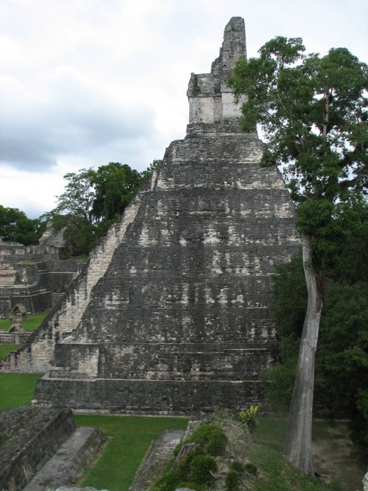
While I was wandering around, taking pictures, a Mayan family came in, knelt, and prayed before Temple 1I.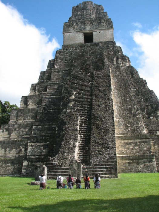
Directly across the 1.5 acre plaza is Temple II or the “Temple of the Masks,” because of the two carved masks on either side of the main stairs. 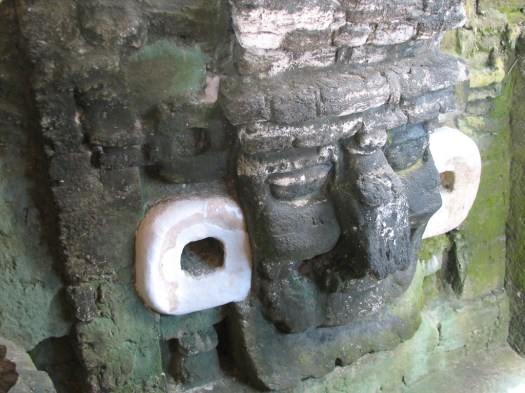
Temple I contained the tomb of Hasaw Chan K’awil who ascended to the throne in 682 AD and died in 721 AD. Temple II contained the tomb of his wife.
The height and distancing of these two temples is so exact that, early in the day during an equinox the shadow of Temple I barely touches the base of Temple II and later that day the shadow of Temple II barely touches the base of Temple I. These temples are 44 meters (about 144 feet) above the plaza.
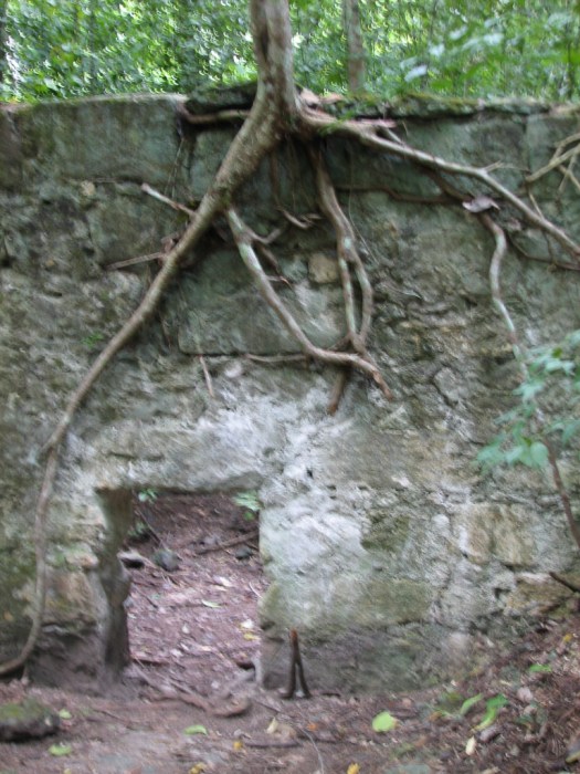
The jungle appears to always be encroaching on everything. This is a path in the National Park, obviously very heavily traveled by tourists, but, nevertheless, with jungle encroaching.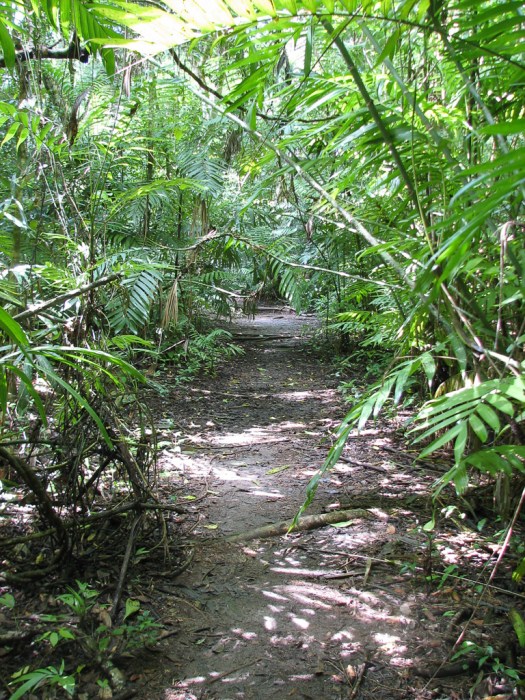 And here are a couple of stone structures, mostly covered by the jungle.
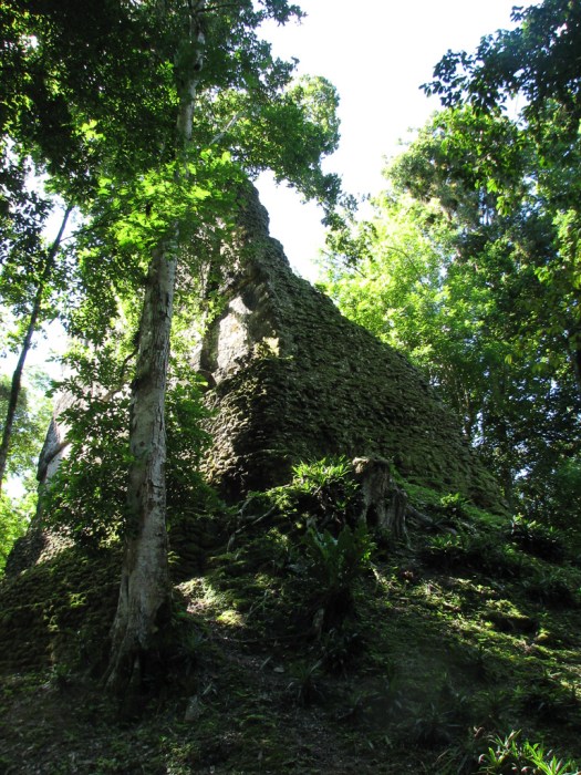

Temple III is not yet restored and is not accessible but here it is as seen through the jungle.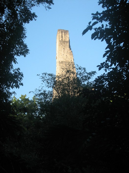 Temple IV is the tallest of the temples in Tikal at 65 meters (212 feet). I climbed to the top of Temple IV, not just once, but twice. Once during the tour and again at sunset. I’m sure somebody added more steps on my second trip up. Temple IV was built in 741 AD and is thought to be a burial site, though nobody has yet found a tomb. Temple IV is in the process of restoration.
This is the view across the top of the jungle from the top of Temple IV. Visible are the tops of Temple III (far right) Temple II (middle) and Temple I (left).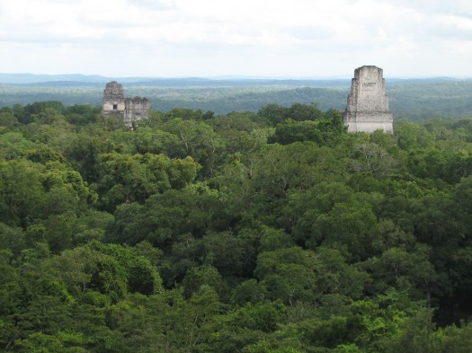
We also visited El Mundo Perdido (The Lost World) and the Plaza of the Seven Temples. Not much is known about these and they have not yet been restored.
Temple V.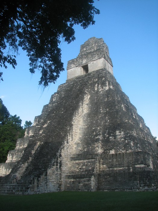

The low, round stones in a line in front of the pyramid are where captured enemy soldiers were sacrificed in public offerings to the Mayan gods.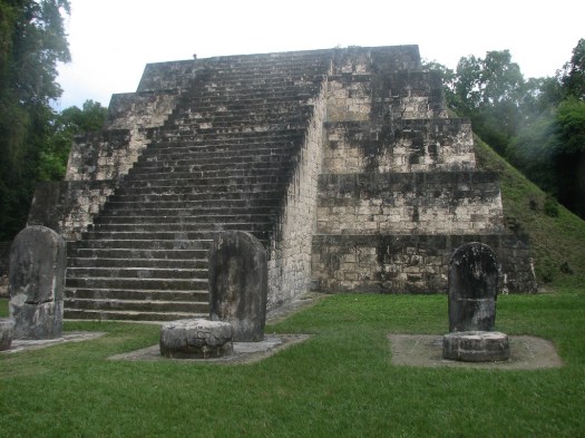
It’s difficult not to be overwhelmed by the immensity, age and detail of Tikal. I was surprised by how much still remains to be unearthed. Everywhere you walk there are obviously temples buried under centuries of detritus, completely taken over by the jungle, but still showing the classic structure of the pyramid rising sharply from the jungle floor.  I can return tomorrow on my own and will do some more exploring.
Watching the sun set from the top of Temple IV.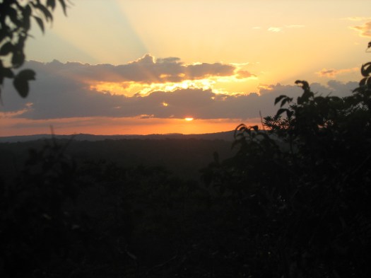
8 December 2009

This will surprise those of you who know that I’m allergic to morning, but, even though I was up at 3:00 am yesterday, I asked for a 5:00 am wake up this morning. I wanted to see and photograph the sunrise over the temples. This would be the only chance I’d have to do that.
The hotel night clerk knocked on my door at the appointed time. He had to come to my room because there are no phones. Because we’re in the jungle, services are really limited. Hot water is only available starting at 6:30 pm. I forget what time they turn it off. Electricity is only available during certain hours and 5:00 am wasn’t one of them so I shaved by the light of a small LED flashlight I’d brought.
They have an early morning tour they offer but there’s a four person minimum and there weren’t three other people willing to get up and hike into the jungle at that hour so I went by myself. The park opens at 6:00 am and I had to buy another entrance ticket for Q150 (about $20US). That’s the price for foreigners. Guatemalans with ID pay Q25 (about $3US). That’s a common pricing scheme. Foreigners pay more for entry to museums, national parks and historical sites.
I’d asked at the hotel and they said the best place to see the sunrise would be from the top of Temple IV. I’m guessing Temple IV is the best place to see anything because it’s the highest of the temples. The only problem was that this morning was very foggy so I wasn’t going to be able to see much no matter where I was. I chose to go first to the Gran Plaza to take some pictures of the temples in the mist to see how those turned out.
It was kind of a spooky feeling, walking through the jungle in the mist, unable to see very far and these amazing stone edifices appearing out of the mist. At this hour the jungle was alive with animal sounds as the jungle animals welcomed the new day.
I then returned to the hotel for breakfast, then back to the park. This time, instead of heading straight to the archaeological sites, I went to the two museums. One, the Museo Lítico (“stone museum”). And this museum, in fact, did focus on the stone temples, stone steles and stone altars. Just about everything here is built of limestone. The second museum is the ceramics museum that displays some wonderful ceramics and has a recreation of Hasaw Chan K’awil’s tomb, showing how the skeleton, all the jade jewelry that was on the body at its burial and all the offerings that were buried with him.
Then it was back into the main part of the park and I went to some of the minor sites I hadn’t seen yet. There are still major sites I haven’t seen, but many of them are a significant hike away and I can’t go too far and risk missing the shuttle that will take me to the airport to catch my plane back to Guatemala City.
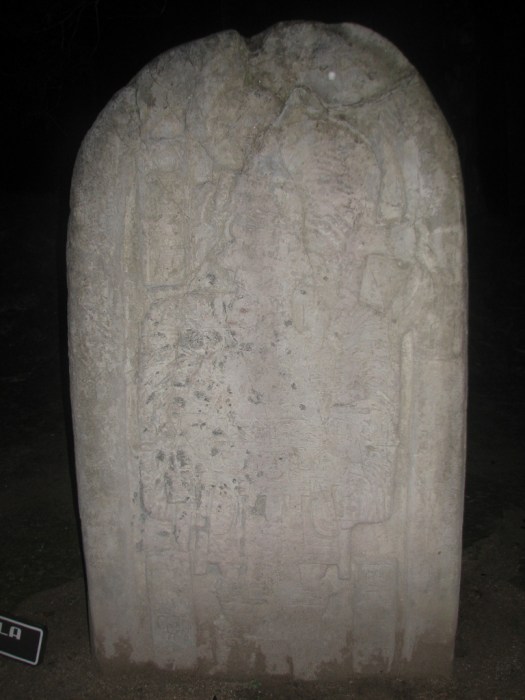
In front of most of the temples you see a vertical stele with a round stone altar. The steles had glyphs and carvings that commemorated important rulers and events. 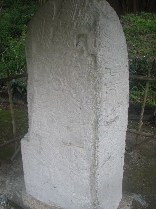
 The altars were just that.
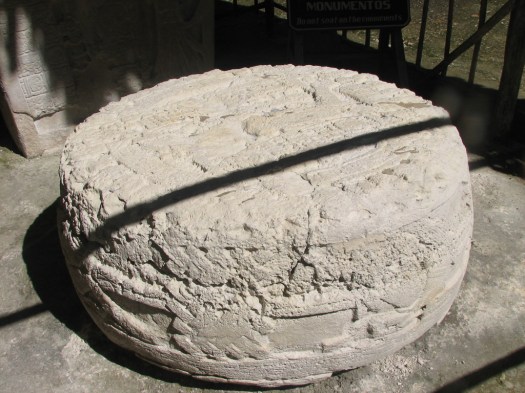
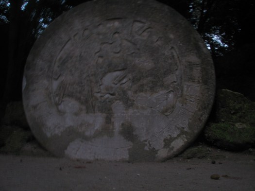 Some of the carvings on the temples show these altars being used for human sacrifice. Based on the number of steles and altars, I’d guess there was a lot of sacrificing going on, though I don’t believe all the sacrifices were human.
There are seven known complexes of twin pyramids. Each complex has two flat-top pyramids facing each other with stairs ascending each of the four sides. The pyramids are always aligned on an east-west axis. I visited Complexes Q, R and P. Complex Q dates from about 771 AD and is the most restored of the complexes. 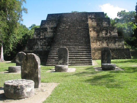 This un-restored pyramid is opposite the restored pyramid above in Complex Q.
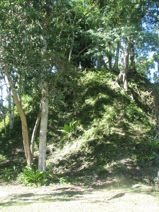 These complexes are thought to have possibly been built to commemorate the end of a 20-year period known as a Katun. Ceremonies are still held in Complex Q by Mayan shaman to commemorate auspicious days in the Mayan calendar. Many of the temples and complexes have circular cement altars built into the ground with a sign saying they’re contemporary Mayan altars. They provide a place for sacrificial fires for today’s Mayan rituals.
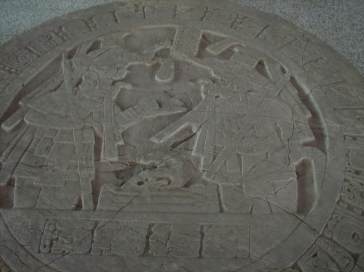
Here are some of the un-restored areas.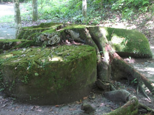


From here it was back to the hotel where I ate the midday meal and left by shuttle for the Flores airport. I rode with a Canadian couple who were going to a hotel in Flores to continue exploring the area. We were together, too, coming from Antigua to Flores and we’d spoken frequently in Tikal where we stayed at the same hotel. The man is also a motorcyclist so we had a great time talking motorcycles.
The flight was, again, smooth and uneventful. I can’t say the same for the shuttle ride from the airport in Guatemala back to Antigua. We were back in Guatemala rush hour traffic and, although I flew across better than half the country in 45 minutes, it took two hours to drive from Guatemala City to Antigua, a distance of only 23 kilometers (14 miles) as the crow flies.
10 December 2009
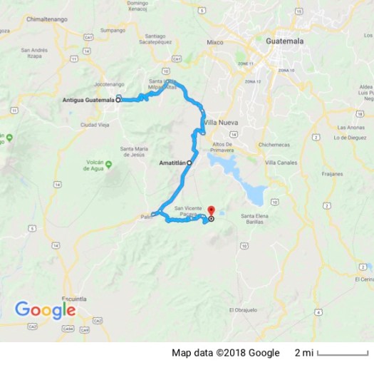
In order to rest my legs from hiking through the jungle and climbing up temples for the last couple of days, I spent yesterday doing Christmas shopping in Antigua.
Today was set aside to hike a volcano. There are a few of the many volcanoes in the area that are active. One of them, Pacaya, at 2250 meters (7,382 feet) is a popular tourist destination where there’s usually some volcanic activity to see. The amount of activity, of course, varies from day to day and is unpredictable. I could choose between a morning hike or an afternoon hike. I figured that an afternoon hike that ended after dark would allow me to take pictures of lava at night would be more dramatic, so that’s the one I chose.
Although it’s possible to hike the area alone, trails are not clearly marked and crisscross the area. Wandering around lost in a car is one thing. Hiking up and down a volcano is something else. I chose to go with a group on a guided hike.
A van picked up the group in Antigua and delivered us to the town of San Francisco de Sales on the side of the volcano. At an altitude of 1818 meters, San Francisco de Sales is 432 meters or 1,417 vertical feet below the volcano. Because the volcano is a national park we had a Q40 entrance fee to pay. The driver collected all our fees and took them in to the park office to pay. As soon as the van stopped it was surrounded by kids selling bags of marshmallows tourists could toast on sticks held over the molten lava.
We continued on to the trail head and met our guide, Jose. Of course I brought both my cameras, the little digital and the large film camera, plus the usually assortment of different lenses, filters and other camera equipment. Because I was going to be trying to photograph after dark, I also brought a tripod. All that plus my one-liter bottle of water made me easily one of the most heavily laden people on the trail. Looking around I also noticed that I was easily the oldest in my group by about 20 years. The only person who was close was a man who appeared to be in his 40’s with his teen-age son.
I wasn’t exactly sure how this old man, laden like a pack animal, was going to keep up with a bunch of 20-somethings climbing up a volcano, but I’m stubborn and was determined to give it my best shot.
As soon as we got out of the van the group was surrounded by another bunch of kids wanting to sell us walking sticks and horseback rides up. Of course I was singled out as the one most obviously in need of a horse and met some very determined young salesmen. I declined all offers and we started up.
Being good entrepreneurs, those on horseback followed us up, figuring we might change our minds as the reality of just how steep a climb this was hit us. There were periodic calls of, “Taxi, taxi!” from some and I had a young man on horseback attach himself to me, frequently reminding me I could ride, rather than walk.
The first part of the hike was through forest, and, although steep, was doable. I was working hard, though and sweating every bit as much as I sweat in the humid jungle climbing temples. (To be honest, I did a pretty good job of sweating in the jungle just hiking level trails, not even counting climbs up to the top of temples.) After almost an hour of hiking up Pacaya the boy on horseback disappeared.
When he discovered I could speak Spanish, I was engaged in conversation by a man who turned out to be the boy’s father. He buoyed my spirits by asking my age and expressing admiration that I was doing it all on foot when one of the 20-something women gave up and got on a horse. He encouraged me to keep hiking and to do it all on foot. I also had numerous offers from fellow hikers to help carry some of my load but I declined.
The going got tougher as we rose above the tree line. Our footing turned to loose volcanic cinders and every step forward resulted in that foot sliding backwards at least half the distance of my original step in the loose cinders so my progress was slowed significantly. Here we are emerging from the clouds.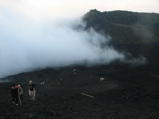
 The trail up through the loose lava rock.
Those people look pretty far up. And my tired old legs have to carry me up there.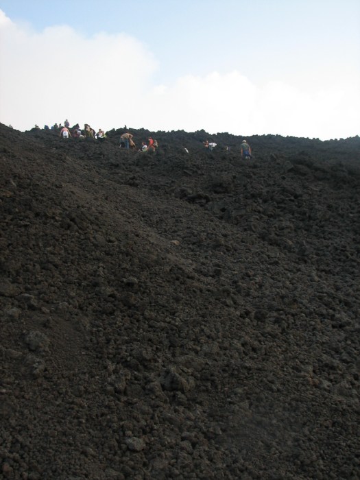
Eventually we made it to an area of solidified lava, frozen in the shape of the flowing semi-liquid it once was. 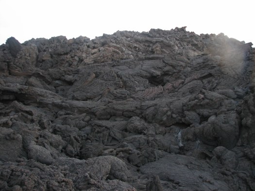 Noticeable heat was escaping from this lava and looking underneath our feet, where there were cracks in the lava you could see glimpses of red that told you just beneath where you were walking, molten lava was still flowing.
Vents in the cooled lava spewed hot air; so hot that when someone put a small stick over a vent it burst into flame. 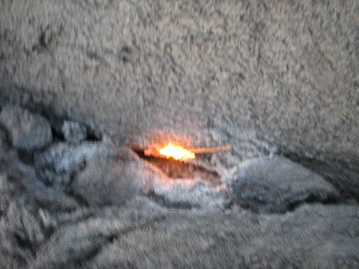 After dark you could see how hot those vent holes were.
 Our group was one of many groups making this hike so there were maybe 40 people in the area. Our guides lead us across the cooled lava to where the molten lava flowed out from underneath, continued horizontally for a short distance, then flowed over the edge and down the cone.
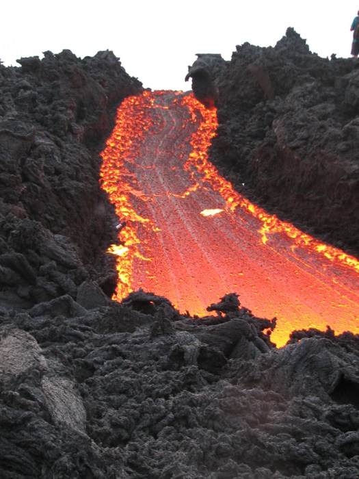
The actual caldera and the peak of the volcano was still above us and none of the groups continued up because it was getting dark and, Jose said, that was another 45 minute hike up. This is looking up at the caldera.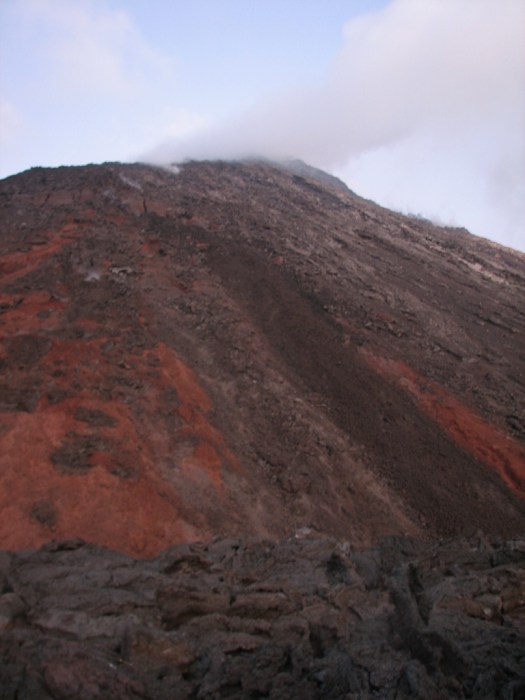 You can see the steam (or smoke… I don’t know which it was) escaping from the top of the volcano.
The setting sun.
After a too short time to take pictures we began our hike down the mountain in the dark. I’d prepared for that and got my flashlight out that’s affixed to a headband so it’s hands-free. On the way down I asked Jose about deep holes that were dug along the trail. He said they were for rainwater and I told him I thought they were for the bodies of tourists who couldn’t keep walking. Although my leg muscles felt like rubber by the time I got back to the van, I made it all the up and back down, on foot, carrying all my gear.
This is a view looking back at the volcano on the hike back down after dark. You can see the trail of the lava flowing down the mountain.
It doesn’t seem to me that the pictures justify the effort it took to get them but it was a memorable experience.
11 December 2009
I have to pack today and be up tomorrow morning at about 3:00 am to catch my flight home. Those facts, plus the fact that I assumed I’d need to let my poor old legs recover from yesterday’s hike up Pacaya meant I planned to just wander around Antigua taking pictures of everyday kinds of things that I haven’t previously shown you. I have to admit that I’m surprised by the fact that my legs really don’t feel too bad. They’re hardly sore at all. On the other hand, the arthritis in my knees is definitely talking to me.
As I wandered around Antigua taking pictures I was approached by many Mayan women trying to sell me their wares. One of them, selling women’s jewelry, suggested I buy something for my wife or mother-in-law. I told her I had no wife and therefore, no mother-in-law and didn’t want anything, thank you. So she suggested I buy something for my girlfriend. I told her I didn’t have a girlfriend and didn’t want to buy anything, thank you. As is typical she was not to be dissuaded so she suggested I buy something for my enemy. That got a good laugh.
So, as unusual as it may be, I have nothing much to say; just a bunch of pictures of everyday stuff around Antigua. Turn me loose in an interesting area with a camera and I’m a happy camper.
I have no idea what he was waiting for but this man was just standing there, waiting for something or someone. A typical street. You can see the man pictured above at the left side of this picture.
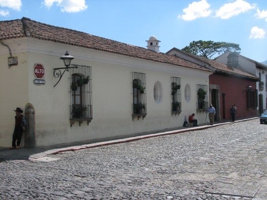 This guy just struck me as kind of an interesting looking character.
 Many businesses hire private security guards, all of whom stand either just outside the business or in the doorway with a short-barreled shotgun at the ready.
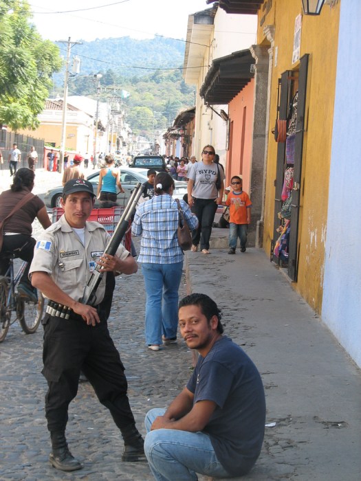
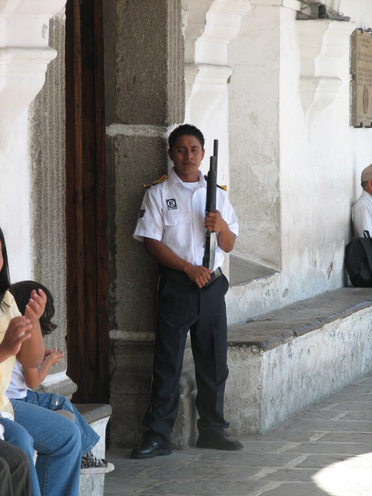 These Mayan women carry their inventory with them in a cloth slung around their necks. Notice the young girl watching (probably her mom) and learning how to sell to tourists.
 When not selling these women frequently sit down and take the load of their wares off their necks by resting in on their laps. You see them sitting or walking everywhere.
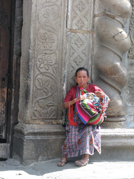
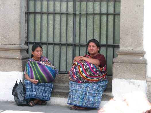 This is the Antigua City Hall at street level
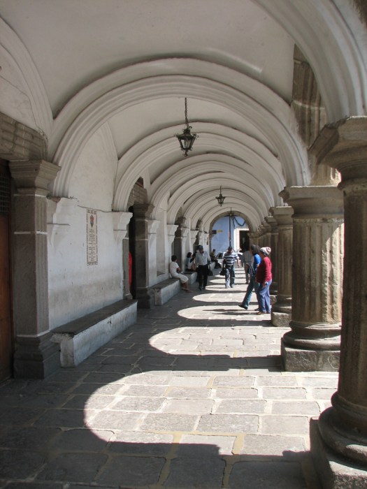
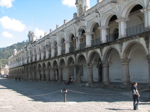 and this is the upstairs
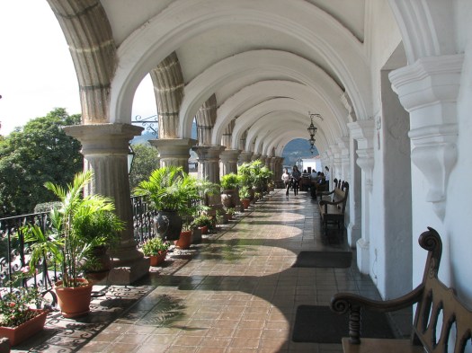 The cathedral from City Hall.
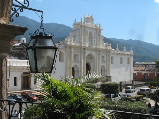 Carrying bundles on your head is a common way of carrying things.
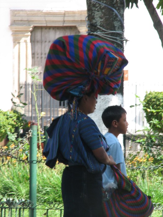 A little Mayan girl.
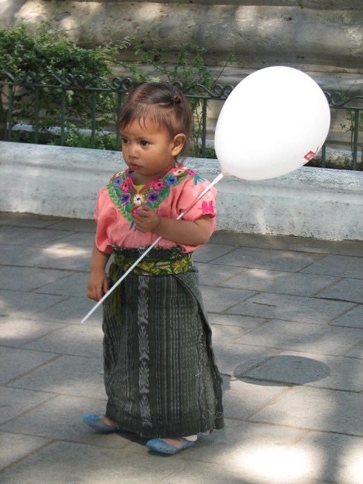 The backpack isn’t so traditional but the traditional Mayan dress for a man is this piece of knee-length checked cloth wrapped around the waist over a pair of usually brightly colored pants. It reminds me of a skirt and I’m not sure what it’s function might be, but it’s common among the indigenous people.
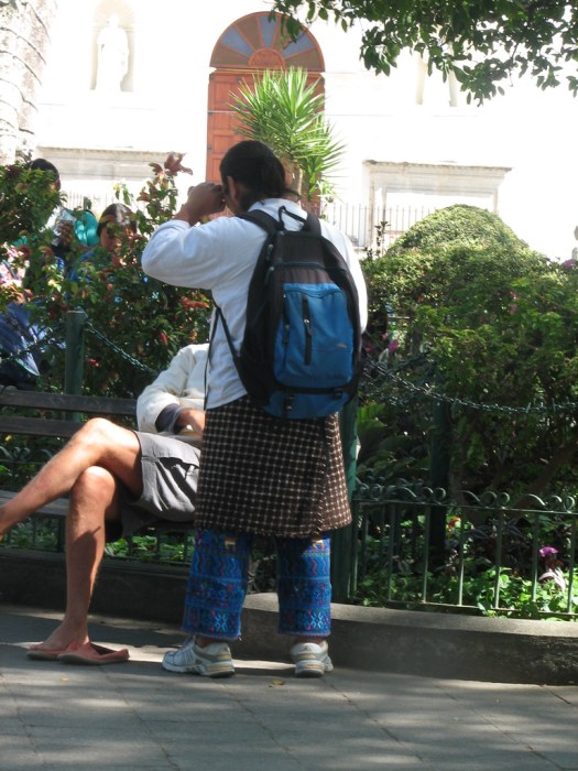 Tourist bait. Rides in a horse-drawn carriage around town attract tourists.
 I’ve talked about Tuk-Tuks, but I don’t think I’ve ever shown a picture of one. Cheap and quick transportation these are ubiquitous.
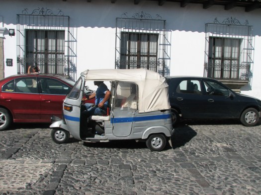 I have no idea why a car wash has to be labeled in English but they all are. In every city there are signs for “car wash”.
 There’s probably no mechanized way to repair these stone streets, so all repairs are done by hand.
Just a variety of buildings I found interesting because of their colors, age or style.
Not only did he not have a spray gun but he didn’t even have a roller. Over the course of a few days I walked by this house on a regular basis and watched this man on a home-built ladder nailed together from scrap lumber, paint this entire building with a 4″ brush.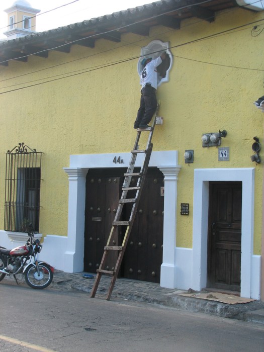 Some stores only allow staff inside. There’s a cage to keep customers away from the merchandise. You walk up to a small opening in the cage, ask for what you want and the employee gets it for you. I’ll bet their incidence of shoplifting is pretty low.
 Small displacement motorcycles are far more common than in the US.
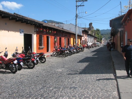
And so ends my time in Guatemala. I didn’t see everything I would have liked to but I’m grateful for what I could experience. Tomorrow I fly back home.
