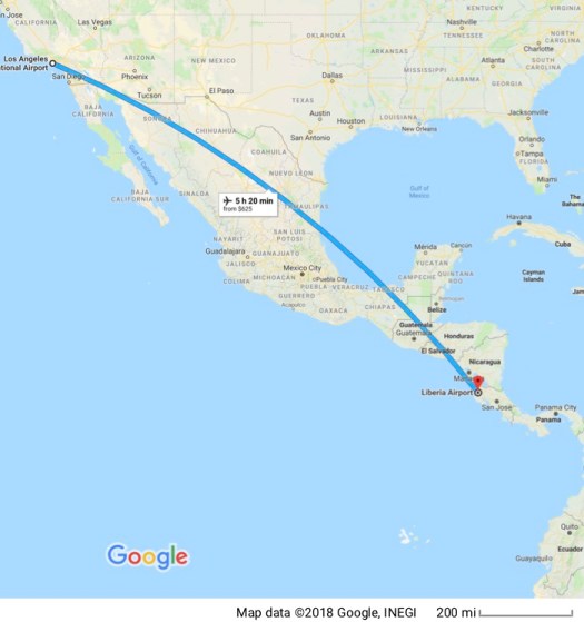
18 September 2010
 Given the state of the airline industry I found it a bit surprising that I didn’t have to pay a fee to check luggage and American even served a meal (a “free” meal). Of course I’d paid for it in my ticket price but airlines now love to charge for everything so it was nice to avoid some of the fees.
I’d found a car rental agency that would negotiate with me and saved me some money on a car rental. They beat the lowest price I could find otherwise. It’s the same here as it was in Guatemala. All the car companies charge an insurance fee for third party liability that almost exactly doubles the cost of the rental. That was a rude surprise last year in Guatemala. This year I asked about it and included it in my comparisons.

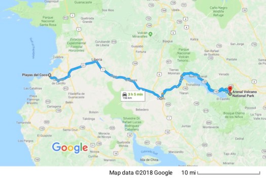
On the drive from the airport in Liberia to my room in Playas de Coco I discovered that they weren’t kidding when they said this is the rainy season here. The skies simply opened up, visibility went way down and I picked my way through unfamiliar territory, trying to follow the directions I’d been given. I’m writing this blog so, obviously, it all worked out and I got here… wet… but “home” for the next 2 weeks.
19 September 2010
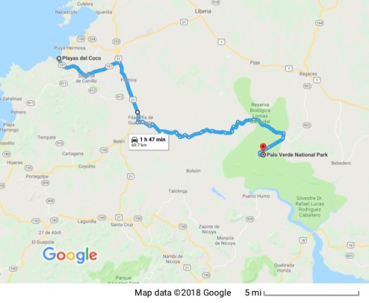 Taking pictures in this rain is going to be an issue. It’s warm and rainy which means my camera lenses fog up and rain drops get on the lens. I drove out to Palo Verde today, a national park built to protect a giant wetland. Major roads were easy to travel, well paved with good signage.
Once, however, I turned off the main road, I had about an hour’s drive on a dirt and gravel track that was full of potholes all of which were filled with rainwater, making it impossible to tell just how deep the pothole was.  To save money I rented the smallest car available, which is just fine on main roads. On dirt tracks where I’m driving through streams that are crossing the road, deep mud that has turned the “road” into a quagmire (particularly difficult on an uphill section of the road) and potholes that swallow a tire, the drive is slow and tortuous and I definitely didn’t have the ground clearance I needed. When the road was in good shape, though I could increase my speed in spots all the way up to 30 kph (about 20 mph).
I made it, though, and drove through the entrance which was unattended because it was lunchtime. There’s one main road through the park (dirt and gravel, of course) which is built on high ground through the forest just to one side of the wetlands. Wildlife is abundant, especially birds. A cloud of bright green parrots erupted from the trees and flew off as I approached. Of course they didn’t return so I could take pictures. A turtle crossing the road was doing his best to escape before him I could catch on film. 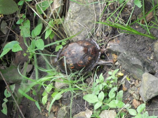
Most animals were too quick and too wary for me to take pictures of unless I wanted to spend time I didn’t have to sit still for extended periods of time. But I was quicker than the turtle!
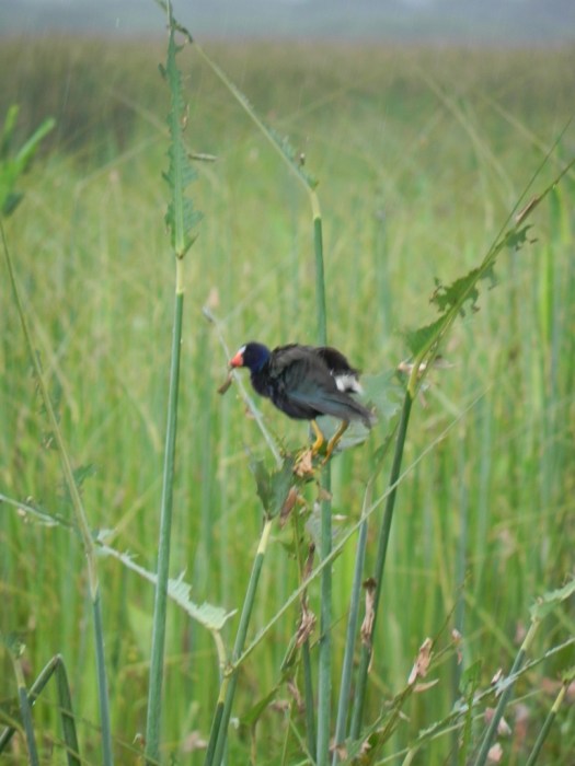
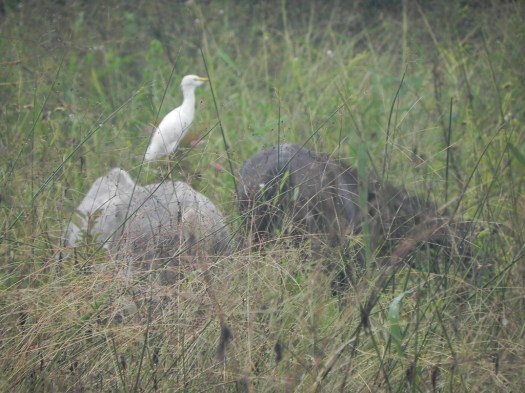
I stopped at a research station where there was an attendant who told me about the park and gave me directions and a map. A little further up the road I could stop in the mud beside the road and slog to a wooden bridge that was built out into the wetlands.  I could stand there in the rain and watch all kinds of birds feeding.
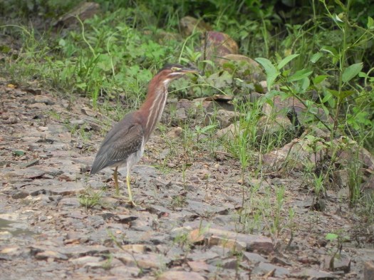
 I very much wish I’d been able to capture the brown bird whose picture I’ve attached in flight.
  I don’t know if his wing feathers were translucent or the underside was just so bright it looked as if they were but his wings just lit up when he took flight. Again my issue was time as much as it was the rain. I very much wanted to avoid driving the dirt road in the dark.
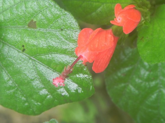
Plants, some flowering, grew in abundance.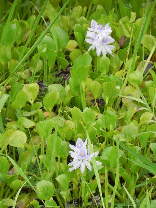
Fungus was pretty happy, too.
I’ve seen this plant being sold in nurseries back home as a house plant. Here it grows wild in the rain forest.
I drove to the end of the road which was also the park boundary at the Rio Tempisque. 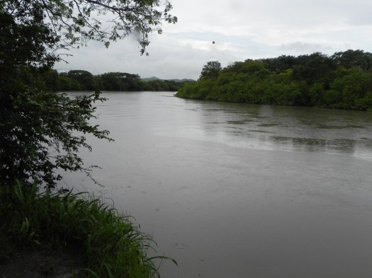 The individual at the research station had told me crocodiles abound on the banks of the Tempisque but none were evident when I was there.
I headed back out, stopping to take a short hike through the forest.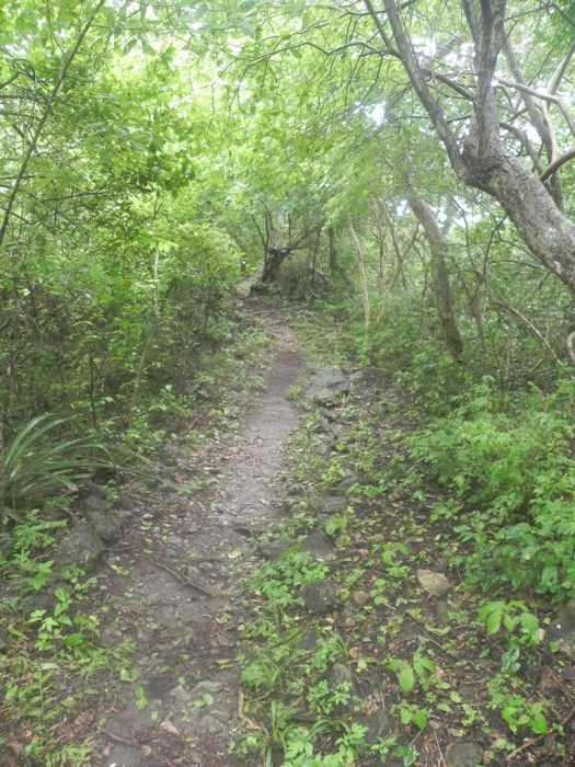 The trail led up a hill to a rock that juts up above the forest canopy to give a panoramic view of the wetlands.
 This was still in the National Park, and I do know that you aren’t supposed to disturb (much less kill) wildlife in a National Park. However… I don’t believe that any of the hoards of mosquitoes I killed on that short hike were from an endangered species… at least I hope not. They were bad while I was hiking. If I stopped to take a picture it was as if the UN food supply truck had stopped in the middle of the refugee camp, and my blood was the special-of-the-day. They attacked en masse.
While I was taking pictures from on top of La Roca this vulture was perched in a dead tree not 6 feet (2 meters) behind me. He was totally undisturbed by my presence, even as I moved around. I wondered if he was betting on my plunging off the rock into the wetlands far below and getting a meal out of me.
Rain forest bordered the wetlands.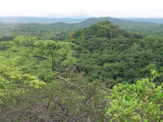
When I got to the entrance the chain was up to prevent the exit of people who’d entered (as I had) while the entry hut was unattended. I paid the $10 entry fee and when the attendant discovered I speak Spanish we had a conversation. He was there by himself so I imagine it gets lonely. The entry fee brings up an interesting point. ATM’s here give you the option of withdrawing funds in US dollars or Costa Rican colones. The dollar is widely accepted and the receipt for entry to this National Park was denominated in dollars. The attendant only knew the entry fee in dollars. He had to use a calculator to compute the fee in colones when I told him I didn’t have dollars with me. I was fortunate to make it out of the park when I did. He put up the chain to close the park right behind me as I left at 5pm.
I almost made it to the Pan American Highway before dark, but not quite. 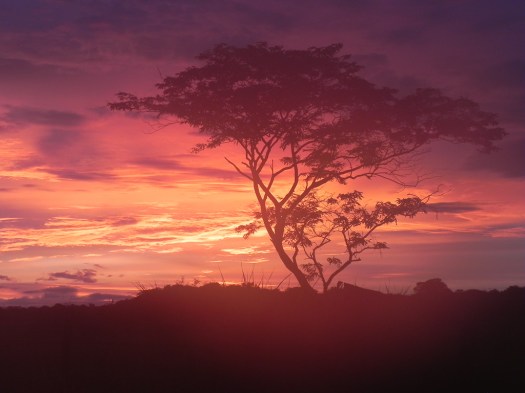 The last bit of the dirt road was in the dark. Although some of the potholes I hit made me worry about a broken wheel strut or some other suspension part, I made it out and, except for lots of extra mud and dirt on the car it seemed to have survived what I’d put it through. From there it was a fairly uneventful drive back to Playas de Coco.
20 September 2010
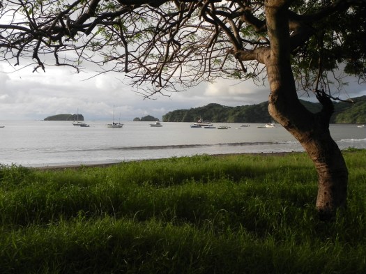
 Never went far from home today. Completed first blog entries this morning, errands, wandered around Playas de Coco. The internet situation, by the way, is that I have no wireless access from my room. The office is a few blocks away from the condominium buildings and I have to go there to get access. This is the view from my terrace.
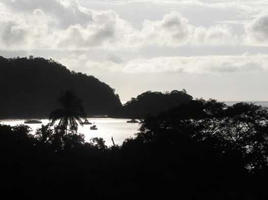
I learned why the town is called Playas de Coco – the sand here is the color of a coconut husk. It’s interesting but looks kind of like dirt (it isn’t… it’s all sand… no dirt in it) and when the waves have sand in them the water looks dirty. It’s just the color of the sand, but it looks dirty. You can see the color of the sand better in the first picture.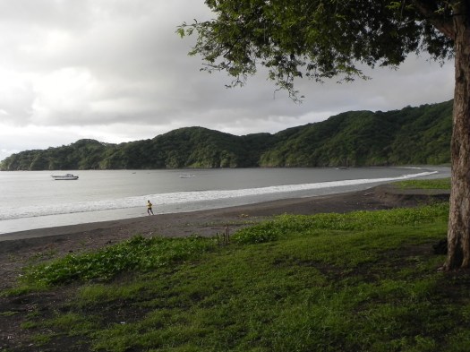
While wandering through the town, which is small and quiet but very tourist-oriented, I went into a local dive shop. I’d brought my old SCUBA instructor certification card with me, thinking I might try diving Costa Rica, and I explained to them that I used to teach but haven’t been diving in about a century. They accepted my certification, even though it was from the dark ages, but wanted to check me out in a pool with some very basic skill tests. So tomorrow morning the alarm gets set for 5:30 am so I can get to the shop for a skills test before we leave for some local diving.
21 September 2010
The skills test this morning went just fine. I had no trouble with the skills but I did have to learn the ins and outs of the equipment that’s in use today so my equipment handling was clumsy rather than smooth and confident as I figured it out for the first time. Things have changed significantly since I was last underwater. Not surprising considering how long it’s been.
We returned to the shop (the pool they used for the test was at a bed and breakfast about a kilometer from the shop) and waited for the rest of our dive group to show up.
Four other people showed up: three American guys and a Dutch woman whose English was, of course, outstanding. The oldest was about half my age, I think. We walked to the beach where a small boat met us to take us out to the dive boat which was tied up to a buoy in the bay. This is the dive boat and my fellow divers.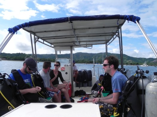
We made two dives off two small islands just offshore. This is one of the little islands.  Between the dives we motored over to a bay where we tied up to a buoy to rest and allow any nitrogen build-up to dissipate. The heavily forested peninsula that jutted out on one side of the bay had several huge, obviously luxurious homes showing through the trees. If you look toward the top of the hill on the left you can see one of those luxury homes poking up out of the trees.
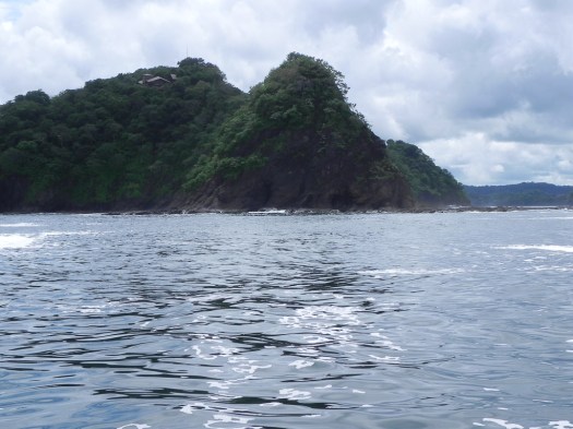 The dive master said that although they’re private homes they can be rented, so if you want to try living in an exclusive home on a bay in Costa Rica with a view of the Pacific Ocean, you can rent one of these for only $10,000 US per week. When I was talking about these homes to one of the staff at the condo office while working on this blog he knew the homes I was talking about and said Michael Jordon owns one and Madonna owns another. I’m definitely not in that income bracket so there’s no danger of my buying a vacation home with a view here.
I was disappointed by the lack of clarity of the water on our dives. On the first dive visibility was probably in the neighborhood of 20 feet and on the second dive it was only about 15 feet. It was nevertheless good to be diving again and I definitely enjoyed it. Unfortunately without any underwater gear for my cameras I have no underwater pictures to share. The highlight for me was on the first dive when we got into the middle of a huge school of Mojarra Grunt.
We were smack in the middle of the school with hundreds of tightly packed fish above us, below us and on all sides of us. They swam so close to us I felt I could reach out and touch them, though when I tried, they moved just enough to stay out of arms reach. But they showed no fear and kept schooling right around us. There were so many it got noticeably darker as the fish above us blocked much of the sunlight.
After the dive it was back to the shop where we looked up the names of all the fish we saw. I came home and showered off the salt water, fixed myself some lunch and, since most of the day was gone just went out for a drive.
22 September 2010
 Today I went to the Rincón de la Vieja (The Old Lady’s Corner) National Park. Rincón de la Vieja is the name of an active Costa Rican volcano and this park protects the volcano, neighboring volcanoes and the watershed that stems from their slopes. That watershed is significant and includes 32 rivers and 16 seasonal streams which combined provide most of the water for the entire province of Guanacaste to the west.
I didn’t attempt a hike to the volcano’s crater but did a hike on its flanks entering at the Las Pailas ranger station. A “paila” is a kettle or a large cooking pot and is the term used for the mud pots and other geothermally active pots scattered along the trail. Even before you reached one of the mud pots or steam vents you could see the steam rising from out of the jungle ahead of you.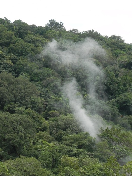
They called this Fumarole Lagoon. There were signs everywhere warning that the water temperature was 75 -106C, 192-248F.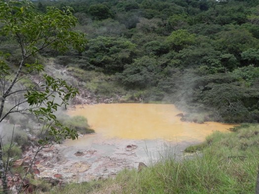 There were water pots with geothermal steam escaping
 and mud pots. The mud was constantly making blooping noises as underground gases made their way to the surface.
 They called this a “volcancito”, a “Little Volcano”. Probably because it was very actively emitting gases which can be seen in the bubbling by the rock at the left side of the picture.
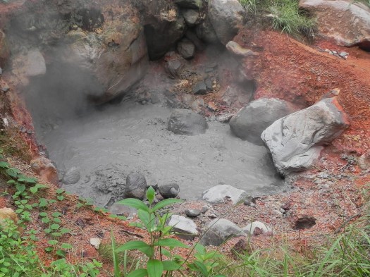 Having learned my lesson at Palo Verde, this time I wore a long sleeve shirt, jeans and liberally slathered insect repellant on all exposed skin. Either that worked or the mosquitoes weren’t as active at Rincón de la Vieja as they were at Palo Verde.
I didn’t see the animal life I would have liked to. Probably, in part, due to the fact that I frequently had my eyes pointed down at my feet, trying to pick the least muddy part of the trail to walk on. Even doing my best, several times I sank several inches into the muck. You can see why looking at the photos of the trail.


I know the picture below looks like a little muddy creek. It isn’t. It’s a section of the trail that was underwater. That’s one of the consequences of coming during the rainy season. There are consequences of coming during the dry season, too. That’s the popular tourist season. It gets much more crowded and rates for everything go up.
This was the most sophisticated river crossing on the trail. A swinging bridge with cement steps leading up to it over the Rio Colorado. 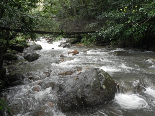 Other river crossings consisted of rocks in the water or logs over the river. Most of the time when crossing by log it was just a log. This one was actually flattened on top to make walking on it easier… nice.
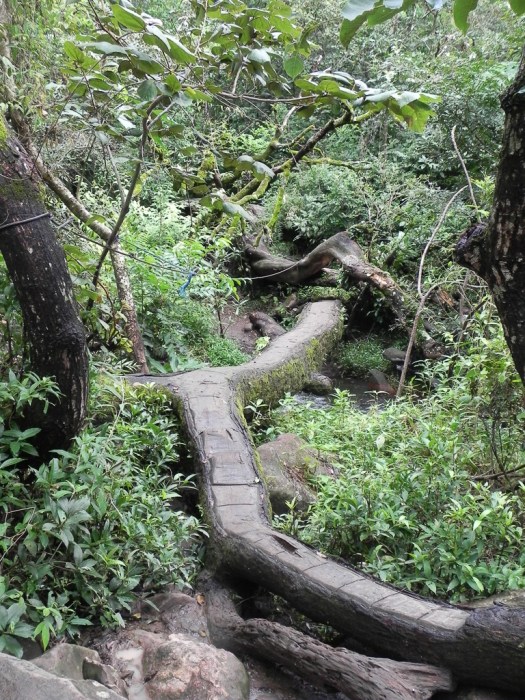
This is the Rio Colorado.
I was told the Toucan is common at Rincón de la Vieja but I didn’t see one. I did see and tried to photograph a Blue-Crowned Motmot. It, however, landed on a branch far enough away that I had to use the longest lens I had and it was just too dark to hold a lens that long still enough at the slow shutter speed I had to use. I got a number of pictures that were too blurry to be of any use except to show to a park ranger as I left. She was able to recognize and identify the bird for me. I hyperlinked the name of the bird to an identifiable picture so you can see what it looked like. It was certainly impressive.
Although most of my stops along the trail were to look at geothermal activity, there was also just the beauty of the rain forest through which I was hiking, like this mossy tree branch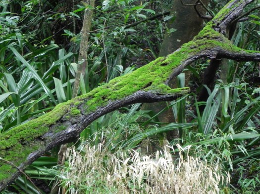
or this white fungus growing on a fallen branch.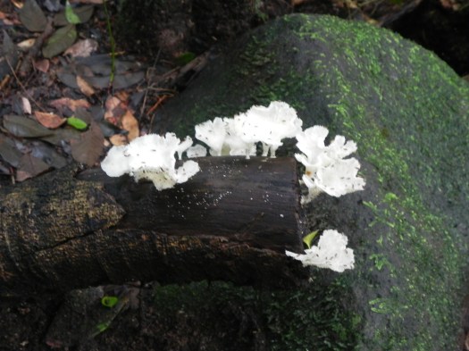
I also went by a seasonal waterfall on the Rio Quebrada Pailas (Broken Pots River).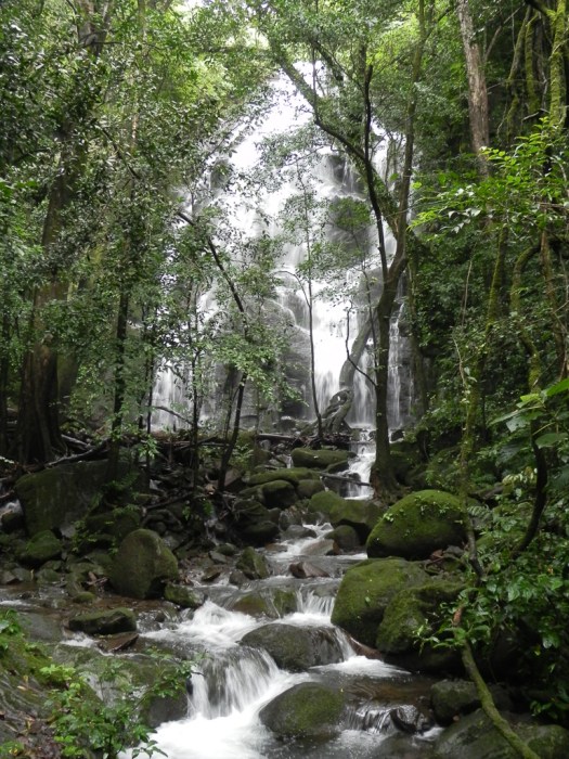
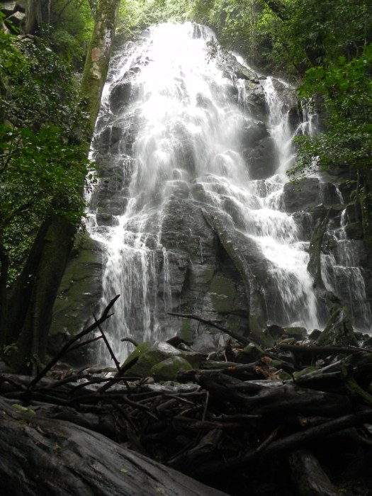
The waterfall is seasonal and only exists in the rainy season so I guess that was my reward for slogging through all that mud. Somehow it seems to get everywhere. Laundry is on my agenda for tomorrow.
I was also fascinated by the Strangler Fig Tree.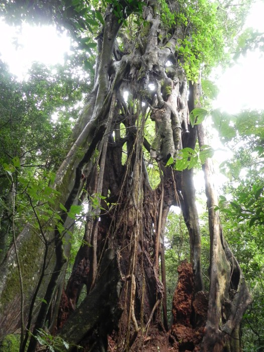 The Strangler Fig is a parasitic tree that doesn’t grow on its own but grows next to another tree. It wraps itself around the other tree’s trunk competing with it for food, water and light. It eventually kills the host tree which dies and rots away, leaving the fig whose trunk is still this mosaic it originally wrapped around the host. The fig in the picture obviously wrapped itself around and killed a very large tree.
24 September 2010
 A tropical depression has moved into the area so the normal rainy season I was experiencing has only intensified. Travel and outdoor photography are complicated by the wet but the quality of most photographs is compromised by the very flat lighting the solid cloud cover creates. Sky is more interesting in a picture if there’s at least some blue in it. Today it’s solid gray.
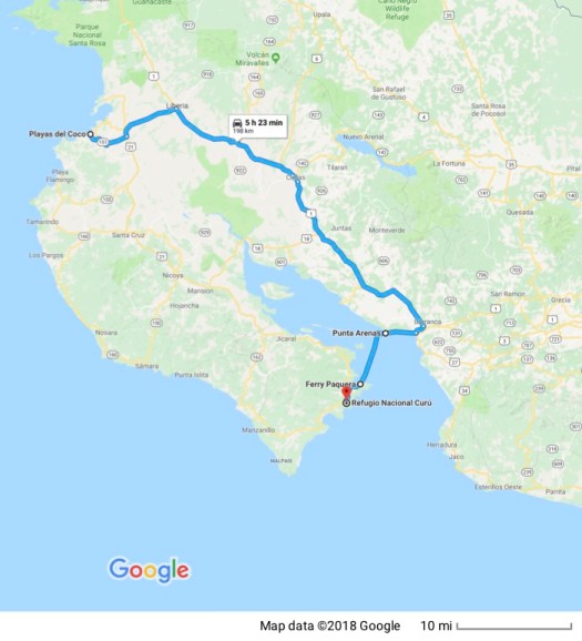
I tried getting out of it by traveling a good distance south to the Refugio Nacional Vida Silvestre Curú (the National Wildlife Refuge in Curú). The first issue is how to get there. The most direct route is straight down the Peninsula Nicoya from where I am. The problem with this route is that there’s a section of dirt road that the guide book warns requires four wheel drive “most of the year.” With that warning, taking my little car by that route not only during the rainy season, but also during the constant rain of a tropical depression, requires more chutzpah than I’ve got. So the alternative is a three hour drive (plus or minus… usually plus…) to Puntarenas where there’s a ferry that for about $14 will take me and my car on a one hour trip across the Gulf of Nicoya to Paquera from where the road is paved. I choose the ferry.
The drive down is wet but uneventful. I arrive at the ferry with minimal difficulty where an attendant with a two-way radio tells somebody on the other end of the radio to wait, there’s one more and instructs me to leave my car in the middle of the road to the ferry and run across the street to buy a ticket but to hurry because they’re leaving. I end up being the next-to-the-last car on.
The trip across the gulf is uneventful (thankfully) and in Paquera I stop at an agency that arranges activities in the Refuge. I wanted to try sea kayaking because my travel guide says this is one of the most beautiful places to participate in that activity. All activities, however, are cancelled because of the weather. The seas are rougher than they want to risk taking tourists of unknown abilities and physical conditioning out in.
The rain here is lighter and more intermittent than farther north but the skies are still uniformly gray. I’ll take that (not that I have any choice). I drive out to the refuge which is mostly on private land. The owner decided to reverse the trend of clearing out native rain forest to create pasture for cattle and farmland in 1983 and declared about 75% of his land as the first wildlife refuge in Costa Rica. He’s still in the process of reintroducing native plant and animal species.
This is the road into the Refuge.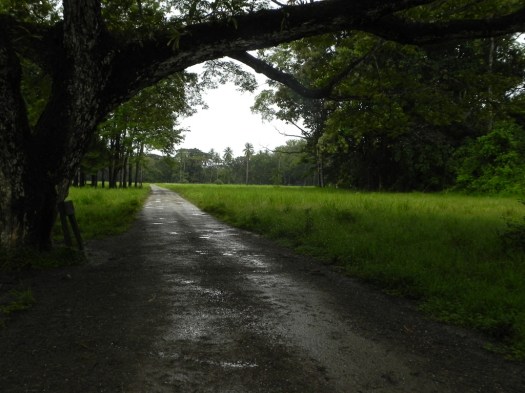
I pay the $10 entry fee and motor in to the first trail I see, stop and load up my camera gear for a hike through the rain forest. This is a general view of the Refuge.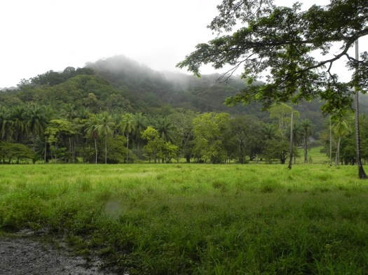 The trails are well marked and well maintained.
  There are even signs with inspirational messages along the path (“Only nature creates great works of art without expecting anything in return” “In nature there are no rewards or punishments, only consequences” “My only request is the sky above me and the path beneath my feet”)


The refuge is deserted and I have the whole place almost to myself. Partly because the heavy tourist season is the dry season (of course) and partly because, even for the rainy season it’s pretty damp out today.
The trail through the rain forest followed this stream most of the way.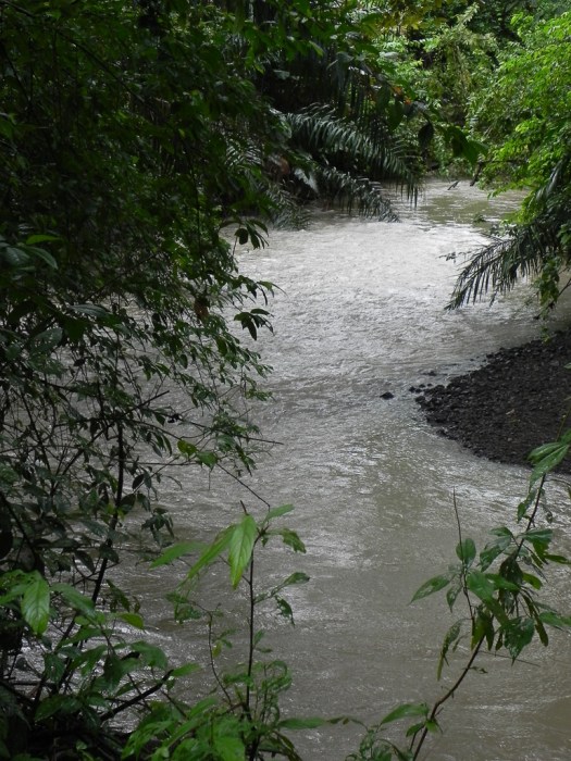
Fresh water crabs were prolific along the shores of the stream. Every little orange spot in this picture is a freshwater crab outside its home in the ground.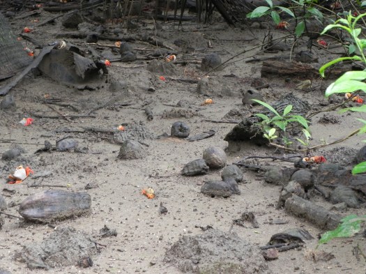
Any time I got close they’d all disappear into their underground homes. But this one stood his ground long enough for me to take his portrait.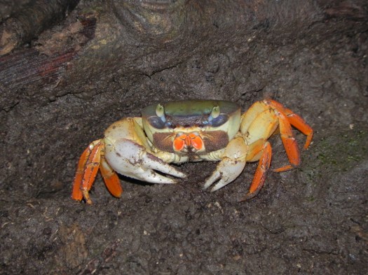
A mamma and a poppa duck with their ducklings seemed oblivious to the wet weather.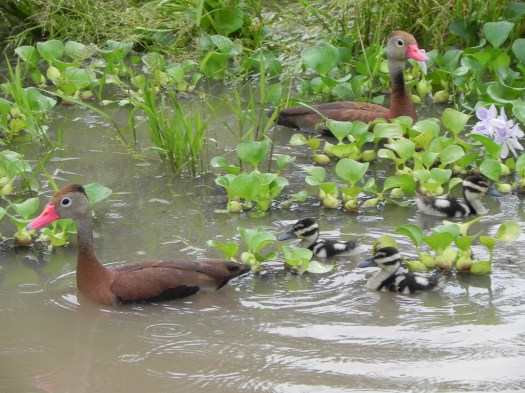
There were other birds, too, like this Golden Bellied Flycatcher, who seemed to be keeping a close eye on the human intruder.
I couldn’t find this one in my Costa Rican bird identification chart but I thought he looked pretty interesting.
The forested areas had their own set of wildlife including this White-faced Capuchin Monkey.
In addition to the fauna the forest supported some interesting flora such as this fungus
I make it out of the refuge after closing time but before they close up the gate and go home and head for the ferry dock. There’s a ferry waiting, though this one is much bigger and can accommodate multiple cars, buses and 18-wheelers all of which are packed on board as tightly as possible and with care to try to balance the load. Another uneventful trip across the gulf and I’m glad I brought a book to read as there’s nothing to see since it’s not only dark but the clouds are very low-lying.
After I make it through Puntarenas and onto the Pan-American Highway, I stop at a local “soda” for dinner. Small, informal restaurants locally are called sodas, though some of them aren’t really that small but they are less formal (and cheaper) than a “restaurante”.
The rest of the drive back “home” is uneventful except for one time I’m startled half to death when I blow right by what I guess was a police checkpoint of some sort. A uniformed officer was standing, with no lighting or reflective material, in the dark right on the double yellow centerline opposite a small police station. Seems to me you have to have a death wish to do that on a dark rainy night here.
25 September 2010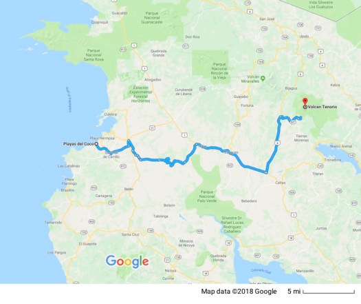
I’m not sure now exactly what the weather system is we’ve got here. Originally, one of the locals told me it was a tropical depression. Today I talked to one who told me it’s a hurricane and has been named Hurricane Matthew. (Actually he said it was “Huracán Mateo” and I’m just guessing that when they do the news in English they translate the name, even though nothing would prevent them from calling it Hurricane Mateo.)
Either way it sure has been raining a lot. It’s always rained every day but not all day every day with a constant cloud cover so we never see the sun.
Ever hopeful, today I drove out to Parque Nacional Volcán Tenorio hoping the clouds would clear when I got there. That’s about a two hour drive one way. No such luck. I decided not to try the dirt road into the national park in the rain and, instead, had a nice meal at a local “soda” and returned home.
While driving a section of paved road the 18-wheeler in front of me suddenly was all over the road. He didn’t look out of control at all but he was zigzagging back and forth across the double yellow line in a very unpredictable pattern. I’ve been driving here long enough to know exactly what he was doing because I knew that when I reached the spot where he was, I, too, would be playing the driving game – “try to drive a route that misses all the potholes.” There aren’t just a few, there are a LOT, and they’re deep. I just noticed that I have a bent rim on one of my wheels that probably happened when I either didn’t see or couldn’t miss a pothole. That will, I’m sure, give the car rental company an excuse to charge me more money.
Part of the car rental racket here is that they charge you for every dent, ding or scratch on the car but they never pay to fix any of the cosmetic damage. When you rent the car they just catalog all the current damage and if there’s anything new they charge you. I’m sure when they’re done with the car they sell it “as is” and just pocket all the money they charged all their customers for repairs.
26 September 2010
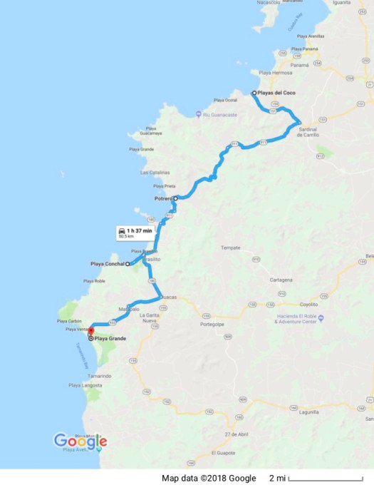 Today I explored some of the beaches on the Nicoya Peninsula. One of them is billed as the most beautiful beach in Costa Rica – Playa Conchal. A “concha” is a seashell and the beach is made up of billions of seashells that have washed up and been crushed into a course sand. They probably cover the bottom underwater, too, because I’m told the water is a turquoise blue, which is really unusual for a Pacific beach. It pretty much just looked gray when there was no sun to shine on it, though.
I also went to a beach that’s a surfing beach during the day and, since 1991, a protected reserve at night because, in the right season, it’s a nesting ground for the leatherback turtle, an endangered species. I wasn’t planning on staying up all night at the reserve to see if maybe the turtles would come up on the beach that night (nesting season starts next month in October) but I was hoping to go through a turtle museum my guide book mentioned. It looked to be permanently closed.
The leatherback is particularly impressive with a shell up to about 1.6 meters (5 feet) in length and weighing in at up to 360 kg (800 lb.).
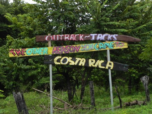
Not many pictures because the constant rain isn’t conducive. I’ve been intrigued, however, by how bilingual this place is. English is very common and lots of signs are posted in either just English or bilingually in both Spanish and English. I took a few pictures of signs for Outback Jack, the “Australian Road Kill Grill”, 
 and a sign advertising homes and condos for sale at a rather exclusive gated residential community.
  American real estate companies (Re-Max and Century 21) are common here and many homes and lots have “For Sale” signs, though some also say “Se vende”. With signs like these it’s pretty obvious their target audience is English-speaking Americans.
27 September 2010
I decided to try again for the Parque Nacional Volcán Tenorio, in spite of the fact that the overcast was solid. The rain wasn’t completely continuous, though sometimes it came down in sheets. After the two hour trip out to the dirt road that led to the park I wasn’t so sure I’d made a very good decision to try coming out. But, in spite of the fact that the road has been pounded by a hurricane for the last few days it looked to be mostly rock so, if that held true, I was guessing the car wouldn’t get swallowed up in a giant mud puddle.
The road turned out to be mostly rock, most of the way. It was like trying to drive on a river bottom and progress was agonizingly slow (it took another hour to get to the park), but I made it. As I was slowly jouncing my way along there was an old lady with a plastic bag of fruit, standing in the road at an intersection flagging me down. I stopped and rolled down the passenger window and she asked for a ride to the next village. Actually, it’s hard to know what to call it. It’s smaller than a village. What you see along these roads is the occasional isolated “finca” (farmhouse or ranch house) then, you periodically run into a collection of maybe half-a-dozen homes all together. The trail map I picked up at the national park oriented itself by showing two of these groupings and labeled them a “puesto” which, in this context, would translate as a post or an outpost.
They have names. She wanted to go to San Miguel which, she said, was on the way to the park. I had no idea because these outposts don’t show up on any map I have. I had difficulty understanding her Spanish. That could have been because it’s harder to enunciate clearly when you have no teeth. Although I can’t remember the last time I picked up a hitchhiker I gave her a ride and dropped her off at the house she indicated.
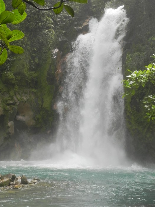
When I arrived at the park the rain was still intermittent so I gambled on the chance for sunshine, paid the entry fee ($10 US – I still can’t get over the fact that the Costa Rican National Park System charges their entry fees in US dollars) and went for a hike that followed the Rio Celeste on the southeast flank of the volcano.
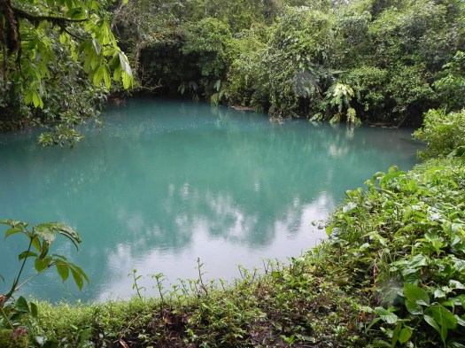
This is a relatively new park in the national park system and is famous for the color of the river Celeste. 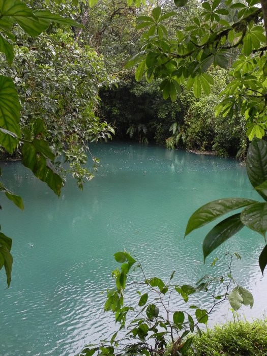 It really is that aquamarine color in the pictures. The color is created by the many minerals brought up by the volcano and dissolved in the water as it courses down the slopes of the volcano.
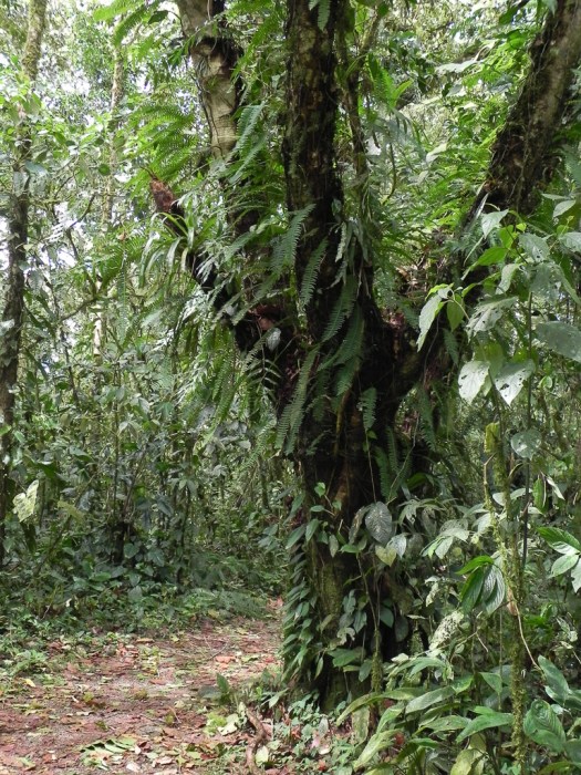
It’s amazing (to me) as I hike through the rain forest, how much plant life grows on tree trunks and branches. This tree is covered with ferns and other plants growing right on the trunk and branches.
As I hiked I noticed all the green leaves on the trail. They were there as a result of the winds and rain from the hurricane.

Mostly it was lots of green, but there was the occasional flowering plant.
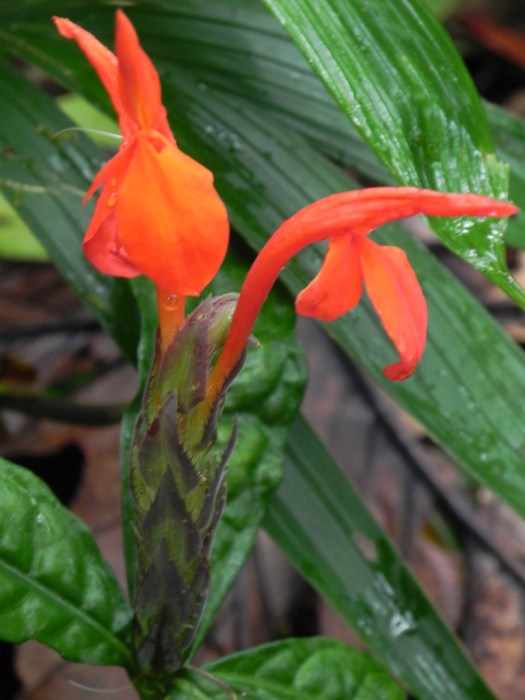
Or other color that stood out against the otherwise green background.

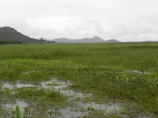
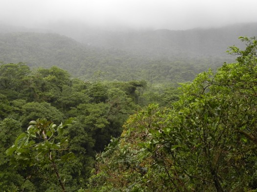
At one high point on the trail I got an overview of the rain forest through which I’ve been hiking.
Although I got rained on a lot, the sun did cooperate by coming out periodically so I could take some pictures. That blue of the water shows up a lot better when the sun’s on it. The trail took me to a waterfall and lagoon


and a small “poza” or pool beside the trail.
Although there was more to see, including geothermally active vents, hot springs, mudpots, etc., farther down the trail, it was late enough that I hiked back out so I could at least make it off the dirt road before dark.
I did make it out to a paved road before dark. By the time I got back to the Pan American Highway it was dark. Although this is the primary north-south artery in the country, it’s only a two-lane road. If there’s a problem in your lane you stop and wait. The people at the front of the line will work their way around the problem as they can and your turn will come. That happened twice on the way home tonight. The first time when I got to the source of the problem there was a trailer from an 18-wheeler parked in the northbound lane (no tractor to be seen) with a complete 18-wheeler (tractor and trailer) parked in front of it. I got around them and things went smoothly for about 5 kilometers when we came to another complete stop. We inched our way toward the front and when I got there I saw two 18-wheeler tractors (no trailers) stopped in the middle of the northbound lane. Who knows… it makes no sense to me, though I’m sure there’s a story.
28 September 2010
I’ve been checking with the travel agency that’s connected with the condos where I’m staying. I’ve been wanting a guided tour to Volcán Arenal and to Parque Nacional Monteverde, especially Monteverde. Although I’ve been willing to drive the local dirt roads, the warnings in the guidebook I have were vivid enough to make me think I’d be better off letting someone else do the driving to Monteverde. They require a minimum of four people for a tour so I had to wait to see if at least three other people wanted to go were I want to go. There isn’t anybody for Monteverde but I can join a group to Volcán Arenal tomorrow.
For today I tried again to visit Playa Conchal and made it there in between showers. A large hotel bought all the land in front of Playa Conchal and walled it off. You may recall from my earlier post that Playa Conchal is billed as the most beautiful beach in Costa Rica and the “sand” is comprised, not of sand but the crushed shells of billions of sea creatures.
The beaches, by law, have to stay public so they can’t make it a private beach but, by walling off all the land in front of the hotel, the only option people not staying at the hotel have is to go to the next beach, Playa Brasilto, and walk a couple of kilometers back south along the beach to Playa Conchal. This is Playa Brasilito.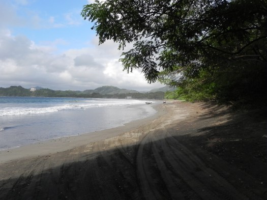 In the course of the walk down to Playa Conchal I drowned my iPod.
My car is too little for a trunk so I can’t leave anything in it when I leave it. Anything left in it would be an invitation to thieves. I put everything I had in a bag that I slung across my shoulder. As I was walking down the beach I came to a stream that was emptying into the ocean and waded across. It got a lot deeper than I’d expected but I held my camera high to keep it out of the water. I was wearing trunks and was barefoot so it was no big deal… I thought… I’d forgotten about the bag on my back and the water was deep enough that the bottom of the bag (where the iPod happened to be) went in the water. It was dead when I remembered it and tried to rescue it. :-< I am not a happy camper.
I continued on to Playa Conchal and took some pictures. It was sufficiently overcast that the water didn’t look the beautiful color that it does when the sun’s on it but it’s still a beautiful beach.


This closeup of the “sand” on Playa Conchal was taken just above the high tide line where the shells were larger and more obvious because they hadn’t gotten the pounding of the waves closer to the ocean. The entire beach you see in the pictures above is comprised of shells like this.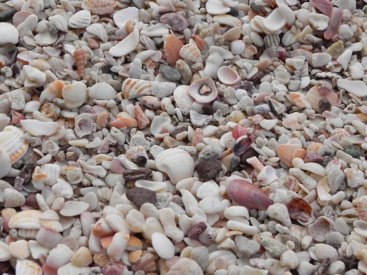
29 September 2010
 I met the tour guide in front of the condo office for the trip to Volcán Arenal and he greeted me in English so I replied in English and he immediately asked if I speak Spanish. His English was excellent, as you’d expect from a guide for an English-speaking group, so I knew he wasn’t asking because he’d struggle to understand me in English. I was totally blown away because I don’t think anybody has ever thought, based on my appearance, that I speak Spanish.
I switched over to Spanish and asked him why he asked. He said he thought he detected a Spanish accent in my English. Go figure. Maybe if I were to stay here long enough my English might develop a Spanish accent, though, honestly, I can’t imagine that ever really happening. And certainly not after just 2 weeks. But from then on, my conversations with him were primarily in Spanish.
Our first stop was at an 800-year-old Guanacaste tree that’s growing out of the middle of an intersection in Liberia. 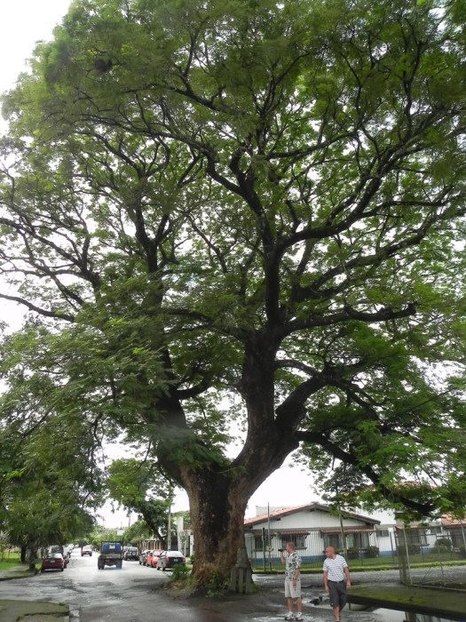 The province I’m in is Guanacaste province and this is its signature tree. The name of the province comes from the name of the tree in the language of the indigenous peoples of the area. The fruit of the tree (which is not edible but had other uses for the indigenous peoples) is shaped like a human ear so their name for it comes from that fact in their language.
Volcán Arenal is an active volcano that appeared to be dormant until 1968 when it erupted destroying three villages, killing about 80 people and 45,000 cattle. Since then the level of activity has been much lower and people, many of whom provide services to the hoards of tourists who flock to see the volcano, have settled back in. I’m not so sure I’d want to live at the foot of a smoking volcano.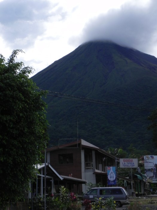 Arenal has continued to belch smoke, ash clouds and lava flows; sometimes generating spectacular displays.
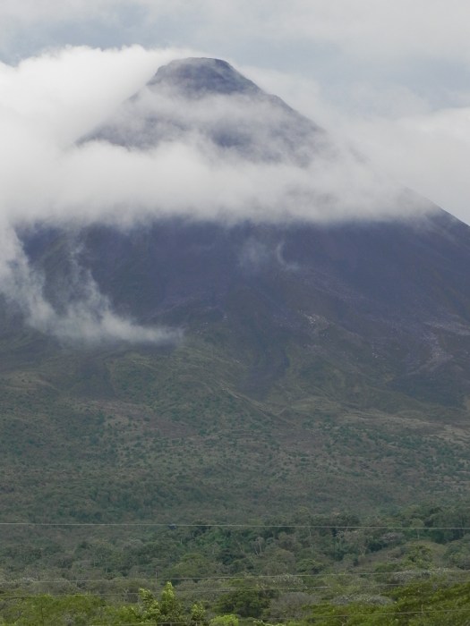
Of course I was hoping to see it put on a show for me but the bigger question was whether we’d be able to see it at all since there was a good chance it would be totally obscured by rain clouds.
To get there we had to travel all the way around Laguna de Arenal, a large, artificial lake created by ICE, the country’s electricity company, to generate hydroelectric power. It’s 88 square kilometers (34 square miles) and is the largest lake in the country. The lake is very long and narrow. This view is looking across the narrow width of the lake. Rain clouds obscured the view of the length of the lake.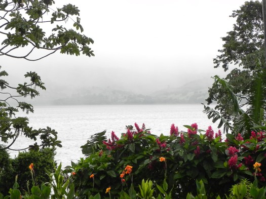 SCUBA divers can visit a town whose buildings still exist under the lake. The people were all moved farther up the hillside when the dam was built and the valley flooded to create the lake.
We stopped at a private reserve to hike the trails in its section of rain forest. It was actually more of a stroll than a hike since the trails were all level, well graded, graveled and drained. They also built ponds, food stations and other animal amenities to attract wildlife, though the animals are not captive and are free to come and go as they wish. I don’t know if that’s considered cheating but that fact, plus my guide’s greater knowledge of the wildlife and sharper eyes than mine combined to help me see and photograph more wildlife than I would have seen on my own. The downside is that being with a group I had to move along at their speed and they didn’t stop as long as I would have liked most places so there were pictures I couldn’t afford the time to take.
This little red-eyed tree frog was asleep on the underside of a banana leaf when I saw him. I had to poke him to get him to wake up and open his eyes.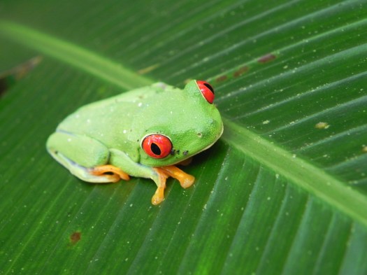
There were lots of beautiful flower that are very happy in the rain forest environment.
In spite of the fact that this was one huge iguana, I never would have spotted it. It’s sleeping in the tree branches and was pointed out by our guide. Seems like kind of a precarious perch on which to sleep but he liked it.

This is a female Green Basilisk.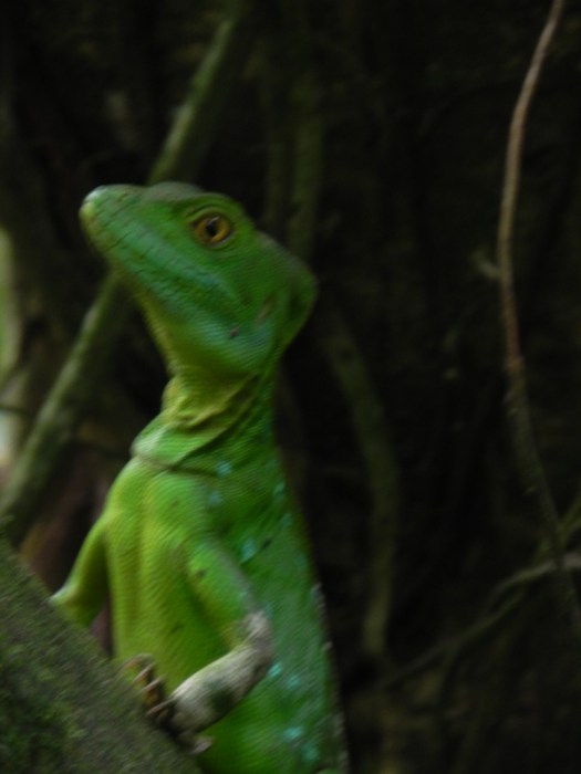 I did see a male who is distinguished by a large fin across his back, looking very much like some of the dinosaur drawings. He was too deeply into the rain forest for enough light for a picture, though. There was barely enough light for the female.
And a Strawberry Poison Dart Frog. Tiny little guy but you wouldn’t want to touch him with bare hands.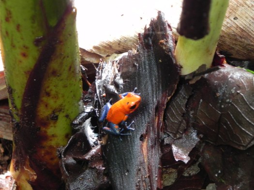 Some colorful birds came by for a visit. This is a Yellow-throated Euphonia
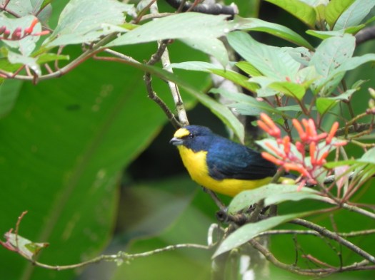
And this is a Cherrie’s Tanager
And some butterflies showed up at the feeding stations.


Our next stop was at a hotel with a series of pools fed by a subterranean river of geothermally heated water. The pools are arranged sequentially and as you move closer to the source of the water the temperature of the pool increases. The hot water felt good but it very much had the feel of a highly commercial enterprise trying to imitate nature, rather than natural hot springs.
As the sun set, the time came when I was hoping to catch the glow of hot lava cascading down the slopes of the volcano or erupting from its crater set against the dark sky. Clouds, however, totally obscured the volcano and there were no sounds of explosions so that part of the hoped-for show didn’t occur and, after dinner, we started the three-hour trip back home.
30 September 2010
Natives of the different Central American countries each have a different nickname. A Costa Rican is a “Tico” and you see the term everywhere.
Several days ago along the road just outside Playas de Coco, I met a Tico woodworker who hand-makes artistic wooden signs from the wood of the Pochote tree; a local tree common in “dry” rain forests. (See the next entry for discussion of “dry” rain forests.) I commissioned a personalized sign from him for me and went back today to pick it up and I ordered a few more. This is his home.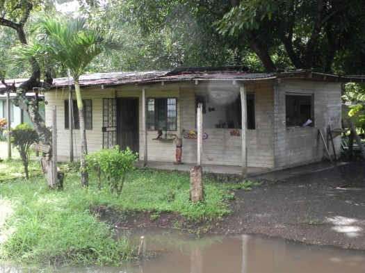 He lives on the left side of the building and his shop occupies the right side. This is his shop area.
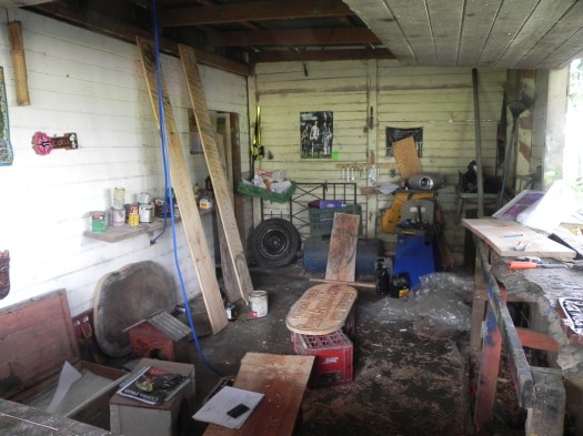 He used to be a bar tender at a hotel in Tamarindo, a town heavily populated with Americans during the dry season. (“Summer” in the local lexicon.) He’s primarily mono-lingual in Spanish. Although he has picked up enough English for some basic communication, any extensive conversation is impossible in English. He’s learned, however, that his limited English is better than most Americans’ Spanish so he was really surprised to run into an American who is fluent in Spanish and we’ve had a great time talking. Each time I’m there I end up spending an hour or so just talking and he’s taught me some of the local slang.
Meet Johan, the artisan. You can see a few examples of his handiwork.
Today he invited me to watch a game of soccer tonight in which he was playing. There’s a local “indoor” soccer field that lots of local teams play on. It’s actually outdoors but is a tiny field with artificial turf and small goals, completely enclosed with netting. Five-man teams play each other instead of the 11-man team that would use a full-sized field. My evenings are usually pretty quiet since I’m not much of a “night life” kind of person so I went out and had a great time watching him play.
If you come to this part of Costa Rica, stop by and say “hi” to him.
1 October 2010
This is a “dry” rain forest; so called because it’s comprised of primarily deciduous trees that lose all their leaves in the dry season and is watered by seasonal streams. This is an overview of the dry rain forest. You can see how dense it is. It’s also the largest remaining stand of tropical dry forest in Central America. That’s not to say it’s always been that way. Sabaneros (the local cowboys) used to burn the forest every year to ensure pasture for their cows.
It’s being allowed to restore itself to forest so most of the park is second growth rather than old growth forest. I did pass a sign that identified a section that was original old growth with some trees that stay green all year. It contains some trees that are between 100 and 500 years old. The impact this has on the forest is interesting – there are different animals that predominate in the old-growth section and the temperature there is about 5 degrees Celsius (9 degrees F) cooler in the dry season than the temperature in the second growth areas.
This is the Pochote tree. The tree that produces the wood my Tico friend uses to make signs.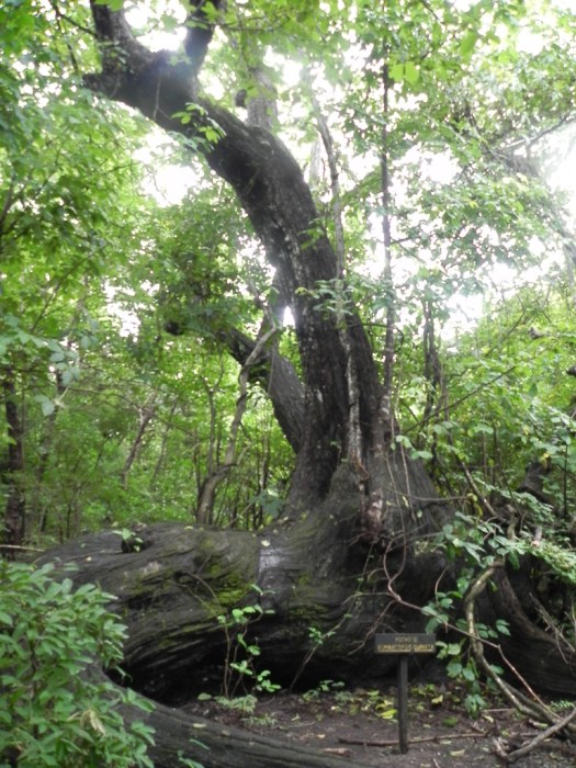
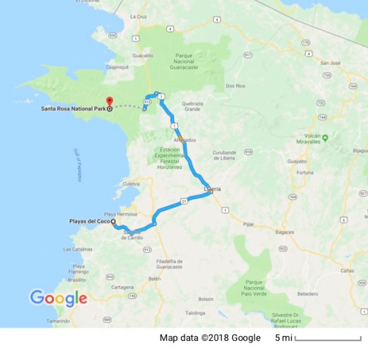
The park is of great historical significance to Costa Ricans, too. Costa Rica has been invaded three times in its history. Each time the invading force was defeated in Santa Rosa. I confess to being completely unaware that one of those invasions (the best known one, as it turns out) was by an American.
William Walker headed a group of mercenaries and adventurers known as the “Filibusters.” They had already invaded and seized much of southern Nicaragua and in 1856, invaded Costa Rica with a goal of gaining control over all of Central America. The president of Costa Rica correctly guessed Walker’s intentions, assembled a small group of fighters and marched up to Santa Rosa where Walker’s fighters were surrounded in La Casona (a large hacienda which is still there) and in a 14 minute battle defeated Walker who never returned to Costa Rica. Later, however, Walker did declare himself to be president of Nicaragua.
La Casona has now been turned into a museum which houses displays describing Walker’s invasion and defeat. While I was there two groups of school children went through the museum with guides who told them about Walker’s invasion and the role of La Casona in Costa Rican history.
This is one of La Casona’s porches.
I have no trouble imagining a row of chairs out here and people sitting outside at the end of the day to talk and enjoy the view and the breeze.
A couple of out buildings.
And a stone corral.
The most recent invasion was in 1955 by Anastasio Somoza, the Nicaraguan dictator. Santa Rosa was also the area used by Oliver North as a staging point for clandestine US intervention in the Sandinista-Contra war.
The park also contains a large expanse of beach that is ecologically important as turtle nesting areas but all the beaches are accessible only by four-wheel-drive vehicles, even in the dry season. If you’re in a high-clearance four-wheel-drive and want to take those dirt roads you have to sign a waiver at the park entrance acknowledging that you assume all liability and you’re on your own. If you break something you have to repair it yourself because no help is available.
Needless to say, I limited myself to La Casona and a short trail through the forest called the “Indio Desnudo” trail. That translates as the “Naked Indian” trail. The name comes from a tree in the forest named “Indio Desnudo”. It’s called that because of its fairly smooth reddish bark that is peeling making it look like a naked Indian… or a sunburned tourist whose skin is peeling…
I saw little in the way of wildlife, though the forest was beautiful.
A couple of airline pilots who were hiking just ahead of me located and showed me some unmarked petroglyphs. 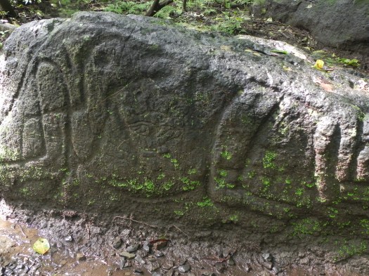
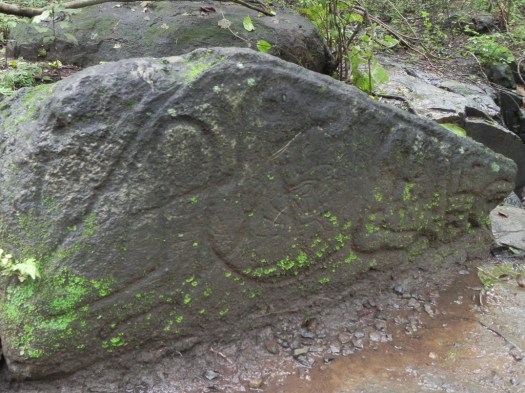 When I found a park staff person to ask, she confirmed that there are pre-Colombian petroglyphs that aren’t currently marked with signs.
I don’t know who was more startled – me or the very large iguana that scuttled across my path right at my feet to its hiding place as I walked by. I left the area then returned later and, sure enough, he’d emerged from hiding to bask in the sun again. This time I knew he was there so neither one of us was startled.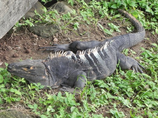
This was my last trip in Costa Rica. Tomorrow I fly out. There’s so much more I want to see and do here, but it will have to wait for another time.
